 |
|
Location & QuickFacts
| FAA Information Effective: | 2008-09-25 |
| Airport Identifier: | OK42 |
| Airport Status: | Operational |
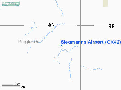
| Longitude/Latitude: | 097-43-01.1830W/36-05-00.1410N
-97.716995/36.083373 (Estimated) |
| Elevation: | 1053 ft / 320.95 m (Surveyed) |
| Land: | 60 acres |
| From nearest city: | 9 nautical miles SE of Hennessey, OK |
| Location: | Kingfisher County, OK |
| Magnetic Variation: | 07E (1985) |
Owner & Manager
| Ownership: | Privately owned |
| Owner: | Jerry Siegmann |
| Address: | Rt 3, Box 51
Hennessey, OK 73742 |
| Phone number: | 405-853-2305 |
| Manager: | Jerry Seigmann |
| Address: | Rt. 3 Box 51
Hennessey, OK 73742 |
| Phone number: | 405-853-2305 |
Airport Operations and Facilities
| Airport Use: | Private |
| Wind indicator: | Yes |
| Segmented Circle: | No |
| Control Tower: | No |
| Landing fee charge: | No |
| Sectional chart: | Wichita |
| Region: | ASW - Southwest |
| Boundary ARTCC: | ZKC - Kansas City |
| Tie-in FSS: | MLC - Mc Alester |
| FSS on Airport: | No |
| FSS Toll Free: | 1-800-WX-BRIEF |
Airport Services
| Airframe Repair: | NONE |
| Power Plant Repair: | NONE |
Runway Information
Runway 17/35
| Dimension: | 1700 x 50 ft / 518.2 x 15.2 m |
| Surface: | TURF, |
| |
Runway 17 |
Runway 35 |
| Traffic Pattern: | Left | Left |
| Obstruction: | 25 ft pline, 465.0 ft from runway, 18:1 slope to clear | , 50:1 slope to clear |
|
Radio Navigation Aids
| ID |
Type |
Name |
Ch |
Freq |
Var |
Dist |
| LCY | NDB | Logan County | | 326.00 | 07E | 20.5 nm |
| JWG | NDB | Watonga | | 359.00 | 07E | 36.9 nm |
| OK | NDB | Tuloo | | 406.00 | 07E | 37.2 nm |
| FAU | NDB | Fairview | | 246.00 | 07E | 38.9 nm |
| RQO | NDB | El Reno | | 335.00 | 07E | 39.0 nm |
| CUH | NDB | Cushing | | 242.00 | 05E | 47.3 nm |
| CQB | NDB | Tilghman | | 396.00 | 06E | 48.8 nm |
| TIK | TACAN | Tinker | 105X | | 07E | 42.2 nm |
| ODG | VOR/DME | Woodring | 027X | 109.00 | 08E | 17.8 nm |
| SWO | VOR/DME | Stillwater | 021X | 108.40 | 07E | 32.0 nm |
| PWA | VOR/DME | Wiley Post | 081X | 113.40 | 08E | 33.3 nm |
| END | VORTAC | Vance | 101X | 115.40 | 09E | 18.6 nm |
| IFI | VORTAC | Kingfisher | 094X | 114.70 | 09E | 21.8 nm |
| IRW | VORTAC | Will Rogers | 088X | 114.10 | 07E | 43.9 nm |
| PER | VORTAC | Pioneer | 079X | 113.20 | 06E | 48.1 nm |
| OKC | VOT | Oklahoma Will Rgs W | | 108.80 | | 41.8 nm |
Remarks
- PROVIDED RWY 17 DISPLACED TO ASSURE 20:1 APCH SLOPE OVER 15' PLINE AND FENCE W SIDE OF RWY RELOCATED MINIMUM 300' W OF RWY CENTERLINE.
Images and information placed above are from
http://www.airport-data.com/airport/OK42/
We thank them for the data!
| General Info
|
| Country |
United States
|
| State |
OKLAHOMA
|
| FAA ID |
OK42
|
| Latitude |
36-05-00.141N
|
| Longitude |
097-43-01.183W
|
| Elevation |
1053 feet
|
| Near City |
HENNESSEY
|
We don't guarantee the information is fresh and accurate. The data may
be wrong or outdated.
For more up-to-date information please refer to other sources.
|
|


