 |
|
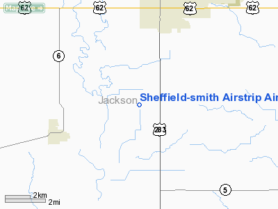
Sheffield-smith Airstrip Airport |
Location & QuickFacts
| FAA Information Effective: | 2008-09-25 |
| Airport Identifier: | OK83 |
| Airport Status: | Operational |
| Longitude/Latitude: | 099-21-06.0000W/34-34-06.0000N
-99.351667/34.568333 (Estimated) |
| Elevation: | 1355 ft / 413.00 m (Estimated) |
| Land: | 0 acres |
| From nearest city: | 4 nautical miles SW of Altus, OK |
| Location: | Jackson County, OK |
| Magnetic Variation: | 08E (1985) |
Owner & Manager
| Ownership: | Privately owned |
| Owner: | King Ag Aviation Of Oklahoma, Inc. |
| Address: | Po Box 189
Sudan, TX 79371 |
| Phone number: | 806-946-3399 |
| Manager: | Rick Netherton |
| Address: | Po Box 874
Altus, OK 73522 |
| Phone number: | 580-477-4643 |
Airport Operations and Facilities
| Airport Use: | Private |
| Wind indicator: | Yes |
| Segmented Circle: | No |
| Control Tower: | No |
| Landing fee charge: | No |
| Sectional chart: | Dallas-ft Worth |
| Region: | ASW - Southwest |
| Boundary ARTCC: | ZFW - Fort Worth |
| Tie-in FSS: | MLC - Mc Alester |
| FSS on Airport: | No |
| FSS Toll Free: | 1-800-WX-BRIEF |
Airport Services
| Airframe Repair: | NONE |
| Power Plant Repair: | NONE |
Runway Information
Runway 17/35
| Dimension: | 1800 x 25 ft / 548.6 x 7.6 m |
| Surface: | ASPH, |
| |
Runway 17 |
Runway 35 |
| Traffic Pattern: | Left | Left |
|
Radio Navigation Aids
| ID |
Type |
Name |
Ch |
Freq |
Var |
Dist |
| FSI | FAN MARKER | Trail | | | 09E | 48.6 nm |
| VRT | NDB | Wilbarger | | 230.00 | 08E | 20.9 nm |
| PFL | NDB | Post | | 308.00 | 08E | 47.0 nm |
| OFZ | NDB | Trail | | 388.00 | 09E | 48.6 nm |
| LAW | VOR/DME | Lawton | 031X | 109.40 | 09E | 46.7 nm |
| LTS | VORTAC | Altus | 035X | 109.80 | 08E | 6.9 nm |
| HBR | VORTAC | Hobart | 055X | 111.80 | 10E | 22.9 nm |
| BFV | VORTAC | Burns Flat | 037X | 110.00 | 08E | 40.8 nm |
| CDS | VORTAC | Childress | 123X | 117.60 | 10E | 48.0 nm |
| SYO | VORTAC | Sayre | 099X | 115.20 | 10E | 48.7 nm |
Remarks
- PARL PLINE 100' WEST OF RWY.
- RY 17/35 600' OVERRUN SOUTH END.
Images and information placed above are from
http://www.airport-data.com/airport/OK83/
We thank them for the data!
| General Info
|
| Country |
United States
|
| State |
OKLAHOMA
|
| FAA ID |
OK83
|
| Latitude |
34-34-06.000N
|
| Longitude |
099-21-06.000W
|
| Elevation |
1355 feet
|
| Near City |
ALTUS
|
We don't guarantee the information is fresh and accurate. The data may
be wrong or outdated.
For more up-to-date information please refer to other sources.
|
|


