 |
|
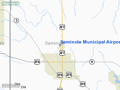
Location & QuickFacts
| FAA Information Effective: | 2008-09-25 |
| Airport Identifier: | SRE |
| Airport Status: | Operational |
| Longitude/Latitude: | 096-40-30.5830W/35-16-28.8410N
-96.675162/35.274678 (Estimated) |
| Elevation: | 1024 ft / 312.12 m (Estimated) |
| Land: | 220 acres |
| From nearest city: | 3 nautical miles N of Seminole, OK |
| Location: | Seminole County, OK |
| Magnetic Variation: | 06E (1985) |
Owner & Manager
| Ownership: | Publicly owned |
| Owner: | City Of Seminole |
| Address: | City Hall
Seminole, OK 74868 |
| Phone number: | 405-382-4330 |
| Manager: | Dale Wallace |
| Address: | 12021 N. Hwy 99
Seminole, OK 74868 |
| Phone number: | 405-382-2180 |
Airport Operations and Facilities
| Airport Use: | Open to public |
| Wind indicator: | Yes |
| Segmented Circle: | Yes |
| Control Tower: | No |
| Lighting Schedule: | DUSK-DAWN
MIRL RY 16/34 PRESET LOW INTST; TO INCR INTST ACTVT - CTAF. |
| Beacon Color: | Clear-Green (lighted land airport)
ROTG BCN OTS INDEFLY. |
| Landing fee charge: | No |
| Sectional chart: | Dallas-ft Worth |
| Region: | ASW - Southwest |
| Boundary ARTCC: | ZFW - Fort Worth |
| Tie-in FSS: | MLC - Mc Alester |
| FSS on Airport: | No |
| FSS Toll Free: | 1-800-WX-BRIEF |
| NOTAMs Facility: | SRE (NOTAM-d service avaliable) |
| Federal Agreements: | NGY |
Airport Communications
| CTAF: | 122.800 |
| Unicom: | 122.800 |
Airport Services
| Fuel available: | 100LLA |
| Airframe Repair: | MAJOR |
| Power Plant Repair: | MAJOR |
Runway Information
Runway 05/23
| Dimension: | 2000 x 150 ft / 609.6 x 45.7 m |
| Surface: | TURF, Poor Condition
RY EXTREMELY ROUGH. GOPHER HOLES, MOUNDS, AND TALL GRASS ON SURFACE. |
| |
Runway 05 |
Runway 23 |
| Longitude: | 096-40-42.8800W | 096-40-28.4700W |
| Latitude: | 35-16-12.7300N | 35-16-28.5900N |
| Elevation: | 995.00 ft | 1012.00 ft |
| Alignment: | 37 | 127 |
| Traffic Pattern: | Left | Left |
| Obstruction: | 35 ft trees, 10.0 ft from runway | , 50:1 slope to clear |
|
Runway 16/34
| Dimension: | 5000 x 75 ft / 1524.0 x 22.9 m |
| Surface: | ASPH, Fair Condition
RY EXTREMELY ROUGH. GOPHER HOLES, MOUNDS, AND TALL GRASS ON SURFACE. |
| Weight Limit: | Single wheel: 16000 lbs. |
| Edge Lights: | Medium |
| |
Runway 16 |
Runway 34 |
| Longitude: | 096-40-37.1300W | 096-40-22.0700W |
| Latitude: | 35-16-56.6800N | 35-16-08.8000N |
| Elevation: | 1024.00 ft | 1000.00 ft |
| Alignment: | 127 | 127 |
| Traffic Pattern: | Left | Right |
| Markings: | Non-precision instrument, Poor Condition
NRS AND CENTERLINE NOT VISIBLE. | Non-precision instrument, Poor Condition
NRS AND CENTERLINE NOT VISIBLE. |
| Crossing Height: | 47.00 ft | 31.00 ft |
| VASI: | 4-light PAPI on left side
PAPI OTS INDEFLY. | 4-light PAPI on left side
PAPI OTS INDEFLY. |
| Visual Glide Angle: | 3.00° | 3.00° |
| Runway End Identifier: | Yes | Yes |
| Obstruction: | 45 ft trees, 624.0 ft from runway, 9:1 slope to clear | 23 ft pline, 580.0 ft from runway, 286 ft right of centerline, 16:1 slope to clear |
|
Radio Navigation Aids
| ID |
Type |
Name |
Ch |
Freq |
Var |
Dist |
| SRE | NDB | Seminole | | 278.00 | 06E | 0.2 nm |
| GGU | NDB | Prague | | 314.00 | 06E | 14.7 nm |
| HDL | NDB | Holdenville | | 411.00 | 06E | 17.2 nm |
| CQB | NDB | Tilghman | | 396.00 | 06E | 27.8 nm |
| TZO | NDB | Bristow | | 251.00 | 05E | 32.2 nm |
| HET | NDB | Henryetta | | 267.00 | 04E | 33.4 nm |
| CUH | NDB | Cushing | | 242.00 | 05E | 37.3 nm |
| OUN | NDB | Norman | | 260.00 | 07E | 39.0 nm |
| PVJ | NDB | Pauls Valley | | 384.00 | 06E | 43.3 nm |
| OK | NDB | Tuloo | | 406.00 | 07E | 47.1 nm |
| LCY | NDB | Logan County | | 326.00 | 07E | 49.9 nm |
| TIK | TACAN | Tinker | 105X | | 07E | 35.9 nm |
| ADH | VOR/DME | Ada | 125X | 117.80 | 06E | 28.4 nm |
| OKM | VOR/DME | Okmulgee | 096X | 114.90 | 08E | 46.9 nm |
| IRW | VORTAC | Will Rogers | 088X | 114.10 | 07E | 46.1 nm |
| OKC | VOT | Oklahoma Will Rgs W | | 108.80 | | 45.9 nm |
Remarks
Images and information placed above are from
http://www.airport-data.com/airport/SRE/
We thank them for the data!
| General Info
|
| Country |
United States
|
| State |
OKLAHOMA
|
| FAA ID |
SRE
|
| Time |
UTC-6(-5DT)
|
| Latitude |
35.274678
35° 16' 28.84" N
|
| Longitude |
-96.675161
096° 40' 30.58" W
|
| Elevation |
1024 feet
312 meters
|
| Type |
Civil
|
| Magnetic Variation |
004° E (01/06)
|
| Beacon |
Yes
|
| Operating Agency |
U.S.CIVIL AIRPORT WHEREIN PERMIT COVERS USE BY TRANSIT MILITARY AIRCRAFT
|
| Operating Hours |
SEE REMARKS FOR OPERATING HOURS OR COMMUNICATIONS FOR POSSIBLE HOURS
|
| Daylight Saving Time |
Second Sunday in March at 0200 to first Sunday in November at 0200 local time (Exception Arizona and that portion of Indiana in the Eastern Time Zone)
|
We don't guarantee the information is fresh and accurate. The data may
be wrong or outdated.
For more up-to-date information please refer to other sources.
|
|


