 |
|
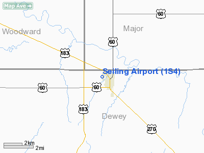
Location & QuickFacts
| FAA Information Effective: | 2008-09-25 |
| Airport Identifier: | 1S4 |
| Airport Status: | Operational |
| Longitude/Latitude: | 098-56-01.3420W/36-09-18.1440N
-98.933706/36.155040 (Estimated) |
| Elevation: | 1746 ft / 532.18 m (Surveyed) |
| Land: | 60 acres |
| From nearest city: | 0 nautical miles NW of Seiling, OK |
| Location: | Dewey County, OK |
| Magnetic Variation: | 08E (1985) |
Owner & Manager
| Ownership: | Publicly owned |
| Owner: | City Of Seiling |
| Address: | City Hall Po Box 1043
Seiling, OK 73663 |
| Phone number: | 580-922-4460 |
| Manager: | Amy Howard
CITY MANAGER. |
| Address: | City Hall Po Box 1043
Seiling, OK 73663 |
| Phone number: | 580-922-4460 |
Airport Operations and Facilities
| Airport Use: | Open to public |
| Wind indicator: | Yes |
| Segmented Circle: | No |
| Control Tower: | No |
| Lighting Schedule: | DUSK-DAWN
ACTVT LIRL RY 17/35 - CTAF. |
| Landing fee charge: | No |
| Sectional chart: | Wichita |
| Region: | ASW - Southwest |
| Boundary ARTCC: | ZKC - Kansas City |
| Tie-in FSS: | MLC - Mc Alester |
| FSS on Airport: | No |
| FSS Toll Free: | 1-800-WX-BRIEF |
| NOTAMs Facility: | MLC (NOTAM-d service avaliable) |
Airport Communications
Airport Services
| Airframe Repair: | NONE |
| Power Plant Repair: | NONE |
| Bottled Oxygen: | NONE |
| Bulk Oxygen: | NONE |
Runway Information
Runway 17/35
| Dimension: | 2435 x 38 ft / 742.2 x 11.6 m |
| Surface: | ASPH, Fair Condition
RY ROUGH & BUMPY WITH MODERATE GRASS ENCROACHMENT ON SURFACE. |
| Edge Lights: | Low |
| |
Runway 17 |
Runway 35 |
| Traffic Pattern: | Left | Left |
| Crossing Height: | 16.00 ft | 23.00 ft |
| VASI: | tri-color on left side
TRIL OTS INDEFLY. | tri-color on left side
TRIL OTS INDEFLY. |
| Visual Glide Angle: | 4.50° | 6.50° |
| Obstruction: | , 50:1 slope to clear
15 FT ROAD 35 FT FM THLD; +35 FT TREE 100 FT L OF CNTRLN AT THLD. | 35 ft trees, 204.0 ft from runway
5 FT ROAD 118 FT FM THLD; +35 FT TREES 140 FT FM THLD. |
|
Radio Navigation Aids
| ID |
Type |
Name |
Ch |
Freq |
Var |
Dist |
| FAU | NDB | Fairview | | 246.00 | 07E | 23.4 nm |
| MDF | NDB | Mooreland/dcmsnd | | 284.00 | 08E | 23.5 nm |
| JWG | NDB | Watonga | | 359.00 | 07E | 30.4 nm |
| OWU | NDB | West Woodward | | 329.00 | 08E | 33.2 nm |
| CLK | NDB | Clinton | | 320.00 | 07E | 37.0 nm |
| AVK | NDB | Alva | | 203.00 | 08E | 39.6 nm |
| OJA | NDB | Weatherford | | 272.00 | 07E | 39.7 nm |
| BZ | NDB | Fossi | | 393.00 | 08E | 44.3 nm |
| EZY | NDB | Elk City | | 241.00 | 08E | 49.3 nm |
| GAG | VORTAC | Gage | 103X | 115.60 | 10E | 47.3 nm |
| IFI | VORTAC | Kingfisher | 094X | 114.70 | 09E | 49.9 nm |
Remarks
- 496 FT AGL UNLGTD TOWER 18 NM S OF ARPT.
Images and information placed above are from
http://www.airport-data.com/airport/1S4/
We thank them for the data!
| General Info
|
| Country |
United States
|
| State |
OKLAHOMA
|
| FAA ID |
1S4
|
| Latitude |
36-09-18.144N
|
| Longitude |
098-56-01.342W
|
| Elevation |
1746 feet
|
| Near City |
SEILING
|
We don't guarantee the information is fresh and accurate. The data may
be wrong or outdated.
For more up-to-date information please refer to other sources.
|
|


