 |
|
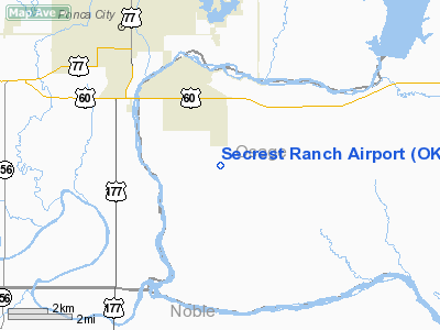
Location & QuickFacts
| FAA Information Effective: | 2008-09-25 |
| Airport Identifier: | OK49 |
| Airport Status: | Operational |
| Longitude/Latitude: | 097-01-01.1370W/36-39-00.1410N
-97.016982/36.650039 (Estimated) |
| Elevation: | 1050 ft / 320.04 m (Estimated) |
| Land: | 0 acres |
| From nearest city: | 4 nautical miles SE of Ponca City, OK |
| Location: | Osage County, OK |
| Magnetic Variation: | 07E (1985) |
Owner & Manager
| Ownership: | Privately owned |
| Owner: | M.m. Secrest |
| Address: | Rte 7 Box 357
Ponca City, OK 74604 |
| Phone number: | 405-762-1584 |
| Manager: | M M Secrest |
| Address: | Rte 7 Box 357
Ponca City, OK 74604 |
| Phone number: | 405-762-1584 |
Airport Operations and Facilities
| Airport Use: | Private |
| Wind indicator: | Yes |
| Segmented Circle: | No |
| Control Tower: | No |
| Landing fee charge: | No |
| Sectional chart: | Wichita |
| Region: | ASW - Southwest |
| Boundary ARTCC: | ZKC - Kansas City |
| Tie-in FSS: | MLC - Mc Alester |
| FSS on Airport: | No |
| FSS Toll Free: | 1-800-WX-BRIEF |
Airport Services
| Airframe Repair: | NONE |
| Power Plant Repair: | NONE |
Runway Information
Runway 17/35
| Dimension: | 1900 x 75 ft / 579.1 x 22.9 m |
| Surface: | TURF, |
| |
Runway 17 |
Runway 35 |
| Traffic Pattern: | Right | Right |
|
Radio Navigation Aids
| ID |
Type |
Name |
Ch |
Freq |
Var |
Dist |
| PN | NDB | Ponca | | 515.00 | 05E | 11.3 nm |
| EGT | NDB | Wellington | | 414.00 | 07E | 44.3 nm |
| CUH | NDB | Cushing | | 242.00 | 05E | 47.2 nm |
| SWO | VOR/DME | Stillwater | 021X | 108.40 | 07E | 25.8 nm |
| ODG | VOR/DME | Woodring | 027X | 109.00 | 08E | 40.8 nm |
| BVO | VOR/DME | Bartlesville | 126X | 117.90 | 08E | 49.4 nm |
| PER | VORTAC | Pioneer | 079X | 113.20 | 06E | 9.0 nm |
| END | VORTAC | Vance | 101X | 115.40 | 09E | 47.3 nm |
Images and information placed above are from
http://www.airport-data.com/airport/OK49/
We thank them for the data!
| General Info
|
| Country |
United States
|
| State |
OKLAHOMA
|
| FAA ID |
OK49
|
| Latitude |
36-39-00.141N
|
| Longitude |
097-01-01.137W
|
| Elevation |
1050 feet
|
| Near City |
PONCA CITY
|
We don't guarantee the information is fresh and accurate. The data may
be wrong or outdated.
For more up-to-date information please refer to other sources.
|
|


