 |
|
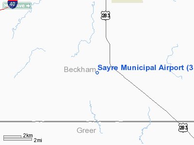
Location & QuickFacts
| FAA Information Effective: | 2008-09-25 |
| Airport Identifier: | 3O4 |
| Airport Status: | Operational |
| Longitude/Latitude: | 099-39-28.3450W/35-10-03.1880N
-99.657874/35.167552 (Estimated) |
| Elevation: | 1937 ft / 590.40 m (Surveyed) |
| Land: | 320 acres |
| From nearest city: | 7 nautical miles S of Sayre, OK |
| Location: | Beckham County, OK |
| Magnetic Variation: | 08E (1985) |
Owner & Manager
| Ownership: | Publicly owned |
| Owner: | City Of Sayre |
| Address: | 102 W Main
Sayre, OK 73662 |
| Phone number: | 580-928-2260 |
| Manager: | Mike Blevins
AIRPORT BOARD CHAIRMAN. |
| Address: | 129 E. Main
Sayre, OK 73662 |
| Phone number: | 580-928-5800 |
Airport Operations and Facilities
| Airport Use: | Open to public |
| Wind indicator: | Yes |
| Segmented Circle: | No |
| Control Tower: | No |
| Lighting Schedule: | DUSK-DAWN
MIRL RY 17/35 PRESET LOW INTST DUSK-2230; AFT 2230 ACTVT - CTAF. |
| Beacon Color: | Clear-Green (lighted land airport)
ROTG BCN OTS INDEFLY. |
| Landing fee charge: | No |
| Sectional chart: | Dallas-ft Worth |
| Region: | ASW - Southwest |
| Boundary ARTCC: | ZFW - Fort Worth |
| Tie-in FSS: | MLC - Mc Alester |
| FSS on Airport: | No |
| FSS Toll Free: | 1-800-WX-BRIEF |
| NOTAMs Facility: | MLC (NOTAM-d service avaliable) |
| Federal Agreements: | NGRY |
Airport Communications
Airport Services
| Airframe Repair: | NONE |
| Power Plant Repair: | NONE |
| Bottled Oxygen: | NONE |
| Bulk Oxygen: | NONE |
Runway Information
Runway 17/35
| Dimension: | 5017 x 130 ft / 1529.2 x 39.6 m |
| Surface: | CONC, Good Condition |
| Weight Limit: | Single wheel: 30000 lbs. |
| Edge Lights: | Medium |
| |
Runway 17 |
Runway 35 |
| Traffic Pattern: | Left | Left |
| Markings: | Basic, Fair Condition | Basic, Fair Condition |
| Crossing Height: | 54.00 ft | 0.00 ft |
| Displaced threshold: | 351.00 ft
THLD DSPLCD DAY VFR ONLY. | 374.00 ft
THLD DSPLCD DAY VFR ONLY. |
| VASI: | 2-light PAPI on left side | |
| Visual Glide Angle: | 3.00° | 0.00° |
| Obstruction: | 5 ft fence, 209.0 ft from runway, 1:1 slope to clear
APCH SLOPE 50:1 TO DSPLCD THLD.
+5 FT FENCE 105 FT FM RY END; +17 FT ROAD 157 FT FM RY END. | , 50:1 slope to clear
APCH SLOPE 50:1 TO DSPLCD THLD.
+4 FT FENCE 118 FT FM RY END; +15 FT ROAD 123 FT FM RY END. |
|
Radio Navigation Aids
| ID |
Type |
Name |
Ch |
Freq |
Var |
Dist |
| EZY | NDB | Elk City | | 241.00 | 08E | 20.1 nm |
| BZ | NDB | Fossi | | 393.00 | 08E | 28.1 nm |
| CLK | NDB | Clinton | | 320.00 | 07E | 41.9 nm |
| SYO | VORTAC | Sayre | 099X | 115.20 | 10E | 10.7 nm |
| BFV | VORTAC | Burns Flat | 037X | 110.00 | 08E | 22.6 nm |
| HBR | VORTAC | Hobart | 055X | 111.80 | 10E | 34.4 nm |
| LTS | VORTAC | Altus | 035X | 109.80 | 08E | 35.8 nm |
Remarks
Images and information placed above are from
http://www.airport-data.com/airport/3O4/
We thank them for the data!
| General Info
|
| Country |
United States
|
| State |
OKLAHOMA
|
| FAA ID |
3O4
|
| Latitude |
35-10-03.188N
|
| Longitude |
099-39-28.345W
|
| Elevation |
1937 feet
|
| Near City |
SAYRE
|
We don't guarantee the information is fresh and accurate. The data may
be wrong or outdated.
For more up-to-date information please refer to other sources.
|
|


