 |
|
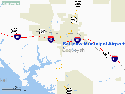
Location & QuickFacts
| FAA Information Effective: | 2008-09-25 |
| Airport Identifier: | JSV |
| Airport Status: | Operational |
| Longitude/Latitude: | 094-48-10.0000W/35-26-17.4000N
-94.802778/35.438167 (Estimated) |
| Elevation: | 528 ft / 160.93 m (Surveyed) |
| Land: | 85 acres |
| From nearest city: | 1 nautical miles SW of Sallisaw, OK |
| Location: | Sequoyah County, OK |
| Magnetic Variation: | 05E (1990) |
Owner & Manager
| Ownership: | Publicly owned |
| Owner: | City Of Sallisaw |
| Address: | City Hall, 115 E.choctaw
Sallisaw, OK 74955 |
| Phone number: | 918-775-6241 |
| Manager: | Kevin Burch |
| Address: | 1700 S. Kerr Blvd.
Sallisaw, OK 74955 |
| Phone number: | 918-775-4384 |
Airport Operations and Facilities
| Airport Use: | Open to public |
| Wind indicator: | Yes |
| Segmented Circle: | Yes |
| Control Tower: | No |
| Lighting Schedule: | DUSK-DAWN |
| Beacon Color: | Clear-Green (lighted land airport) |
| Landing fee charge: | No |
| Sectional chart: | Memphis |
| Region: | ASW - Southwest |
| Boundary ARTCC: | ZME - Memphis |
| Tie-in FSS: | MLC - Mc Alester |
| FSS on Airport: | No |
| FSS Toll Free: | 1-800-WX-BRIEF |
| NOTAMs Facility: | JSV (NOTAM-d service avaliable) |
| Federal Agreements: | NGY |
Airport Communications
| CTAF: | 122.700 |
| Unicom: | 122.700 |
Airport Services
| Fuel available: | 100LL
FUEL AVBL SELF-SERVE AFT HRS WITH MAJOR CREDIT CARD. FOR ADDNL SVCS AFT HRS CALL 918-571-8772. |
| Airframe Repair: | MAJOR |
| Power Plant Repair: | MAJOR |
| Bottled Oxygen: | NONE |
| Bulk Oxygen: | NONE |
Runway Information
Runway 17/35
| Dimension: | 4000 x 75 ft / 1219.2 x 22.9 m |
| Surface: | ASPH, Good Condition |
| Edge Lights: | Medium |
| |
Runway 17 |
Runway 35 |
| Longitude: | 094-48-10.0100W | 094-48-10.2700W |
| Latitude: | 35-26-37.3200N | 35-25-57.7600N |
| Elevation: | 527.00 ft | 518.00 ft |
| Alignment: | 127 | 0 |
| Traffic Pattern: | Left | Left |
| Markings: | Non-precision instrument, Good Condition | Non-precision instrument, Good Condition |
| Crossing Height: | 46.00 ft | 40.00 ft |
| VASI: | 2-light PAPI on left side | 2-light PAPI on left side |
| Visual Glide Angle: | 3.00° | 2.50° |
| Obstruction: | 45 ft tree, 1110.0 ft from runway, 8 ft left of centerline, 20:1 slope to clear
-3 FT DRAINAGE DITCH 125 FT FM END OF RY. | 65 ft trees, 525.0 ft from runway, 75 ft left of centerline, 5:1 slope to clear
-4-5 FT DRAINAGE DITCH 222 FT FM RY END. |
|
Radio Navigation Aids
| ID |
Type |
Name |
Ch |
Freq |
Var |
Dist |
| IQS | NDB | Sallisaw | | 520.00 | 05E | 2.4 nm |
| MKO | NDB | Muskogee | | 306.00 | 06E | 25.5 nm |
| TQH | NDB | Tahlequah | | 215.00 | 05E | 31.0 nm |
| SLG | NDB | Siloam Springs | | 284.00 | 04E | 47.7 nm |
| MEE | VOR | Davis | | 108.60 | 06E | 30.8 nm |
| DAK | VOR/DME | Drake | 025X | 108.80 | 07E | 46.8 nm |
| FSM | VORTAC | Fort Smith | 041X | 110.40 | 07E | 26.2 nm |
| PGO | VORTAC | Rich Mountain | 082X | 113.50 | 04E | 46.5 nm |
Remarks
- FBO: BARONS AIR SERVICE, BARON WYLIE 918-775-2363. HC61 BOX 28 SALLISAW, OK 74955.
- +200 FT TOWER/ANT 2.2 MILES NORTH ON EXTDD CNTRLN.
- AUTHORIZED ACCESS TO TERMINAL AVBL AFT HRS CALL 918-571-8772.
Images and information placed above are from
http://www.airport-data.com/airport/JSV/
We thank them for the data!
| General Info
|
| Country |
United States
|
| State |
OKLAHOMA
|
| FAA ID |
JSV
|
| Latitude |
35-26-17.400N
|
| Longitude |
094-48-10.000W
|
| Elevation |
528 feet
|
| Near City |
SALLISAW
|
We don't guarantee the information is fresh and accurate. The data may
be wrong or outdated.
For more up-to-date information please refer to other sources.
|
|


