 |
|
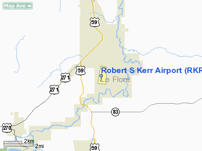
Location & QuickFacts
| FAA Information Effective: | 2008-09-25 |
| Airport Identifier: | RKR |
| Airport Status: | Operational |
| Longitude/Latitude: | 094-37-16.5090W/35-01-17.8550N
-94.621253/35.021626 (Estimated) |
| Elevation: | 451 ft / 137.46 m (Surveyed) |
| Land: | 175 acres |
| From nearest city: | 2 nautical miles S of Poteau, OK |
| Location: | Le Flore County, OK |
| Magnetic Variation: | 03E (2005) |
Owner & Manager
| Ownership: | Publicly owned |
| Owner: | City Of Poteau |
| Address: | City Hall, 111 Peters St.
Poteau, OK 74953 |
| Phone number: | 918-647-4191 |
| Manager: | Ellis Whigham |
| Address: | 1900 Airport Road
Poteau, OK 74953 |
| Phone number: | 918-647-4226 |
Airport Operations and Facilities
| Airport Use: | Open to public |
| Wind indicator: | Yes |
| Segmented Circle: | Yes |
| Control Tower: | No |
| Lighting Schedule: | DUSK-DAWN
ACTVT MIRL RY 18/36 - CTAF. |
| Beacon Color: | Clear-Green (lighted land airport)
ROTG BCN OTS INDEFLY. |
| Landing fee charge: | No |
| Sectional chart: | Memphis |
| Region: | ASW - Southwest |
| Boundary ARTCC: | ZME - Memphis |
| Tie-in FSS: | MLC - Mc Alester |
| FSS on Airport: | No |
| FSS Toll Free: | 1-800-WX-BRIEF |
| NOTAMs Facility: | RKR (NOTAM-d service avaliable) |
| Federal Agreements: | NGY |
Airport Communications
| CTAF: | 122.800 |
| Unicom: | 122.800 |
Airport Services
| Fuel available: | 100LLA
FUEL AVBL 24 HR WITH CREDIT CARD. |
| Airframe Repair: | MAJOR |
| Power Plant Repair: | MAJOR |
Runway Information
Runway 18/36
| Dimension: | 4006 x 75 ft / 1221.0 x 22.9 m |
| Surface: | ASPH, Good Condition |
| Weight Limit: | Single wheel: 27000 lbs. |
| Edge Lights: | Medium |
| |
Runway 18 |
Runway 36 |
| Longitude: | 094-37-12.4360W | 094-37-20.5980W |
| Latitude: | 35-01-37.3700N | 35-00-58.3170N |
| Elevation: | 445.00 ft | 448.00 ft |
| Alignment: | 127 | 10 |
| Traffic Pattern: | Left | Left |
| Markings: | Non-precision instrument, Good Condition | Non-precision instrument, Good Condition |
| Crossing Height: | 38.00 ft | 0.00 ft |
| VASI: | 2-light PAPI on left side | |
| Visual Glide Angle: | 2.75° | 0.00° |
|
Radio Navigation Aids
| ID |
Type |
Name |
Ch |
Freq |
Var |
Dist |
| IQS | NDB | Sallisaw | | 520.00 | 05E | 24.2 nm |
| MEZ | NDB | Mena | | 242.00 | 04E | 34.9 nm |
| MKO | NDB | Muskogee | | 306.00 | 06E | 47.5 nm |
| PGO | VORTAC | Rich Mountain | 082X | 113.50 | 04E | 20.5 nm |
| FSM | VORTAC | Fort Smith | 041X | 110.40 | 07E | 27.9 nm |
Remarks
- ULTRALIGHT ACTIVITY ON & INVOF ARPT.
Images and information placed above are from
http://www.airport-data.com/airport/RKR/
We thank them for the data!
| General Info
|
| Country |
United States
|
| State |
OKLAHOMA
|
| FAA ID |
RKR
|
| Latitude |
35-01-17.855N
|
| Longitude |
094-37-16.509W
|
| Elevation |
451 feet
|
| Near City |
POTEAU
|
We don't guarantee the information is fresh and accurate. The data may
be wrong or outdated.
For more up-to-date information please refer to other sources.
|
|


