 |
|
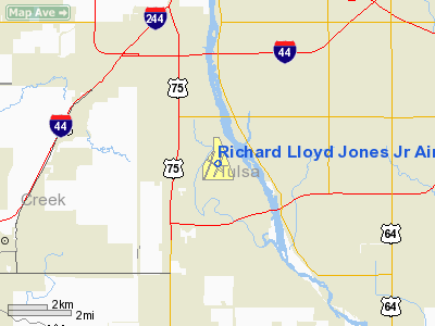
Richard Lloyd Jones Jr Airport |
| Richard Lloyd Jones Jr. Airport |
| IATA: RVS – ICAO: KRVS |
| Summary |
| Airport type |
Public |
| Operator |
Tulsa Airport Authority |
| Location |
Tulsa, Oklahoma |
| Elevation AMSL |
638 ft / 194.5 m |
| Coordinates |
36°02′22.6″N 95°59′04.7″W / 36.039611°N 95.984639°W / 36.039611; -95.984639Coordinates: 36°02′22.6″N 95°59′04.7″W / 36.039611°N 95.984639°W / 36.039611; -95.984639 |
| Runways |
| Direction |
Length |
Surface |
| ft |
m |
| 1L/19R |
5,102 |
1,555 |
Asphalt |
| 1R/19L |
4,208 |
1,283 |
Asphalt |
| 13/31 |
2,808 |
856 |
Asphalt |
| Statistics (2008) |
| Aircraft operations |
339,085 |
| Based aircraft |
297 |
Richard Lloyd Jones Jr. Airport (IATA: RVS, ICAO: KRVS) is a public airport located five miles (8 km) south of Tulsa, in Tulsa County, Oklahoma, USA. It serves as the reliever airport for Tulsa International Airport. HistoryR.L. Jones, Jr. Airport (RVS) opened on July 3, 1958 as a reliever airport for Tulsa International. At that time, the airport had one 4,000-foot (1,200 m) long runway, an aircraft ramp, and one concrete building. Throughout the past fifty years, the airport has grown to become a hub of business and economic activity for the Tulsa region. It now includes three runways, over two hundred commercial and private hangars, and over 500 based aircraft. In 2007, RVS was the seventh busiest general aviation airport in the country. Like many general aviation airports throughout the country, R.L. Jones, Jr. provides Tulsa and surrounding communities with vital transportation services. Operations include charter, business, medical, law enforcement, government, and privately owned aircraft. The airport drives economic activity in the region in a multitude of ways:
The airport provides convenient access to the nation’s air transportation system, allowing business owners to save valuable time by making point to point travel.
The airport’s flight schools make RVS a hub of flight training activity, bringing students from around the world to our community, all needing shelter, food, and other living necessities.
Ground operations, hangar rentals, and engine maintenance and repair services are just a few of the needed services provided by businesses on airport property.
The airport drives business to local suppliers of aircraft engine parts and interiors.
Over 1.5 million gallons of fuel were purchased by aircraft operators at RVS last year.
Commercial operators at RVS employ over 300 area residents, generating a payroll of over $6 million annually.
RVS covers 752.16 acres (3.0439 km) in southwest Tulsa. 120 acres (0.49 km) are leased to the Tulsa County Board of Commissioners for the operation of South Lakes Golf Course.
205 hangars currently stand on airport property.
Facilities
Richard Lloyd Jones Jr. Airport covers 664 acres (2.69 km) and has three runways:
- Runway 1L/19R: 5,102 x 100 ft. (1,555 x 30 m), Surface: Asphalt
- Runway 1R/19L: 4,208 x 100 ft. (1,283 x 30 m), Surface: Asphalt
- Runway 13/31: 2,641 x 50 ft. (856 x 15 m), Surface: Asphalt
The above content comes from Wikipedia and is published under free licenses – click here to read more.
Location & QuickFacts
| FAA Information Effective: | 2008-09-25 |
| Airport Identifier: | RVS |
| Airport Status: | Operational |
| Longitude/Latitude: | 095-59-04.7000W/36-02-22.6000N
-95.984639/36.039611 (Estimated) |
| Elevation: | 638 ft / 194.46 m (Surveyed) |
| Land: | 664 acres |
| From nearest city: | 5 nautical miles S of Tulsa, OK |
| Location: | Tulsa County, OK |
| Magnetic Variation: | 06E (1985) |
Owner & Manager
| Ownership: | Publicly owned |
| Owner: | City Of Tulsa |
| Address: | Tulsa Arpt Authority
Box 581838 Tulsa, OK 74158 |
| Phone number: | 918-838-5000 |
| Manager: | Steven Mushrush |
| Address: | 8303 S. Hangar Rd.
Tulsa, OK 74132 |
| Phone number: | 918-299-5886 |
Airport Operations and Facilities
| Airport Use: | Open to public |
| Wind indicator: | Yes |
| Segmented Circle: | Yes |
| Control Tower: | Yes |
| Lighting Schedule: | DUSK-DAWN
WHEN ATCT CLSD HIRL RY 01L/19R PRESET MED INTST; TO INCR INTST ACTVT - 120.3; MIRL RYS 13/31 & 01R/19L PRESET MED ONLY. |
| Beacon Color: | Clear-Green (lighted land airport) |
| Landing fee charge: | No |
| Sectional chart: | Kansas City |
| Region: | ASW - Southwest |
| Traffic Pattern Alt: | 1075 ft |
| Boundary ARTCC: | ZKC - Kansas City |
| Tie-in FSS: | MLC - Mc Alester |
| FSS on Airport: | No |
| FSS Toll Free: | 1-800-WX-BRIEF |
| NOTAMs Facility: | RVS (NOTAM-d service avaliable) |
| Federal Agreements: | NGY |
Airport Communications
| CTAF: | 120.300 |
| Unicom: | 122.950 |
Airport Services
| Fuel available: | 100LLA |
| Airframe Repair: | MAJOR |
| Power Plant Repair: | MAJOR |
| Bottled Oxygen: | LOW |
| Bulk Oxygen: | NONE |
Runway Information
Runway 01L/19R
| Dimension: | 5102 x 100 ft / 1555.1 x 30.5 m |
| Surface: | ASPH, Good Condition |
| Weight Limit: | Single wheel: 30000 lbs.
Dual wheel: 60000 lbs. |
| Edge Lights: | High |
| |
Runway 01L |
Runway 19R |
| Longitude: | 095-59-16.3410W | 095-59-02.0105W |
| Latitude: | 36-01-58.8387N | 36-02-47.9256N |
| Elevation: | 622.00 ft | 638.00 ft |
| Alignment: | 13 | 127 |
| ILS Type: | ILS
| |
| Traffic Pattern: | Left | Right |
| Markings: | Precision instrument, Good Condition | Non-precision instrument, Good Condition |
| Crossing Height: | 21.00 ft | 22.00 ft |
| VASI: | 4-light PAPI on left side | 4-light PAPI on left side |
| Visual Glide Angle: | 3.00° | 3.20° |
| Runway End Identifier: | No | |
| Centerline Lights: | No | |
| Touchdown Lights: | No | |
| Obstruction: | , 50:1 slope to clear | 42 ft trees, 1125.0 ft from runway, 22:1 slope to clear |
|
Runway 01R/19L
| Dimension: | 4208 x 100 ft / 1282.6 x 30.5 m |
| Surface: | ASPH, Good Condition |
| Weight Limit: | Single wheel: 30000 lbs.
Dual wheel: 60000 lbs. |
| Edge Lights: | Medium |
| |
Runway 01R |
Runway 19L |
| Longitude: | 095-59-06.5209W | 095-58-54.6995W |
| Latitude: | 36-02-02.4688N | 36-02-42.9535N |
| Elevation: | 619.00 ft | 630.00 ft |
| Alignment: | 13 | 127 |
| Traffic Pattern: | Right | Left |
| Markings: | Non-precision instrument, Good Condition | Non-precision instrument, Good Condition |
| Crossing Height: | 20.00 ft | 21.00 ft |
| Displaced threshold: | 0.00 ft | 142.00 ft |
| VASI: | 2-box on left side | 2-box on left side |
| Visual Glide Angle: | 3.00° | 3.00° |
| Runway End Identifier: | | No |
| Centerline Lights: | | No |
| Touchdown Lights: | | No |
| Obstruction: | , 50:1 slope to clear | 8 ft road, 200.0 ft from runway
APCH RATIO 43:1 FM DSPLCD THLD. |
|
Runway 13/31
| Dimension: | 2641 x 50 ft / 805.0 x 15.2 m |
| Surface: | ASPH, Good Condition |
| Weight Limit: | Single wheel: 30000 lbs. |
| Edge Lights: | Medium |
| |
Runway 13 |
Runway 31 |
| Longitude: | 095-59-13.6075W | 095-58-50.1067W |
| Latitude: | 36-02-29.3796N | 36-02-11.5532N |
| Elevation: | 624.00 ft | 615.00 ft |
| Alignment: | 127 | 127 |
| Traffic Pattern: | Left | Right |
| Markings: | Basic, Good Condition | Basic, Good Condition |
| Crossing Height: | 52.00 ft | 24.00 ft |
| VASI: | 2-box on left side | 2-box on left side |
| Visual Glide Angle: | 4.00° | 3.00° |
| Obstruction: | 67 ft trees, 1391.0 ft from runway, 17:1 slope to clear | 63 ft trees, 1818.0 ft from runway, 25:1 slope to clear |
|
Radio Navigation Aids
| ID |
Type |
Name |
Ch |
Freq |
Var |
Dist |
| OWP | NDB | William Pogue | | 362.00 | 06E | 11.5 nm |
| DW | NDB | Owaso | | 375.00 | 06E | 16.9 nm |
| TZO | NDB | Bristow | | 251.00 | 05E | 26.9 nm |
| HET | NDB | Henryetta | | 267.00 | 04E | 38.2 nm |
| CUH | NDB | Cushing | | 242.00 | 05E | 39.5 nm |
| MKO | NDB | Muskogee | | 306.00 | 06E | 43.2 nm |
| CQB | NDB | Tilghman | | 396.00 | 06E | 44.9 nm |
| GGU | NDB | Prague | | 314.00 | 06E | 47.6 nm |
| TQH | NDB | Tahlequah | | 215.00 | 05E | 48.1 nm |
| MEE | VOR | Davis | | 108.60 | 06E | 37.6 nm |
| GNP | VOR/DME | Glenpool | 043X | 110.60 | 06E | 7.2 nm |
| OKM | VOR/DME | Okmulgee | 096X | 114.90 | 08E | 21.6 nm |
| BVO | VOR/DME | Bartlesville | 126X | 117.90 | 08E | 47.8 nm |
| TUL | VORTAC | Tulsa | 091X | 114.40 | 08E | 13.4 nm |
| TUL | VOT | Tulsa Intl | | 109.00 | | 13.4 nm |
Remarks
- AER 13; ADJ RUNUP PAD; THE NE, NW & SW RAMPS AND PORTIONS OF TWYS C; D; G & R ARE NOT VISIBLE FM ATCT.
- NOISE ABATEMENT: NO TURNS ON DEPARTURE PRIOR TO 1500' MSL.
- NUMEROUS BIRDS ON & INVOF ARPT.
- TWY R CLSD INDEFLY.
- OPEN STORM GRATE 59 FT SOUTH OF WEST END OF TWY D.
Images and information placed above are from
http://www.airport-data.com/airport/RVS/
We thank them for the data!
| General Info
|
| Country |
United States
|
| State |
OKLAHOMA
|
| FAA ID |
RVS
|
| Latitude |
36-02-22.659N
|
| Longitude |
095-59-04.686W
|
| Elevation |
638 feet
|
| Near City |
TULSA
|
We don't guarantee the information is fresh and accurate. The data may
be wrong or outdated.
For more up-to-date information please refer to other sources.
|
|


