 |
|
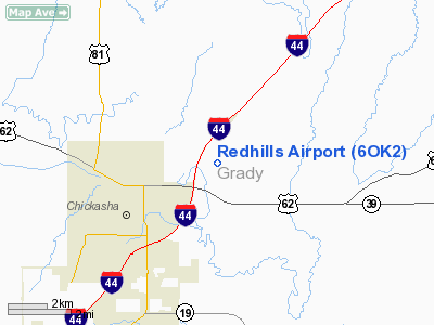
Location & QuickFacts
| FAA Information Effective: | 2008-09-25 |
| Airport Identifier: | 6OK2 |
| Airport Status: | Operational |
| Longitude/Latitude: | 097-53-43.1550W/35-03-46.2350N
-97.895321/35.062843 (Estimated) |
| Elevation: | 1175 ft / 358.14 m (Estimated) |
| Land: | 31 acres |
| From nearest city: | 2 nautical miles NE of Chickasha, OK |
| Location: | Grady County, OK |
| Magnetic Variation: | 07E (1990) |
Owner & Manager
| Ownership: | Privately owned |
| Owner: | Robert Swainson |
| Address: | 1220 County Rd 1346
Chickasha, OK 73018 |
| Phone number: | 405-222-1445 |
| Manager: | Robert Swainson |
| Address: | 1220 County Rd 1346
Chickasha, OK 73018 |
| Phone number: | 405-222-1445 |
Airport Operations and Facilities
| Airport Use: | Private |
| Wind indicator: | Yes |
| Segmented Circle: | No |
| Control Tower: | No |
| Sectional chart: | Dallas-ft Worth |
| Region: | ASW - Southwest |
| Boundary ARTCC: | ZFW - Fort Worth |
| Tie-in FSS: | MLC - Mc Alester |
| FSS on Airport: | No |
| FSS Toll Free: | 1-800-WX-BRIEF |
Airport Services
Runway Information
Runway 17/35
| Dimension: | 1986 x 100 ft / 605.3 x 30.5 m |
| Surface: | TURF, Good Condition |
| |
Runway 17 |
Runway 35 |
| Traffic Pattern: | Left | Left |
| Obstruction: | 85 ft pline, 1000.0 ft from runway | 20 ft pline, 600.0 ft from runway |
|
Radio Navigation Aids
| ID |
Type |
Name |
Ch |
Freq |
Var |
Dist |
| FSI | FAN MARKER | Trail | | | 09E | 30.2 nm |
| OLR | NDB | Chickasha | | 290.00 | 07E | 4.5 nm |
| OUN | NDB | Norman | | 260.00 | 07E | 23.7 nm |
| RQO | NDB | El Reno | | 335.00 | 07E | 25.6 nm |
| OK | NDB | Tuloo | | 406.00 | 07E | 28.4 nm |
| OFZ | NDB | Trail | | 388.00 | 09E | 30.2 nm |
| PFL | NDB | Post | | 308.00 | 08E | 37.1 nm |
| PVJ | NDB | Pauls Valley | | 384.00 | 06E | 38.9 nm |
| OJA | NDB | Weatherford | | 272.00 | 07E | 47.3 nm |
| TIK | TACAN | Tinker | 105X | | 07E | 33.8 nm |
| PWA | VOR/DME | Wiley Post | 081X | 113.40 | 08E | 30.8 nm |
| DUC | VOR/DME | Duncan | 047X | 111.00 | 09E | 40.8 nm |
| LAW | VOR/DME | Lawton | 031X | 109.40 | 09E | 42.6 nm |
| IRW | VORTAC | Will Rogers | 088X | 114.10 | 07E | 22.7 nm |
| IFI | VORTAC | Kingfisher | 094X | 114.70 | 09E | 44.9 nm |
| OKC | VOT | Oklahoma Will Rgs W | | 108.80 | | 24.6 nm |
Remarks
- PARACHUTE JUMPING ON & INVOF RY - TARGET 600 FT EAST OF RY.
- AERIAL BANNERS LAUNCHED & DROPPED ON RY.
Images and information placed above are from
http://www.airport-data.com/airport/6OK2/
We thank them for the data!
| General Info
|
| Country |
United States
|
| State |
OKLAHOMA
|
| FAA ID |
6OK2
|
| Latitude |
35-03-46.235N
|
| Longitude |
097-53-43.155W
|
| Elevation |
1175 feet
|
| Near City |
CHICKASHA
|
We don't guarantee the information is fresh and accurate. The data may
be wrong or outdated.
For more up-to-date information please refer to other sources.
|
|


