 |
|
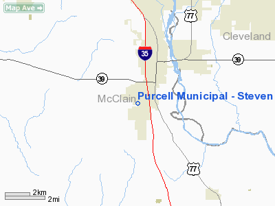
Purcell Muni - Steven E. Shephard Field Airport |
Location & QuickFacts
| FAA Information Effective: | 2008-09-25 |
| Airport Identifier: | 3O3 |
| Airport Status: | Operational |
| Longitude/Latitude: | 097-22-57.4980W/34-59-00.0590N
-97.382638/34.983350 (Estimated) |
| Elevation: | 1143 ft / 348.39 m (Estimated) |
| Land: | 50 acres |
| From nearest city: | 2 nautical miles SW of Purcell, OK |
| Location: | Mc Clain County, OK |
| Magnetic Variation: | 07E (1985) |
Owner & Manager
| Ownership: | Publicly owned |
| Owner: | City Of Purcell |
| Address: | Box 71
Purcell, OK 73080 |
| Phone number: | 405-527-6561 |
| Manager: | Mike Winningham
CITY MANAGER. |
| Address: | Po Box 71
Purcell, OK 73080 |
| Phone number: | 405-527-6561 |
Airport Operations and Facilities
| Airport Use: | Open to public |
| Wind indicator: | Yes |
| Segmented Circle: | Yes |
| Control Tower: | No |
| Lighting Schedule: | DUSK-DAWN
MIRL RY 17/35 PRESET LOW INTST; TO INCR INTST ACTVT - CTAF. |
| Beacon Color: | Clear-Green (lighted land airport) |
| Landing fee charge: | No |
| Sectional chart: | Dallas-ft Worth |
| Region: | ASW - Southwest |
| Boundary ARTCC: | ZFW - Fort Worth |
| Tie-in FSS: | MLC - Mc Alester |
| FSS on Airport: | No |
| FSS Toll Free: | 1-800-WX-BRIEF |
| NOTAMs Facility: | MLC (NOTAM-d service avaliable) |
| Federal Agreements: | N |
Airport Communications
Airport Services
| Airframe Repair: | NONE |
| Power Plant Repair: | NONE |
| Bottled Oxygen: | NONE |
| Bulk Oxygen: | NONE |
Runway Information
Runway 17/35
| Dimension: | 3003 x 60 ft / 915.3 x 18.3 m |
| Surface: | ASPH, Good Condition |
| Weight Limit: | Single wheel: 9500 lbs. |
| Edge Lights: | Medium |
| |
Runway 17 |
Runway 35 |
| Longitude: | 097-22-59.4010W | 097-22-55.5950W |
| Latitude: | 34-59-14.8310N | 34-58-45.2870N |
| Elevation: | 1133.00 ft | 1143.00 ft |
| Alignment: | 127 | 127 |
| Traffic Pattern: | Left | Left |
| Markings: | Basic, Good Condition | Basic, Good Condition |
| Obstruction: | , 50:1 slope to clear | 40 ft trees, 825.0 ft from runway, 15:1 slope to clear |
|
Radio Navigation Aids
| ID |
Type |
Name |
Ch |
Freq |
Var |
Dist |
| OUN | NDB | Norman | | 260.00 | 07E | 16.5 nm |
| PVJ | NDB | Pauls Valley | | 384.00 | 06E | 17.8 nm |
| OLR | NDB | Chickasha | | 290.00 | 07E | 29.9 nm |
| OK | NDB | Tuloo | | 406.00 | 07E | 31.3 nm |
| SRE | NDB | Seminole | | 278.00 | 06E | 38.9 nm |
| RQO | NDB | El Reno | | 335.00 | 07E | 42.8 nm |
| GGU | NDB | Prague | | 314.00 | 06E | 45.7 nm |
| HDL | NDB | Holdenville | | 411.00 | 06E | 48.1 nm |
| TIK | TACAN | Tinker | 105X | | 07E | 27.2 nm |
| PWA | VOR/DME | Wiley Post | 081X | 113.40 | 08E | 35.5 nm |
| ADH | VOR/DME | Ada | 125X | 117.80 | 06E | 36.8 nm |
| DUC | VOR/DME | Duncan | 047X | 111.00 | 09E | 44.6 nm |
| IRW | VORTAC | Will Rogers | 088X | 114.10 | 07E | 25.2 nm |
| ADM | VORTAC | Ardmore | 114X | 116.70 | 06E | 47.6 nm |
| OKC | VOT | Oklahoma Will Rgs W | | 108.80 | | 26.9 nm |
Images and information placed above are from
http://www.airport-data.com/airport/3O3/
We thank them for the data!
| General Info
|
| Country |
United States
|
| State |
OKLAHOMA
|
| FAA ID |
3O3
|
| Latitude |
34-58-47.260N
|
| Longitude |
097-23-09.102W
|
| Elevation |
1140 feet
|
| Near City |
PURCELL
|
We don't guarantee the information is fresh and accurate. The data may
be wrong or outdated.
For more up-to-date information please refer to other sources.
|
|


