 |
|
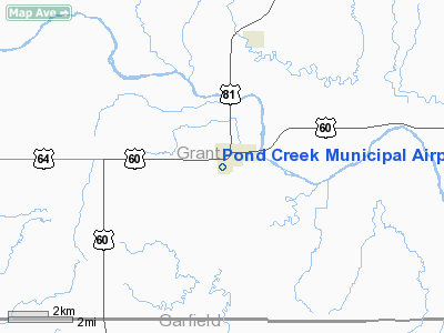
Location & QuickFacts
| FAA Information Effective: | 2008-09-25 |
| Airport Identifier: | 2K1 |
| Airport Status: | Operational |
| Longitude/Latitude: | 097-48-31.1980W/36-39-45.1090N
-97.808666/36.662530 (Estimated) |
| Elevation: | 1061 ft / 323.39 m (Estimated) |
| Land: | 100 acres |
| From nearest city: | 0 nautical miles SW of Pond Creek, OK |
| Location: | Grant County, OK |
| Magnetic Variation: | 07E (1985) |
Owner & Manager
| Ownership: | Publicly owned |
| Owner: | City Of Pond Creek |
| Address: | City Hall, Po Box 6
Pond Creek, OK 73766 |
| Phone number: | 580-532-4915 |
| Manager: | Jayme Wollison
MAYOR. ART CURL, MAINTENANCE SUPERVISOR. |
| Address: | City Hall, Po Box 6
Pond Creek, OK 73766 |
| Phone number: | 580-532-4915
OR 580-532-5050. |
Airport Operations and Facilities
| Airport Use: | Open to public |
| Wind indicator: | Yes |
| Segmented Circle: | No |
| Control Tower: | No |
| Landing fee charge: | No |
| Sectional chart: | Wichita |
| Region: | ASW - Southwest |
| Boundary ARTCC: | ZKC - Kansas City |
| Tie-in FSS: | MLC - Mc Alester |
| FSS on Airport: | No |
| FSS Toll Free: | 1-800-WX-BRIEF |
| NOTAMs Facility: | MLC (NOTAM-d service avaliable) |
| Federal Agreements: | 1 |
Airport Communications
Airport Services
| Airframe Repair: | NONE |
| Power Plant Repair: | NONE |
| Bottled Oxygen: | NONE |
| Bulk Oxygen: | NONE |
Runway Information
Runway 15/33
| Dimension: | 1220 x 30 ft / 371.9 x 9.1 m
FULL WIDTH OF RY NOT MAINTAINED; USE MIDDLE OF RY SFC. |
| Surface: | ASPH, Fair Condition |
| |
Runway 15 |
Runway 33 |
| Longitude: | 097-48-37.5000W | 097-48-31.6493W |
| Latitude: | 36-39-56.1900N | 36-39-45.0855N |
| Elevation: | 1061.00 ft | 1061.00 ft |
| Alignment: | 127 | 127 |
| Traffic Pattern: | Left | Left |
| Obstruction: | 35 ft trees, 250.0 ft from runway, 1:1 slope to clear | , 50:1 slope to clear |
|
Runway 17/35
| Dimension: | 2320 x 430 ft / 707.1 x 131.1 m
FULL WIDTH OF RY NOT MAINTAINED; USE MIDDLE OF RY SFC. |
| Surface: | TURF, Fair Condition |
| |
Runway 17 |
Runway 35 |
| Longitude: | 097-48-31.2000W | 097-48-31.2000W |
| Latitude: | 36-39-55.4400N | 36-39-32.5000N |
| Elevation: | 1061.00 ft | 1061.00 ft |
| Alignment: | 127 | 0 |
| Traffic Pattern: | Left | Left |
| Obstruction: | 35 ft pole, 200.0 ft from runway, 5:1 slope to clear | , 50:1 slope to clear |
|
Radio Navigation Aids
| ID |
Type |
Name |
Ch |
Freq |
Var |
Dist |
| PN | NDB | Ponca | | 515.00 | 05E | 35.5 nm |
| FAU | NDB | Fairview | | 246.00 | 07E | 39.5 nm |
| AVK | NDB | Alva | | 203.00 | 08E | 42.1 nm |
| EGT | NDB | Wellington | | 414.00 | 07E | 44.5 nm |
| ODG | VOR/DME | Woodring | 027X | 109.00 | 08E | 17.4 nm |
| SWO | VOR/DME | Stillwater | 021X | 108.40 | 07E | 43.9 nm |
| END | VORTAC | Vance | 101X | 115.40 | 09E | 19.8 nm |
| PER | VORTAC | Pioneer | 079X | 113.20 | 06E | 31.7 nm |
| ANY | VORTAC | Anthony | 076X | 112.90 | 07E | 34.5 nm |
Images and information placed above are from
http://www.airport-data.com/airport/2K1/
We thank them for the data!
| General Info
|
| Country |
United States
|
| State |
OKLAHOMA
|
| FAA ID |
2K1
|
| Latitude |
36-39-45.109N
|
| Longitude |
097-48-31.198W
|
| Elevation |
1061 feet
|
| Near City |
POND CREEK
|
We don't guarantee the information is fresh and accurate. The data may
be wrong or outdated.
For more up-to-date information please refer to other sources.
|
|


