 |
|
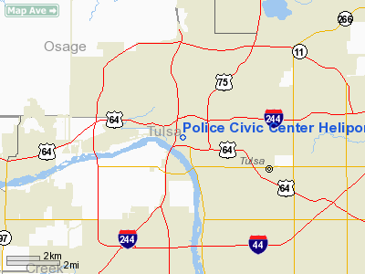
Police Civic Center Heliport |
Location & QuickFacts
| FAA Information Effective: | 2008-09-25 |
| Airport Identifier: | OK41 |
| Airport Status: | Operational |
| Longitude/Latitude: | 095-59-49.9900W/36-08-58.3330N
-95.997219/36.149537 (Estimated) |
| Elevation: | 740 ft / 225.55 m (Estimated) |
| Land: | 0 acres |
| From nearest city: | 0 nautical miles N of Tulsa, OK |
| Location: | Tulsa County, OK |
| Magnetic Variation: | 06E (1985) |
Owner & Manager
| Ownership: | Publicly owned |
| Owner: | City Of Tulsa |
| Address: | 200 Civic Center
Tulsa, OK 74103 |
| Phone number: | 918-596-7411 |
| Manager: | Sgt. Ron Moulton |
| Address: | 600 Civic Center
Tulsa, OK 74103 |
| Phone number: | 918-591-4080 |
Airport Operations and Facilities
| Airport Use: | Private |
| Segmented Circle: | No |
| Control Tower: | No |
| Lighting Schedule: | PHONE REQ
FOR PERIMETER LGTS CALL 918-591-4280. |
| Sectional chart: | Kansas City |
| Region: | ASW - Southwest |
| Boundary ARTCC: | ZKC - Kansas City |
| Tie-in FSS: | MLC - Mc Alester |
| FSS Toll Free: | 1-800-WX-BRIEF |
Runway Information
Helipad H1
| Dimension: | 50 x 50 ft / 15.2 x 15.2 m |
| Surface: | CONC, |
| |
Runway H1 |
Runway |
| Traffic Pattern: | Left | Left |
|
Radio Navigation Aids
| ID |
Type |
Name |
Ch |
Freq |
Var |
Dist |
| OWP | NDB | William Pogue | | 362.00 | 06E | 7.7 nm |
| DW | NDB | Owaso | | 375.00 | 06E | 11.2 nm |
| TZO | NDB | Bristow | | 251.00 | 05E | 30.9 nm |
| CUH | NDB | Cushing | | 242.00 | 05E | 40.9 nm |
| HET | NDB | Henryetta | | 267.00 | 04E | 44.8 nm |
| CQB | NDB | Tilghman | | 396.00 | 06E | 47.5 nm |
| MKO | NDB | Muskogee | | 306.00 | 06E | 48.0 nm |
| MEE | VOR | Davis | | 108.60 | 06E | 42.4 nm |
| GNP | VOR/DME | Glenpool | 043X | 110.60 | 06E | 13.8 nm |
| OKM | VOR/DME | Okmulgee | 096X | 114.90 | 08E | 28.2 nm |
| BVO | VOR/DME | Bartlesville | 126X | 117.90 | 08E | 41.2 nm |
| TUL | VORTAC | Tulsa | 091X | 114.40 | 08E | 10.5 nm |
| TUL | VOT | Tulsa Intl | | 109.00 | | 10.5 nm |
Remarks
- PRVDD INGRESS/EGRESS IS NOT FROM THE SOUTH OR SOUTHEAST DUE TO OBSTRUCTIONS
Images and information placed above are from
http://www.airport-data.com/airport/OK41/
We thank them for the data!
| General Info
|
| Country |
United States
|
| State |
OKLAHOMA
|
| FAA ID |
OK41
|
| Latitude |
36-08-58.333N
|
| Longitude |
095-59-49.990W
|
| Elevation |
740 feet
|
| Near City |
TULSA
|
We don't guarantee the information is fresh and accurate. The data may
be wrong or outdated.
For more up-to-date information please refer to other sources.
|
|


