 |
|
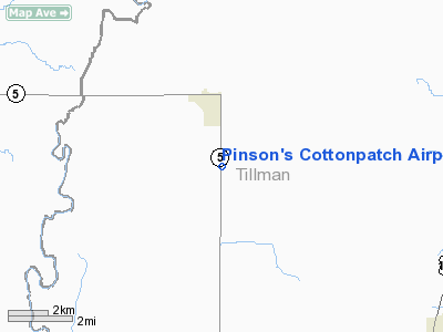
Pinson's Cottonpatch Airport |
Location & QuickFacts
| FAA Information Effective: | 2008-09-25 |
| Airport Identifier: | 6OK3 |
| Airport Status: | Operational |
| Longitude/Latitude: | 099-07-53.2890W/34-28-29.2810N
-99.131469/34.474800 (Estimated) |
| Elevation: | 1297 ft / 395.33 m (Estimated) |
| Land: | 0 acres |
| From nearest city: | 2 nautical miles S of Tipton, OK |
| Location: | Tillman County, OK |
| Magnetic Variation: | 08E (1985) |
Owner & Manager
| Ownership: | Privately owned |
| Owner: | Keith & Lucy Pinson |
| Address: | 21550 State Hwy 5
Tipton, OK 73570 |
| Phone number: | 405-667-5304 |
| Manager: | Keith Pinson |
| Address: | 21550 State Hwy 5
Tipton, OK 73570 |
| Phone number: | 405-667-5304 |
Airport Operations and Facilities
| Airport Use: | Private |
| Wind indicator: | Yes |
| Segmented Circle: | No |
| Control Tower: | No |
| Landing fee charge: | No |
| Sectional chart: | Dallas-ft Worth |
| Region: | ASW - Southwest |
| Boundary ARTCC: | ZFW - Fort Worth |
| Tie-in FSS: | MLC - Mc Alester |
| FSS on Airport: | No |
| FSS Toll Free: | 1-800-WX-BRIEF |
Airport Services
| Airframe Repair: | NONE |
| Power Plant Repair: | NONE |
| Bottled Oxygen: | NONE |
| Bulk Oxygen: | NONE |
Runway Information
Runway 17/35
| Dimension: | 2013 x 60 ft / 613.6 x 18.3 m |
| Surface: | TURF, |
| |
Runway 17 |
Runway 35 |
| Traffic Pattern: | Left | Left |
| Runway End Identifier: | No | No |
| Centerline Lights: | No | No |
| Touchdown Lights: | No | No |
|
Radio Navigation Aids
| ID |
Type |
Name |
Ch |
Freq |
Var |
Dist |
| FSI | FAN MARKER | Trail | | | 09E | 40.5 nm |
| VRT | NDB | Wilbarger | | 230.00 | 08E | 16.7 nm |
| PFL | NDB | Post | | 308.00 | 08E | 36.9 nm |
| OFZ | NDB | Trail | | 388.00 | 09E | 40.5 nm |
| SHP | TACAN | Sheppard | 045X | | 10E | 43.6 nm |
| LAW | VOR/DME | Lawton | 031X | 109.40 | 09E | 35.6 nm |
| LTS | VORTAC | Altus | 035X | 109.80 | 08E | 13.2 nm |
| HBR | VORTAC | Hobart | 055X | 111.80 | 10E | 23.8 nm |
| SPS | VORTAC | Wichita Falls | 074X | 112.70 | 10E | 39.7 nm |
| BFV | VORTAC | Burns Flat | 037X | 110.00 | 08E | 46.0 nm |
Images and information placed above are from
http://www.airport-data.com/airport/6OK3/
We thank them for the data!
| General Info
|
| Country |
United States
|
| State |
OKLAHOMA
|
| FAA ID |
6OK3
|
| Latitude |
34-28-29.281N
|
| Longitude |
099-07-53.289W
|
| Elevation |
1297 feet
|
| Near City |
TIPTON
|
We don't guarantee the information is fresh and accurate. The data may
be wrong or outdated.
For more up-to-date information please refer to other sources.
|
|


