 |
|
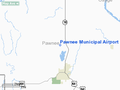
Location & QuickFacts
| FAA Information Effective: | 2008-09-25 |
| Airport Identifier: | H97 |
| Airport Status: | Operational |
| Longitude/Latitude: | 096-48-37.1250W/36-23-00.1880N
-96.810312/36.383386 (Estimated) |
| Elevation: | 875 ft / 266.70 m (Estimated) |
| Land: | 60 acres |
| From nearest city: | 0 nautical miles NE of Pawnee, OK |
| Location: | Pawnee County, OK |
| Magnetic Variation: | 06E (1985) |
Owner & Manager
| Ownership: | Publicly owned |
| Owner: | City Of Pawnee |
| Address: | City Hall, 510 Illinois St
Pawnee, OK 74058 |
| Phone number: | 918-762-2110 |
| Manager: | Tom Briggs
MAYOR. |
| Address: | City Hall, 510 Illinois St
Pawnee, OK 74058 |
| Phone number: | 918-762-2110 |
Airport Operations and Facilities
| Airport Use: | Open to public |
| Wind indicator: | Yes |
| Segmented Circle: | Yes |
| Control Tower: | No |
| Landing fee charge: | No |
| Sectional chart: | Kansas City |
| Region: | ASW - Southwest |
| Boundary ARTCC: | ZKC - Kansas City |
| Tie-in FSS: | MLC - Mc Alester |
| FSS on Airport: | No |
| FSS Toll Free: | 1-800-WX-BRIEF |
| NOTAMs Facility: | MLC (NOTAM-d service avaliable) |
| Federal Agreements: | N |
Airport Communications
Airport Services
| Airframe Repair: | NONE |
| Power Plant Repair: | NONE |
Runway Information
Runway 18/36
| Dimension: | 2130 x 100 ft / 649.2 x 30.5 m
SOUTH 300 FT MUDDY AND SOFT WHEN WET. |
| Surface: | TURF, Good Condition |
| |
Runway 18 |
Runway 36 |
| Traffic Pattern: | Left | Left |
| Obstruction: | 60 ft trees, 490.0 ft from runway, 8:1 slope to clear | 20 ft trees, 175.0 ft from runway, 8:1 slope to clear |
|
Radio Navigation Aids
| ID |
Type |
Name |
Ch |
Freq |
Var |
Dist |
| CUH | NDB | Cushing | | 242.00 | 05E | 29.7 nm |
| PN | NDB | Ponca | | 515.00 | 05E | 30.0 nm |
| OWP | NDB | William Pogue | | 362.00 | 06E | 34.2 nm |
| CQB | NDB | Tilghman | | 396.00 | 06E | 39.7 nm |
| TZO | NDB | Bristow | | 251.00 | 05E | 41.4 nm |
| LCY | NDB | Logan County | | 326.00 | 07E | 43.7 nm |
| DW | NDB | Owaso | | 375.00 | 06E | 45.5 nm |
| SWO | VOR/DME | Stillwater | 021X | 108.40 | 07E | 16.2 nm |
| BVO | VOR/DME | Bartlesville | 126X | 117.90 | 08E | 46.8 nm |
| ODG | VOR/DME | Woodring | 027X | 109.00 | 08E | 47.3 nm |
| GNP | VOR/DME | Glenpool | 043X | 110.60 | 06E | 49.4 nm |
| PER | VORTAC | Pioneer | 079X | 113.20 | 06E | 27.6 nm |
Images and information placed above are from
http://www.airport-data.com/airport/H97/
We thank them for the data!
| General Info
|
| Country |
United States
|
| State |
OKLAHOMA
|
| FAA ID |
H97
|
| Latitude |
36-23-00.188N
|
| Longitude |
096-48-37.125W
|
| Elevation |
875 feet
|
| Near City |
PAWNEE
|
We don't guarantee the information is fresh and accurate. The data may
be wrong or outdated.
For more up-to-date information please refer to other sources.
|
|


