 |
|
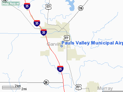
Pauls Valley Muni Airport |
Location & QuickFacts
| FAA Information Effective: | 2008-09-25 |
| Airport Identifier: | PVJ |
| Airport Status: | Operational |
| Longitude/Latitude: | 097-13-23.5810W/34-42-39.7930N
-97.223217/34.711054 (Estimated) |
| Elevation: | 968 ft / 295.05 m (Surveyed) |
| Land: | 480 acres |
| From nearest city: | 2 nautical miles S of Pauls Valley, OK |
| Location: | Garvin County, OK |
| Magnetic Variation: | 06E (1995) |
Owner & Manager
| Ownership: | Publicly owned |
| Owner: | City Of Pauls Valley |
| Address: | City Hall, Po Box 961
Pauls Valley, OK 73075 |
| Phone number: | 405-238-3308 |
| Manager: | Craig Carson |
| Address: | Po Box 961
Pauls Valley, OK 73075 |
| Phone number: | 405-238-7338 |
Airport Operations and Facilities
| Airport Use: | Open to public |
| Wind indicator: | Yes |
| Segmented Circle: | No |
| Control Tower: | No |
| Lighting Schedule: | DUSK-DAWN
ACTVT MIRL RY 17/35, PAPI & REIL RY 17 & 35 - CTAF. |
| Beacon Color: | Clear-Green (lighted land airport) |
| Landing fee charge: | No |
| Sectional chart: | Dallas-ft Worth |
| Region: | ASW - Southwest |
| Boundary ARTCC: | ZFW - Fort Worth |
| Tie-in FSS: | MLC - Mc Alester |
| FSS on Airport: | No |
| FSS Toll Free: | 1-800-WX-BRIEF |
| NOTAMs Facility: | PVJ (NOTAM-d service avaliable) |
| Federal Agreements: | NR13 |
Airport Communications
| CTAF: | 122.800 |
| Unicom: | 122.800 |
Airport Services
| Fuel available: | 100LLA |
| Bottled Oxygen: | NONE |
| Bulk Oxygen: | NONE |
Runway Information
Runway 12/30
| Dimension: | 3500 x 150 ft / 1066.8 x 45.7 m |
| Surface: | CONC, Good Condition |
| Weight Limit: | Single wheel: 42000 lbs.
Dual wheel: 55000 lbs.
Dual tandem wheel: 110000 lbs. |
| |
Runway 12 |
Runway 30 |
| Longitude: | 097-13-34.6800W | 097-13-05.0800W |
| Latitude: | 34-42-56.4900N | 34-42-31.9900N |
| Elevation: | 965.00 ft | 948.00 ft |
| Alignment: | 127 | 127 |
| Traffic Pattern: | Left | Left |
| Markings: | Basic, Good Condition | Basic, Good Condition |
| Obstruction: | 60 ft trees, 727.0 ft from runway, 8:1 slope to clear | 40 ft trees, 900.0 ft from runway, 17:1 slope to clear |
|
Runway 17/35
| Dimension: | 5000 x 100 ft / 1524.0 x 30.5 m |
| Surface: | CONC, Good Condition |
| Weight Limit: | Single wheel: 42000 lbs.
Dual wheel: 55000 lbs.
Dual tandem wheel: 110000 lbs. |
| Edge Lights: | Medium |
| |
Runway 17 |
Runway 35 |
| Longitude: | 097-13-27.0800W | 097-13-27.0800W |
| Latitude: | 34-42-51.9900N | 34-42-02.5500N |
| Elevation: | 968.00 ft | 946.00 ft |
| Alignment: | 127 | 0 |
| Traffic Pattern: | Left | Left |
| Markings: | Non-precision instrument, Good Condition | Non-precision instrument, Good Condition |
| Crossing Height: | 55.00 ft | 42.00 ft |
| VASI: | 4-light PAPI on left side | 4-light PAPI on left side
PAPI OTS INDEFLY. |
| Visual Glide Angle: | 3.00° | 3.00° |
| Runway End Identifier: | Yes | Yes |
| Obstruction: | 40 ft trees, 850.0 ft from runway, 16:1 slope to clear | , 50:1 slope to clear |
|
Radio Navigation Aids
| ID |
Type |
Name |
Ch |
Freq |
Var |
Dist |
| PVJ | NDB | Pauls Valley | | 384.00 | 06E | 0.4 nm |
| AUV | NDB | Arbuckle | | 284.00 | 07E | 34.0 nm |
| OUN | NDB | Norman | | 260.00 | 07E | 34.5 nm |
| SRE | NDB | Seminole | | 278.00 | 06E | 43.2 nm |
| OLR | NDB | Chickasha | | 290.00 | 07E | 43.8 nm |
| HDL | NDB | Holdenville | | 411.00 | 06E | 45.8 nm |
| OK | NDB | Tuloo | | 406.00 | 07E | 49.4 nm |
| TIK | TACAN | Tinker | 105X | | 07E | 44.3 nm |
| ADH | VOR/DME | Ada | 125X | 117.80 | 06E | 27.9 nm |
| DUC | VOR/DME | Duncan | 047X | 111.00 | 09E | 39.6 nm |
| ADM | VORTAC | Ardmore | 114X | 116.70 | 06E | 30.1 nm |
| IRW | VORTAC | Will Rogers | 088X | 114.10 | 07E | 43.3 nm |
| OKC | VOT | Oklahoma Will Rgs W | | 108.80 | | 45.0 nm |
Remarks
- ULTRALIGHTS ON & INVOF ARPT.
- PRE DATES THE ACT.
Images and information placed above are from
http://www.airport-data.com/airport/PVJ/
We thank them for the data!
| General Info
|
| Country |
United States
|
| State |
OKLAHOMA
|
| FAA ID |
PVJ
|
| Latitude |
34-42-39.793N
|
| Longitude |
097-13-23.581W
|
| Elevation |
968 feet
|
| Near City |
PAULS VALLEY
|
We don't guarantee the information is fresh and accurate. The data may
be wrong or outdated.
For more up-to-date information please refer to other sources.
|
|


