 |
|
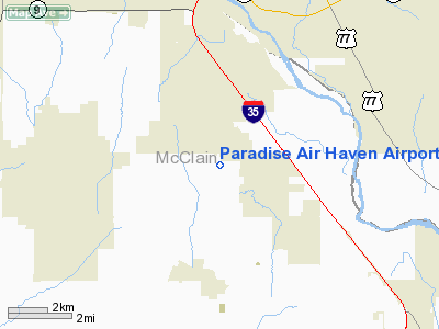
Paradise Air Haven Airport |
Location & QuickFacts
| FAA Information Effective: | 2008-09-25 |
| Airport Identifier: | 39OK |
| Airport Status: | Operational |
| Longitude/Latitude: | 097-28-45.3100W/35-06-41.3400N
-97.479253/35.111483 (Estimated) |
| Elevation: | 1205 ft / 367.28 m (Estimated) |
| Land: | 100 acres |
| From nearest city: | 2 nautical miles S of Goldsby, OK |
| Location: | Mc Clain County, OK |
| Magnetic Variation: | 07E (1985) |
Owner & Manager
| Ownership: | Privately owned |
| Owner: | Paradise Air Haven Homeowners Assn |
| Address: | 27275 St Hwy 74
Washington, OK 73093 |
| Phone number: | 405-288-6700 |
| Manager: | Charles Wood |
| Address: | 27275 St Hwy 74
Washington, OK 73093 |
| Phone number: | 405-288-6700 |
Airport Operations and Facilities
| Airport Use: | Private |
| Wind indicator: | Yes |
| Segmented Circle: | No |
| Control Tower: | No |
| Lighting Schedule: | PHONE REQ
FOR ROTG BCN CALL 405-288-6700. |
| Beacon Color: | Clear-Green (lighted land airport) |
| Sectional chart: | Dallas-ft Worth |
| Region: | ASW - Southwest |
| Boundary ARTCC: | ZFW - Fort Worth |
| Tie-in FSS: | MLC - Mc Alester |
| FSS on Airport: | No |
| FSS Toll Free: | 1-800-WX-BRIEF |
Airport Services
Runway Information
Runway 17/35
| Dimension: | 4000 x 150 ft / 1219.2 x 45.7 m |
| Surface: | TURF, |
| |
Runway 17 |
Runway 35 |
| Traffic Pattern: | Right | Left |
| Obstruction: | | 100 ft tower, 85.0 ft from runway |
|
Radio Navigation Aids
| ID |
Type |
Name |
Ch |
Freq |
Var |
Dist |
| FSI | FAN MARKER | Trail | | | 09E | 49.6 nm |
| OUN | NDB | Norman | | 260.00 | 07E | 8.2 nm |
| OK | NDB | Tuloo | | 406.00 | 07E | 22.5 nm |
| OLR | NDB | Chickasha | | 290.00 | 07E | 24.2 nm |
| PVJ | NDB | Pauls Valley | | 384.00 | 06E | 26.8 nm |
| RQO | NDB | El Reno | | 335.00 | 07E | 34.1 nm |
| SRE | NDB | Seminole | | 278.00 | 06E | 40.7 nm |
| LCY | NDB | Logan County | | 326.00 | 07E | 44.2 nm |
| GGU | NDB | Prague | | 314.00 | 06E | 44.6 nm |
| CQB | NDB | Tilghman | | 396.00 | 06E | 48.9 nm |
| OFZ | NDB | Trail | | 388.00 | 09E | 49.6 nm |
| TIK | TACAN | Tinker | 105X | | 07E | 20.1 nm |
| PWA | VOR/DME | Wiley Post | 081X | 113.40 | 08E | 26.6 nm |
| ADH | VOR/DME | Ada | 125X | 117.80 | 06E | 44.0 nm |
| DUC | VOR/DME | Duncan | 047X | 111.00 | 09E | 48.8 nm |
| IRW | VORTAC | Will Rogers | 088X | 114.10 | 07E | 16.2 nm |
| IFI | VORTAC | Kingfisher | 094X | 114.70 | 09E | 49.0 nm |
| OKC | VOT | Oklahoma Will Rgs W | | 108.80 | | 18.0 nm |
Remarks
- VFR USE ONLY; COORDINATE ATP WITH HUTTON; PACER; FLYING A; & PERRY ARPTS.
Images and information placed above are from
http://www.airport-data.com/airport/39OK/
We thank them for the data!
| General Info
|
| Country |
United States
|
| State |
OKLAHOMA
|
| FAA ID |
39OK
|
| Latitude |
35-06-41.340N
|
| Longitude |
097-28-45.310W
|
| Elevation |
1205 feet
|
| Near City |
GOLDSBY
|
We don't guarantee the information is fresh and accurate. The data may
be wrong or outdated.
For more up-to-date information please refer to other sources.
|
|


