 |
|
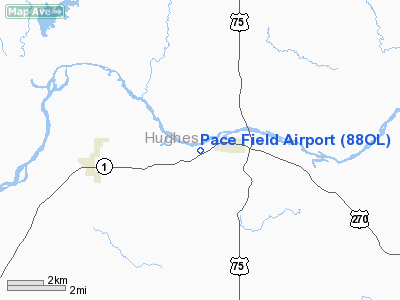
Location & QuickFacts
| FAA Information Effective: | 2008-09-25 |
| Airport Identifier: | 88OL |
| Airport Status: | Operational |
| Longitude/Latitude: | 096-16-16.0230W/34-57-52.3190N
-96.271118/34.964533 (Estimated) |
| Elevation: | 825 ft / 251.46 m (Estimated) |
| Land: | 40 acres |
| From nearest city: | 1 nautical miles W of Calvin, OK |
| Location: | Hughes County, OK |
| Magnetic Variation: | 06E (1985) |
Owner & Manager
| Ownership: | Privately owned |
| Owner: | Robert E Pace |
| Address: | Box 95
Calvin, OK 74531 |
| Phone number: | 405-645-2422 |
| Manager: | Robert E Pace |
| Address: | Box 95
Calvin, OK 74531 |
| Phone number: | 405-645-2422 |
Airport Operations and Facilities
| Airport Use: | Private |
| Wind indicator: | Yes |
| Segmented Circle: | No |
| Control Tower: | No |
| Landing fee charge: | No |
| Sectional chart: | Dallas-ft Worth |
| Region: | ASW - Southwest |
| Boundary ARTCC: | ZFW - Fort Worth |
| Tie-in FSS: | MLC - Mc Alester |
| FSS on Airport: | No |
| FSS Toll Free: | 1-800-WX-BRIEF |
Airport Services
| Airframe Repair: | NONE |
| Power Plant Repair: | NONE |
Runway Information
Runway 03/21
| Dimension: | 2500 x 80 ft / 762.0 x 24.4 m |
| Surface: | TURF, Fair Condition |
| |
Runway 03 |
Runway 21 |
| Traffic Pattern: | Left | Left |
| Obstruction: | 30 ft pline, 300.0 ft from runway, 10:1 slope to clear | 5 ft trees, 100.0 ft from runway, 20:1 slope to clear |
|
Radio Navigation Aids
| ID |
Type |
Name |
Ch |
Freq |
Var |
Dist |
| HDL | NDB | Holdenville | | 411.00 | 06E | 10.1 nm |
| SRE | NDB | Seminole | | 278.00 | 06E | 27.1 nm |
| HET | NDB | Henryetta | | 267.00 | 04E | 29.3 nm |
| GGU | NDB | Prague | | 314.00 | 06E | 39.8 nm |
| TZO | NDB | Bristow | | 251.00 | 05E | 49.0 nm |
| PVJ | NDB | Pauls Valley | | 384.00 | 06E | 49.6 nm |
| ADH | VOR/DME | Ada | 125X | 117.80 | 06E | 21.9 nm |
| OKM | VOR/DME | Okmulgee | 096X | 114.90 | 08E | 48.1 nm |
| MLC | VORTAC | Mc Alester | 057X | 112.00 | 08E | 25.1 nm |
Remarks
- USE EXTREME CARE CATTLE ON RY.
- VFR ONLY
Images and information placed above are from
http://www.airport-data.com/airport/88OL/
We thank them for the data!
| General Info
|
| Country |
United States
|
| State |
OKLAHOMA
|
| FAA ID |
88OL
|
| Latitude |
34-57-52.319N
|
| Longitude |
096-16-16.023W
|
| Elevation |
825 feet
|
| Near City |
CALVIN
|
We don't guarantee the information is fresh and accurate. The data may
be wrong or outdated.
For more up-to-date information please refer to other sources.
|
|


