 |
|
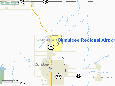
Location & QuickFacts
| FAA Information Effective: | 2008-09-25 |
| Airport Identifier: | OKM |
| Airport Status: | Operational |
| Longitude/Latitude: | 095-56-55.3000W/35-40-05.3000N
-95.948694/35.668139 (Estimated) |
| Elevation: | 720 ft / 219.46 m (Surveyed) |
| Land: | 1100 acres |
| From nearest city: | 3 nautical miles N of Okmulgee, OK |
| Location: | Okmulgee County, OK |
| Magnetic Variation: | 04E (2005) |
Owner & Manager
| Ownership: | Publicly owned |
| Owner: | City Of Okmulgee |
| Address: | 111 E. 4th St., P. O. Box 250
Okmulgee, OK 74447 |
| Phone number: | 918-756-4060 |
| Manager: | Jeremy Porter |
| Address: | 100 East Airport Rd
Okmulgee, OK 74447 |
| Phone number: | 918-756-0412
ADDNL PHONE NR 918-756-0413. |
Airport Operations and Facilities
| Airport Use: | Open to public |
| Wind indicator: | Yes |
| Segmented Circle: | Yes |
| Control Tower: | No |
| Lighting Schedule: | DUSK-DAWN
ACTVT MIRL RY 18/36 & MALSR RY 18 - CTAF. |
| Beacon Color: | Clear-Green (lighted land airport) |
| Landing fee charge: | No |
| Sectional chart: | Dallas-ft Worth |
| Region: | ASW - Southwest |
| Boundary ARTCC: | ZFW - Fort Worth |
| Responsible ARTCC: | ZKC - Kansas City |
| Tie-in FSS: | MLC - Mc Alester |
| FSS on Airport: | No |
| FSS Toll Free: | 1-800-WX-BRIEF |
| NOTAMs Facility: | OKM (NOTAM-d service avaliable) |
| Federal Agreements: | NGY3 |
Airport Communications
| CTAF: | 123.000 |
| Unicom: | 123.000 |
Airport Services
| Fuel available: | 100LLA |
| Bottled Oxygen: | NONE |
| Bulk Oxygen: | NONE |
Runway Information
Runway 18/36
| Dimension: | 5150 x 100 ft / 1569.7 x 30.5 m |
| Surface: | CONC, Good Condition |
| Weight Limit: | Single wheel: 30000 lbs.
Dual wheel: 48000 lbs.
Dual tandem wheel: 78000 lbs. |
| Edge Lights: | Medium |
| |
Runway 18 |
Runway 36 |
| Longitude: | 095-56-54.6300W | 095-56-55.9740W |
| Latitude: | 35-40-30.7250N | 35-39-39.8070N |
| Elevation: | 720.00 ft | 684.00 ft |
| Alignment: | 127 | 1 |
| ILS Type: | ILS
| |
| Traffic Pattern: | Left | Left |
| Markings: | Precision instrument, Good Condition | Non-precision instrument, Good Condition |
| Approach lights: | MALSR | |
| Obstruction: | , 50:1 slope to clear | 70 ft trees, 1830.0 ft from runway, 23:1 slope to clear |
|
Radio Navigation Aids
| ID |
Type |
Name |
Ch |
Freq |
Var |
Dist |
| HET | NDB | Henryetta | | 267.00 | 04E | 16.2 nm |
| TZO | NDB | Bristow | | 251.00 | 05E | 24.0 nm |
| OWP | NDB | William Pogue | | 362.00 | 06E | 31.9 nm |
| MKO | NDB | Muskogee | | 306.00 | 06E | 32.6 nm |
| DW | NDB | Owaso | | 375.00 | 06E | 38.6 nm |
| GGU | NDB | Prague | | 314.00 | 06E | 38.7 nm |
| HDL | NDB | Holdenville | | 411.00 | 06E | 41.8 nm |
| CUH | NDB | Cushing | | 242.00 | 05E | 42.5 nm |
| CQB | NDB | Tilghman | | 396.00 | 06E | 42.6 nm |
| SRE | NDB | Seminole | | 278.00 | 06E | 42.8 nm |
| TQH | NDB | Tahlequah | | 215.00 | 05E | 48.5 nm |
| MEE | VOR | Davis | | 108.60 | 06E | 28.4 nm |
| OKM | VOR/DME | Okmulgee | 096X | 114.90 | 08E | 4.3 nm |
| GNP | VOR/DME | Glenpool | 043X | 110.60 | 06E | 15.2 nm |
| TUL | VORTAC | Tulsa | 091X | 114.40 | 08E | 32.7 nm |
| MLC | VORTAC | Mc Alester | 057X | 112.00 | 08E | 49.9 nm |
| TUL | VOT | Tulsa Intl | | 109.00 | | 32.7 nm |
Remarks
- FLOCK OF MIGRATORY BIRDS & DEER ON & INVOF ARPT.
Images and information placed above are from
http://www.airport-data.com/airport/OKM/
We thank them for the data!
|
|


