 |
|
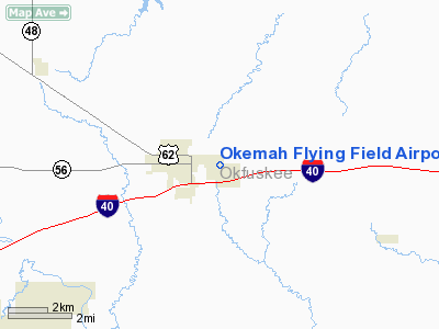
Okemah Flying Field Airport |
Location & QuickFacts
| FAA Information Effective: | 2008-09-25 |
| Airport Identifier: | F81 |
| Airport Status: | Operational |
| Longitude/Latitude: | 096-17-01.8740W/35-25-51.2490N
-96.283854/35.430903 (Estimated) |
| Elevation: | 867 ft / 264.26 m (Estimated) |
| Land: | 80 acres |
| From nearest city: | 1 nautical miles E of Okemah, OK |
| Location: | Okfuskee County, OK |
| Magnetic Variation: | 06E (1985) |
Owner & Manager
| Ownership: | Publicly owned |
| Owner: | City Of Okemah |
| Address: | 502 W. Broadway
Okemah, OK 74859 |
| Phone number: | 918-623-1050 |
| Manager: | Jerry Turner
CITY MANAGER |
| Address: | 502 W. Broadway
Okemah, OK 74859 |
| Phone number: | 918-623-1050 |
Airport Operations and Facilities
| Airport Use: | Open to public |
| Wind indicator: | Yes |
| Segmented Circle: | No |
| Control Tower: | No |
| Landing fee charge: | No |
| Sectional chart: | Dallas-ft Worth |
| Region: | ASW - Southwest |
| Traffic Pattern Alt: | 933 ft |
| Boundary ARTCC: | ZFW - Fort Worth |
| Tie-in FSS: | MLC - Mc Alester |
| FSS on Airport: | No |
| FSS Toll Free: | 1-800-WX-BRIEF |
| NOTAMs Facility: | MLC (NOTAM-d service avaliable) |
| Federal Agreements: | N |
Airport Communications
Airport Services
| Airframe Repair: | NONE |
| Power Plant Repair: | NONE |
| Bottled Oxygen: | NONE |
| Bulk Oxygen: | NONE |
Runway Information
Runway 02/20
| Dimension: | 2375 x 80 ft / 723.9 x 24.4 m |
| Surface: | TURF, Poor Condition
SURFACE ROUGH AND BUMPY WITH SEVERE TRANSVERSE RUTTING. NUMEROUS GOLF TRAILS CROSS THE RY. |
| |
Runway 02 |
Runway 20 |
| Traffic Pattern: | Left | Left |
| Obstruction: | 35 ft trees, 50.0 ft from runway, 20 ft left of centerline, 1:1 slope to clear | 40 ft tree, 390.0 ft from runway, 50 ft right of centerline, 9:1 slope to clear |
|
Runway 17/35
| Dimension: | 2585 x 100 ft / 787.9 x 30.5 m |
| Surface: | TURF, Fair Condition
SURFACE ROUGH AND BUMPY WITH SEVERE TRANSVERSE RUTTING. NUMEROUS GOLF TRAILS CROSS THE RY. |
| |
Runway 17 |
Runway 35 |
| Traffic Pattern: | Left | Left |
| Obstruction: | 30 ft tree, 335.0 ft from runway, 50 ft right of centerline, 11:1 slope to clear | 40 ft tree, 90.0 ft from runway, 125 ft left of centerline, 2:1 slope to clear |
|
Radio Navigation Aids
| ID |
Type |
Name |
Ch |
Freq |
Var |
Dist |
| HET | NDB | Henryetta | | 267.00 | 04E | 13.3 nm |
| SRE | NDB | Seminole | | 278.00 | 06E | 21.4 nm |
| TZO | NDB | Bristow | | 251.00 | 05E | 21.5 nm |
| HDL | NDB | Holdenville | | 411.00 | 06E | 21.7 nm |
| GGU | NDB | Prague | | 314.00 | 06E | 21.9 nm |
| CQB | NDB | Tilghman | | 396.00 | 06E | 31.5 nm |
| CUH | NDB | Cushing | | 242.00 | 05E | 36.6 nm |
| OWP | NDB | William Pogue | | 362.00 | 06E | 45.0 nm |
| MKO | NDB | Muskogee | | 306.00 | 06E | 49.7 nm |
| MEE | VOR | Davis | | 108.60 | 06E | 46.9 nm |
| OKM | VOR/DME | Okmulgee | 096X | 114.90 | 08E | 25.8 nm |
| GNP | VOR/DME | Glenpool | 043X | 110.60 | 06E | 33.2 nm |
| ADH | VOR/DME | Ada | 125X | 117.80 | 06E | 42.3 nm |
| MLC | VORTAC | Mc Alester | 057X | 112.00 | 08E | 42.8 nm |
Remarks
- RY 02/20 LINED WITH +30 FT TREES.
- +4 FT DIRT MOUND IN CENTER OF RY 02/20 360 FT FM RY 02 END.
- +4 FT DIRT MOUND IN CENTER OF STUB TAXIWAY.
- TREES, BROKEN LIGHT FIXTURES, OLD TIRES, GOLF DRIVING RANGE, GOLF TEES, ALL WITHIN PRIMARY SURFACE AND SAFETY AREAS OF BOTH RWYS.
- WATER HOLE AND DRAIN ON EAST SIDE OF RY 17/35 AT TWY INTERSECTION.
- ESTAB PRIOR TO 1959.
Images and information placed above are from
http://www.airport-data.com/airport/F81/
We thank them for the data!
| General Info
|
| Country |
United States
|
| State |
OKLAHOMA
|
| FAA ID |
F81
|
| Latitude |
35-25-51.249N
|
| Longitude |
096-17-01.874W
|
| Elevation |
867 feet
|
| Near City |
OKEMAH
|
We don't guarantee the information is fresh and accurate. The data may
be wrong or outdated.
For more up-to-date information please refer to other sources.
|
|


