 |
|
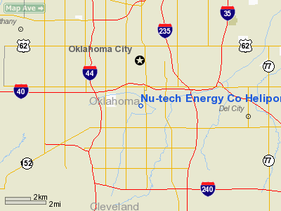
Nu-tech Energy Co Heliport |
Location & QuickFacts
| FAA Information Effective: | 2008-09-25 |
| Airport Identifier: | 8OK9 |
| Airport Status: | Operational |
| Longitude/Latitude: | 097-32-06.1390W/35-27-02.2170N
-97.535039/35.450616 (Estimated) |
| Elevation: | 1225 ft / 373.38 m (Estimated) |
| Land: | 2 acres |
| From nearest city: | 0 nautical miles N of Oklahoma City, OK |
| Location: | Oklahoma County, OK |
| Magnetic Variation: | 07E (1985) |
Owner & Manager
| Ownership: | Privately owned |
| Owner: | Mark Holloway Inc |
| Address: | 100 S Vermont
Oklahoma City, OK 73107 |
| Phone number: | 405-820-2930 |
| Manager: | Andy Sheen |
| Address: | 100 S Vermont
Oklahoma City, OK 73107 |
| Phone number: | 405-820-2930 |
Airport Operations and Facilities
| Airport Use: | Private |
| Wind indicator: | No |
| Segmented Circle: | Yes |
| Control Tower: | No |
| Landing fee charge: | No |
| Sectional chart: | Dallas-ft Worth |
| Region: | ASW - Southwest |
| Boundary ARTCC: | ZFW - Fort Worth |
| Tie-in FSS: | MLC - Mc Alester |
| FSS on Airport: | No |
| FSS Toll Free: | 1-800-WX-BRIEF |
Airport Services
Runway Information
Helipad H1
| Dimension: | 60 x 40 ft / 18.3 x 12.2 m |
| Surface: | CONC, |
| |
Runway H1 |
Runway |
| Traffic Pattern: | Left | Left |
|
Radio Navigation Aids
| ID |
Type |
Name |
Ch |
Freq |
Var |
Dist |
| OK | NDB | Tuloo | | 406.00 | 07E | 3.7 nm |
| OUN | NDB | Norman | | 260.00 | 07E | 12.6 nm |
| RQO | NDB | El Reno | | 335.00 | 07E | 23.3 nm |
| LCY | NDB | Logan County | | 326.00 | 07E | 24.4 nm |
| OLR | NDB | Chickasha | | 290.00 | 07E | 29.9 nm |
| CQB | NDB | Tilghman | | 396.00 | 06E | 38.6 nm |
| GGU | NDB | Prague | | 314.00 | 06E | 40.2 nm |
| SRE | NDB | Seminole | | 278.00 | 06E | 43.5 nm |
| CUH | NDB | Cushing | | 242.00 | 05E | 45.5 nm |
| PVJ | NDB | Pauls Valley | | 384.00 | 06E | 46.7 nm |
| TIK | TACAN | Tinker | 105X | | 07E | 7.7 nm |
| PWA | VOR/DME | Wiley Post | 081X | 113.40 | 08E | 7.4 nm |
| IRW | VORTAC | Will Rogers | 088X | 114.10 | 07E | 6.6 nm |
| IFI | VORTAC | Kingfisher | 094X | 114.70 | 09E | 31.3 nm |
| OKC | VOT | Oklahoma Will Rgs W | | 108.80 | | 4.7 nm |
Remarks
- PRVDD HEAVY EQUIP IS REMOVED FROM LNDG AREA BEFORE HELI OPNS ARE RESUMED; INGRESS/EGRESS ROUTES ARE ESTABD TO/FROM THE EAST ONLY; OPNS ARE CONDUCTED IN DALGT/VFR CONDS.
Images and information placed above are from
http://www.airport-data.com/airport/8OK9/
We thank them for the data!
| General Info
|
| Country |
United States
|
| State |
OKLAHOMA
|
| FAA ID |
8OK9
|
| Latitude |
35-27-02.217N
|
| Longitude |
097-32-06.139W
|
| Elevation |
1225 feet
|
| Near City |
OKLAHOMA CITY
|
We don't guarantee the information is fresh and accurate. The data may
be wrong or outdated.
For more up-to-date information please refer to other sources.
|
|


