 |
|
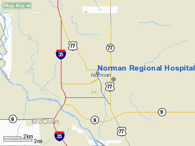
Norman Rgnl Hospital Heliport |
Location & QuickFacts
| FAA Information Effective: | 2008-09-25 |
| Airport Identifier: | 7OK6 |
| Airport Status: | Operational |
| Longitude/Latitude: | 097-26-23.0000W/35-13-45.0000N
-97.439722/35.229167 (Estimated) |
| Elevation: | 1182 ft / 360.27 m (Estimated) |
| Land: | 0 acres |
| From nearest city: | 0 nautical miles N of Norman, OK |
| Location: | Cleveland County, OK |
| Magnetic Variation: | 07E (1990) |
Owner & Manager
| Ownership: | Privately owned |
| Owner: | Norman Regional Hospital |
| Address: | 901 N. Porter
Norman, OK 73070-1308 |
| Phone number: | 405-307-1000 |
| Manager: | Richard Simpson
DIR, SAFETY/SECURITY. |
| Address: | 901 N. Porter
Norman, OK 73070-1308 |
| Phone number: | 405-307-1558 |
Airport Operations and Facilities
| Airport Use: | Private
MEDICAL USE ONLY. |
| Segmented Circle: | No |
| Control Tower: | No |
| Sectional chart: | Dallas-ft Worth |
| Region: | ASW - Southwest |
| Boundary ARTCC: | ZFW - Fort Worth |
| Tie-in FSS: | MLC - Mc Alester |
| FSS on Airport: | No |
| FSS Toll Free: | 1-800-WX-BRIEF |
Runway Information
Helipad H1
| Dimension: | 35 x 35 ft / 10.7 x 10.7 m |
| Surface: | CONC, |
| |
Runway H1 |
Runway |
| Traffic Pattern: | Left | Left |
|
Radio Navigation Aids
| ID |
Type |
Name |
Ch |
Freq |
Var |
Dist |
| OUN | NDB | Norman | | 260.00 | 07E | 1.9 nm |
| OK | NDB | Tuloo | | 406.00 | 07E | 16.7 nm |
| OLR | NDB | Chickasha | | 290.00 | 07E | 27.2 nm |
| RQO | NDB | El Reno | | 335.00 | 07E | 31.7 nm |
| PVJ | NDB | Pauls Valley | | 384.00 | 06E | 32.6 nm |
| LCY | NDB | Logan County | | 326.00 | 07E | 37.1 nm |
| SRE | NDB | Seminole | | 278.00 | 06E | 37.6 nm |
| GGU | NDB | Prague | | 314.00 | 06E | 39.3 nm |
| CQB | NDB | Tilghman | | 396.00 | 06E | 42.5 nm |
| TIK | TACAN | Tinker | 105X | | 07E | 12.8 nm |
| PWA | VOR/DME | Wiley Post | 081X | 113.40 | 08E | 20.9 nm |
| ADH | VOR/DME | Ada | 125X | 117.80 | 06E | 45.7 nm |
| IRW | VORTAC | Will Rogers | 088X | 114.10 | 07E | 11.4 nm |
| IFI | VORTAC | Kingfisher | 094X | 114.70 | 09E | 44.3 nm |
| OKC | VOT | Oklahoma Will Rgs W | | 108.80 | | 12.6 nm |
Remarks
- PRVDD ONLY E & W INGRESS/EGRESS RTS ARE USED; A LGTD WIND INDICATOR VISIBLE TO PILOTS IN THE AIR & ON THE GND IS INSTALLED; A MEANS OF CONTROLLING VEHICULAR & PEDESTRIAN TFC IS IN PLACE WHEN THE HELIPAD IS IN USE.
Images and information placed above are from
http://www.airport-data.com/airport/7OK6/
We thank them for the data!
| General Info
|
| Country |
United States
|
| State |
OKLAHOMA
|
| FAA ID |
7OK6
|
| Latitude |
35-13-45.000N
|
| Longitude |
097-26-23.000W
|
| Elevation |
1182 feet
|
| Near City |
NORMAN
|
We don't guarantee the information is fresh and accurate. The data may
be wrong or outdated.
For more up-to-date information please refer to other sources.
|
|


