 |
|
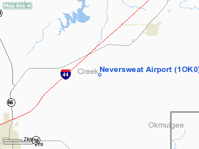
Location & QuickFacts
| FAA Information Effective: | 2008-09-25 |
| Airport Identifier: | 1OK0 |
| Airport Status: | Operational |
| Longitude/Latitude: | 096-16-46.0140W/35-53-40.2990N
-96.279448/35.894528 (Estimated) |
| Elevation: | 775 ft / 236.22 m (Estimated) |
| Land: | 0 acres |
| From nearest city: | 6 nautical miles NE of Bristow, OK |
| Location: | Creek County, OK |
| Magnetic Variation: | 06E (1985) |
Owner & Manager
| Ownership: | Privately owned |
| Owner: | Lawanna Gonzales |
| Address: | 18503 S 257 W Ave
Bristow, OK 74010 |
| Phone number: | 918-247-6464 |
| Manager: | Lawanna Gonzalez |
| Address: | Rr 3 Box 453
Bristow, OK 74010 |
| Phone number: | 918-247-6464 |
Airport Operations and Facilities
| Airport Use: | Private |
| Wind indicator: | Yes |
| Segmented Circle: | No |
| Control Tower: | No |
| Landing fee charge: | No |
| Sectional chart: | Dallas-ft Worth |
| Region: | ASW - Southwest |
| Boundary ARTCC: | ZKC - Kansas City |
| Tie-in FSS: | MLC - Mc Alester |
| FSS on Airport: | No |
| FSS Toll Free: | 1-800-WX-BRIEF |
Airport Communications
Airport Services
| Airframe Repair: | NONE |
| Power Plant Repair: | NONE |
Runway Information
Runway N/S
| Dimension: | 1968 x 70 ft / 599.8 x 21.3 m |
| Surface: | TURF, |
| |
Runway N |
Runway S |
| Traffic Pattern: | Left | Left |
| Obstruction: | | 30 ft pline, 120.0 ft from runway |
|
Radio Navigation Aids
| ID |
Type |
Name |
Ch |
Freq |
Var |
Dist |
| TZO | NDB | Bristow | | 251.00 | 05E | 10.3 nm |
| OWP | NDB | William Pogue | | 362.00 | 06E | 17.8 nm |
| CUH | NDB | Cushing | | 242.00 | 05E | 24.1 nm |
| CQB | NDB | Tilghman | | 396.00 | 06E | 28.2 nm |
| GGU | NDB | Prague | | 314.00 | 06E | 31.2 nm |
| DW | NDB | Owaso | | 375.00 | 06E | 31.6 nm |
| HET | NDB | Henryetta | | 267.00 | 04E | 32.2 nm |
| SRE | NDB | Seminole | | 278.00 | 06E | 42.1 nm |
| HDL | NDB | Holdenville | | 411.00 | 06E | 49.1 nm |
| MEE | VOR | Davis | | 108.60 | 06E | 46.6 nm |
| GNP | VOR/DME | Glenpool | 043X | 110.60 | 06E | 15.2 nm |
| OKM | VOR/DME | Okmulgee | 096X | 114.90 | 08E | 23.5 nm |
| SWO | VOR/DME | Stillwater | 021X | 108.40 | 07E | 43.7 nm |
| TUL | VORTAC | Tulsa | 091X | 114.40 | 08E | 30.0 nm |
| TUL | VOT | Tulsa Intl | | 109.00 | | 30.0 nm |
Remarks
- (E45-17) RWY LGTS ON NORTH END OBSCRD BY GRASS.
Images and information placed above are from
http://www.airport-data.com/airport/1OK0/
We thank them for the data!
| General Info
|
| Country |
United States
|
| State |
OKLAHOMA
|
| FAA ID |
1OK0
|
| Latitude |
35-53-40.299N
|
| Longitude |
096-16-46.014W
|
| Elevation |
775 feet
|
| Near City |
BRISTOW
|
We don't guarantee the information is fresh and accurate. The data may
be wrong or outdated.
For more up-to-date information please refer to other sources.
|
|


