 |
|
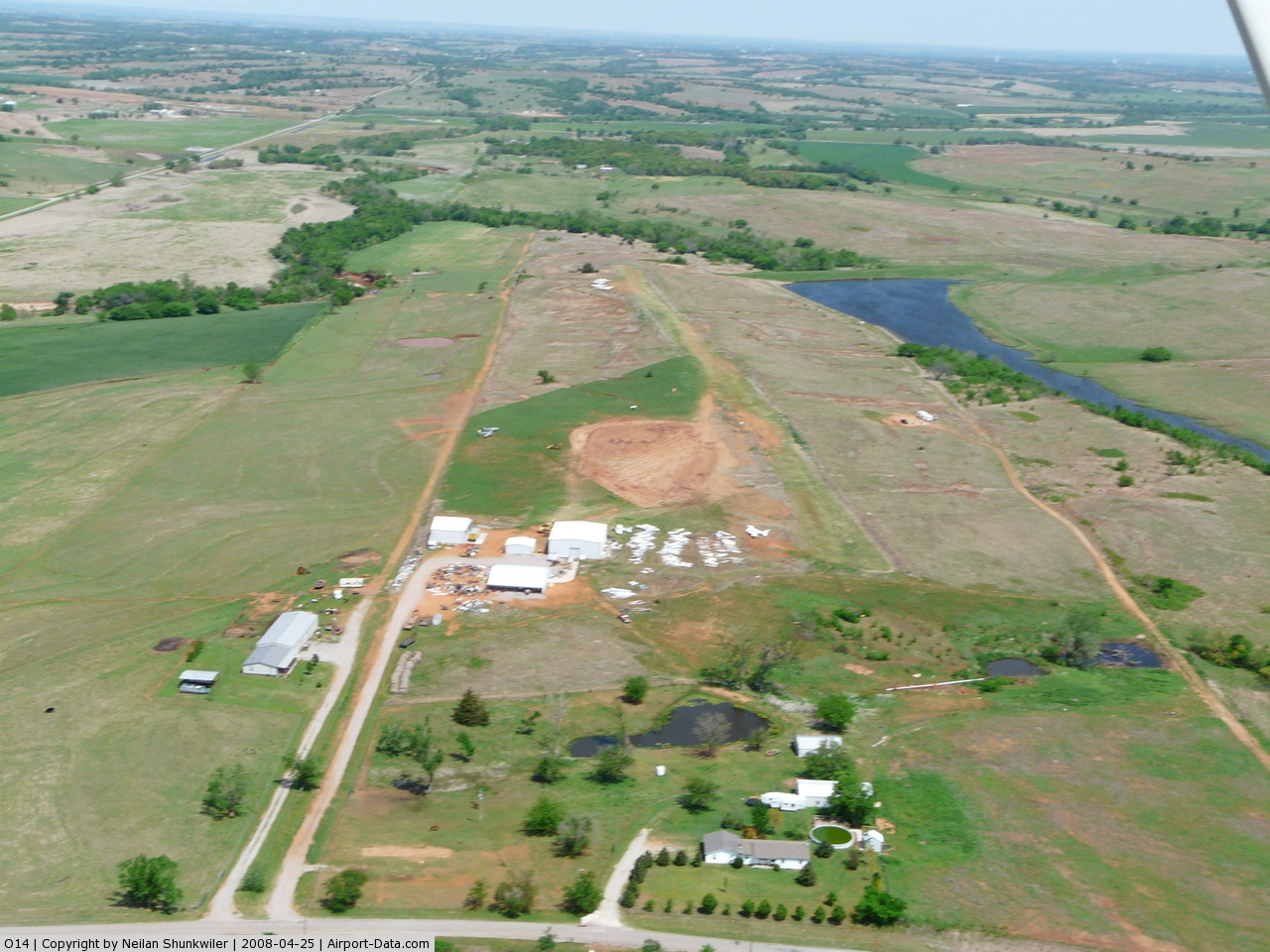 |
(Click on the photo to enlarge) |
Location & QuickFacts
| FAA Information Effective: | 2008-09-25 |
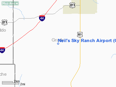
| Airport Identifier: | O14 |
| Airport Status: | Operational |
| Longitude/Latitude: | 097-59-54.0000W/34-53-27.0000N
-97.998333/34.890833 (Estimated) |
| Elevation: | 1200 ft / 365.76 m (Estimated) |
| Land: | 82 acres |
| From nearest city: | 9 nautical miles SW of Ninnekah, OK |
| Location: | Grady County, OK |
| Magnetic Variation: | () |
Owner & Manager
| Ownership: | Privately owned |
| Owner: | Neilan Cole Shunkwiler |
| Address: | 640 Cr 1470
Ninnekah, OK 73067 |
| Phone number: | 405-224-8027 |
| Manager: | Neilan Cole Shunkwiler |
| Address: | 640 Cr 1470
Ninnekah, OK 73067 |
| Phone number: | 405-224-8027 |
Airport Operations and Facilities
| Airport Use: | Open to public |
| Control Tower: | No |
| Sectional chart: | Dallas-ft Worth |
| Region: | ASW - Southwest |
| Boundary ARTCC: | ZFW - Fort Worth |
| Tie-in FSS: | MLC - Mc Alester |
| FSS Toll Free: | 1-800-WX-BRIEF |
| NOTAMs Facility: | MLC (NOTAM-d service avaliable) |
Airport Communications
Airport Services
| Airframe Repair: | MAJOR |
| Power Plant Repair: | MAJOR |
Runway Information
Runway 17/35
| Dimension: | 3000 x 150 ft / 914.4 x 45.7 m
SOUTH 600 FT CLSD INDEFLY. |
| Surface: | TURF, Good Condition |
| |
Runway 17 |
Runway 35 |
| Traffic Pattern: | Left | Left |
| Obstruction: | , 50:1 slope to clear | 60 ft trees, 500.0 ft from runway, 8:1 slope to clear |
|
Radio Navigation Aids
| ID |
Type |
Name |
Ch |
Freq |
Var |
Dist |
| FSI | FAN MARKER | Trail | | | 09E | 21.0 nm |
| OLR | NDB | Chickasha | | 290.00 | 07E | 12.9 nm |
| OFZ | NDB | Trail | | 388.00 | 09E | 21.0 nm |
| PFL | NDB | Post | | 308.00 | 08E | 26.2 nm |
| OUN | NDB | Norman | | 260.00 | 07E | 33.7 nm |
| RQO | NDB | El Reno | | 335.00 | 07E | 35.3 nm |
| PVJ | NDB | Pauls Valley | | 384.00 | 06E | 39.4 nm |
| OK | NDB | Tuloo | | 406.00 | 07E | 39.9 nm |
| TIK | TACAN | Tinker | 105X | | 07E | 44.7 nm |
| DUC | VOR/DME | Duncan | 047X | 111.00 | 09E | 30.7 nm |
| LAW | VOR/DME | Lawton | 031X | 109.40 | 09E | 31.4 nm |
| PWA | VOR/DME | Wiley Post | 081X | 113.40 | 08E | 42.3 nm |
| IRW | VORTAC | Will Rogers | 088X | 114.10 | 07E | 34.0 nm |
| OKC | VOT | Oklahoma Will Rgs W | | 108.80 | | 36.0 nm |
Remarks
- GLIDER ACTIVITY ON & INVOF ARPT.
- 255 FT TOWER 1.5 NM NNW & 350 FT TOWER 2.4 NM EAST.
- SEE AIRSPACE CASE 2005-ASW-733-NRA.
Images and information placed above are from
http://www.airport-data.com/airport/O14/
We thank them for the data!
|
|


