 |
|
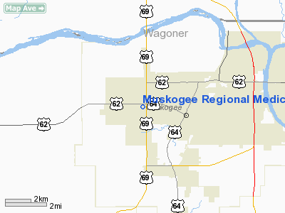
Muskogee Rgnl Medical Center Heliport |
Location & QuickFacts
| FAA Information Effective: | 2008-09-25 |
| Airport Identifier: | 94OK |
| Airport Status: | Operational |
| Longitude/Latitude: | 095-24-21.8940W/35-45-10.3570N
-95.406082/35.752877 (Estimated) |
| Elevation: | 604 ft / 184.10 m (Estimated) |
| Land: | 0 acres |
| From nearest city: | 3 nautical miles E of Muskogee, OK |
| Location: | Muskogee County, OK |
| Magnetic Variation: | 04E (2000) |
Owner & Manager
| Ownership: | Publicly owned |
| Owner: | Muskogee Regional Medical Cen |
| Address: | 300 Rockefeller Dr.
Muskogee, OK 74401 |
| Phone number: | 918-684-2373 |
| Manager: | Eric Matson |
| Address: | 300 Rockefeller Dr
Muskogee, OK 74401 |
| Phone number: | 918-684-2373 |
Airport Operations and Facilities
| Airport Use: | Private
MEDICAL |
| Wind indicator: | Yes |
| Segmented Circle: | No |
| Control Tower: | No |
| Lighting Schedule: | PHONE REQ
FOR PERIMETER LGTS CALL 918-682-5501. |
| Sectional chart: | Dallas-ft Worth |
| Region: | ASW - Southwest |
| Boundary ARTCC: | ZFW - Fort Worth |
| Tie-in FSS: | MLC - Mc Alester |
| FSS Toll Free: | 1-800-WX-BRIEF |
Runway Information
Helipad H1
| Dimension: | 60 x 60 ft / 18.3 x 18.3 m |
| Surface: | CONC, |
| |
Runway H1 |
Runway |
| Traffic Pattern: | Left | Left |
|
Radio Navigation Aids
| ID |
Type |
Name |
Ch |
Freq |
Var |
Dist |
| MKO | NDB | Muskogee | | 306.00 | 06E | 11.1 nm |
| TQH | NDB | Tahlequah | | 215.00 | 05E | 22.1 nm |
| HET | NDB | Henryetta | | 267.00 | 04E | 36.3 nm |
| IQS | NDB | Sallisaw | | 520.00 | 05E | 36.7 nm |
| DW | NDB | Owaso | | 375.00 | 06E | 40.4 nm |
| OWP | NDB | William Pogue | | 362.00 | 06E | 44.3 nm |
| TZO | NDB | Bristow | | 251.00 | 05E | 49.7 nm |
| MEE | VOR | Davis | | 108.60 | 06E | 5.7 nm |
| OKM | VOR/DME | Okmulgee | 096X | 114.90 | 08E | 22.7 nm |
| GNP | VOR/DME | Glenpool | 043X | 110.60 | 06E | 29.2 nm |
| TUL | VORTAC | Tulsa | 091X | 114.40 | 08E | 32.5 nm |
| TUL | VOT | Tulsa Intl | | 109.00 | | 32.5 nm |
Remarks
- PRVDD TREE S SIDE IS REMOVED; THAT INGRESS/EGRESS BE TO/FM NORTHWEST AND/OR SOUTHWEST; AND TFC PATTERN BE COORDINATED WITH HAT BOX ARPT TO ASSURE MUTUALLY COMPATIBLE TFC PTNS.
Images and information placed above are from
http://www.airport-data.com/airport/94OK/
We thank them for the data!
| General Info
|
| Country |
United States
|
| State |
OKLAHOMA
|
| FAA ID |
94OK
|
| Latitude |
35-45-10.357N
|
| Longitude |
095-24-21.894W
|
| Elevation |
604 feet
|
| Near City |
MUSKOGEE
|
We don't guarantee the information is fresh and accurate. The data may
be wrong or outdated.
For more up-to-date information please refer to other sources.
|
|


