 |
|
Municipal Airport
Texhoma Municipal Airport |
| IATA: none – ICAO: none – FAA LID: K49 |
| Summary |
| Airport type |
Public |
| Owner |
City of Texhoma |
| Serves |
Texhoma, Oklahoma |
| Elevation AMSL |
3,462 ft / 1,055 m |
| Coordinates |
36°30′17″N 101°48′44″W / 36.50472°N 101.81222°W / 36.50472; -101.81222 |
| Runways |
| Direction |
Length |
Surface |
| ft |
m |
| 3/21 |
3,564 |
1,086 |
Asphalt |
| 17/35 |
2,340 |
713 |
Turf |
| Statistics (2006) |
| Aircraft operations |
100 |
| Based aircraft |
4 |
| Source: Federal Aviation Administration |
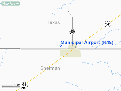
Municipal Airport (FAA LID: K49) is a public use airport in Texas County, Oklahoma, United States. The airport is owned by the City of Texhoma and is located two nautical miles (3.7 km) west of its central business district. It is also known as Texhoma Municipal Airport.
Facilities and aircraft
The airport covers an area of 160 acres (65 ha) at an elevation of 3,462 feet (1,055 m) above mean sea level. It has two runways: 3/21 is 3,564 by 48 feet (1,086 x 15 m) with an asphalt surface; 17/35 is 2,340 by 75 feet (713 x 23 m) with a turf surface.
For the 12-month period ending July 11, 2006, the airport had 100 general aviation aircraft operations, an average of 8 per month. At that time there were 4 aircraft based at this airport: 75% single-engine and 25% ultralight.
The above content comes from Wikipedia and is published under free licenses – click here to read more.
Location & QuickFacts
| FAA Information Effective: | 2008-09-25 |
| Airport Identifier: | K49 |
| Airport Status: | Operational |
| Longitude/Latitude: | 101-48-49.2000W/36-30-20.2000N
-101.813667/36.505611 (Estimated) |
| Elevation: | 3462 ft / 1055.22 m (Surveyed) |
| Land: | 160 acres |
| From nearest city: | 2 nautical miles W of Texhoma, OK |
| Location: | Texas County, OK |
| Magnetic Variation: | 09E (1985) |
Owner & Manager
| Ownership: | Publicly owned |
| Owner: | City Of Texhoma |
| Address: | City Hall
Texhoma, OK 73949 |
| Phone number: | 580-423-7341 |
| Manager: | Dale Meyer
AIRPORT BOARD CHAIRMAN. |
| Address: | Po Box 464
Texhoma, OK 73949 |
| Phone number: | 580-423-7467 |
Airport Operations and Facilities
| Airport Use: | Open to public |
| Wind indicator: | Yes |
| Segmented Circle: | No |
| Control Tower: | No |
| Lighting Schedule: | RDO-CTL
ACTVT MIRL RY 03/21 - CTAF. |
| Landing fee charge: | No |
| Sectional chart: | Wichita |
| Region: | ASW - Southwest |
| Boundary ARTCC: | ZAB - Albuquerque |
| Tie-in FSS: | MLC - Mc Alester |
| FSS on Airport: | No |
| FSS Toll Free: | 1-800-WX-BRIEF |
| NOTAMs Facility: | MLC (NOTAM-d service avaliable) |
Airport Communications
Airport Services
| Airframe Repair: | NONE |
| Power Plant Repair: | NONE |
| Bottled Oxygen: | NONE |
| Bulk Oxygen: | NONE |
Runway Information
Runway 03/21
| Dimension: | 3564 x 48 ft / 1086.3 x 14.6 m |
| Surface: | ASPH, Poor Condition
RY HAS SEVERE SPALLING, DETERIORATION, AND BASE FAILURE.
RY VERY ROUGH. |
| Edge Lights: | Medium |
| |
Runway 03 |
Runway 21 |
| Longitude: | 101-48-58.1900W | 101-48-26.9400W |
| Latitude: | 36-30-05.2800N | 36-30-29.8900N |
| Traffic Pattern: | Left | Left |
| Markings: | Basic, Poor Condition
RY 03/21 MARKINGS SEVERELY FADED. | Basic, Poor Condition |
| Displaced threshold: | 590.00 ft | 340.00 ft |
|
Runway 17/35
| Dimension: | 2340 x 75 ft / 713.2 x 22.9 m |
| Surface: | TURF, Poor Condition
RY HAS SEVERE SPALLING, DETERIORATION, AND BASE FAILURE.
RY VERY ROUGH. |
| |
Runway 17 |
Runway 35 |
| Traffic Pattern: | Left | Left |
| Obstruction: | 4 ft fence, 10.0 ft from runway, 2:1 slope to clear | 15 ft road, 253.0 ft from runway, 16:1 slope to clear |
|
Radio Navigation Aids
| ID |
Type |
Name |
Ch |
Freq |
Var |
Dist |
| GUY | NDB | Guymon | | 275.00 | 09E | 19.1 nm |
| EHA | NDB | Elkhart | | 377.00 | 10E | 30.0 nm |
| BCY | NDB | Thorp | | 212.00 | 10E | 37.9 nm |
| DUX | NDB | Durrett | | 414.00 | 09E | 39.8 nm |
| HQG | NDB | Hugoton | | 365.00 | 09E | 44.8 nm |
| DHT | VORTAC | Dalhart | 057X | 112.00 | 12E | 43.3 nm |
| BGD | VORTAC | Borger | 023X | 108.60 | 11E | 46.9 nm |
Remarks
- ULTRALIGHT ACTIVITY ON & INVOF ARPT.
Images and information placed above are from
http://www.airport-data.com/airport/K49/
We thank them for the data!
| General Info
|
| Country |
United States
|
| State |
OKLAHOMA
|
| FAA ID |
K49
|
| Latitude |
36-30-30.095N
|
| Longitude |
101-48-36.591W
|
| Elevation |
3462 feet
|
| Near City |
TEXHOMA
|
We don't guarantee the information is fresh and accurate. The data may
be wrong or outdated.
For more up-to-date information please refer to other sources.
|
|


