 |
|
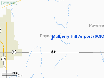
Location & QuickFacts
| FAA Information Effective: | 2008-09-25 |
| Airport Identifier: | 6OK9 |
| Airport Status: | Operational |
| Longitude/Latitude: | 096-56-35.5000W/36-08-29.6000N
-96.943194/36.141556 (Estimated) |
| Elevation: | 1026 ft / 312.72 m (Estimated) |
| Land: | 6 acres |
| From nearest city: | 6 nautical miles E of Stillwater, OK |
| Location: | Payne County, OK |
| Magnetic Variation: | 06E (1990) |
Owner & Manager
| Ownership: | Privately owned |
| Owner: | Mulberry Hill Homeowners |
| Address: | 8603 E Lakeview Rd
Stillwater, OK 74075-8865 |
| Phone number: | 405-372-8015 |
| Manager: | Monte Jestes |
| Address: | 8603 E Lakeview Rd
Stillwater, OK 74075-8865 |
| Phone number: | 405-372-8015 |
Airport Operations and Facilities
| Airport Use: | Private |
| Wind indicator: | Yes |
| Segmented Circle: | No |
| Control Tower: | No |
| Sectional chart: | Kansas City |
| Region: | ASW - Southwest |
| Boundary ARTCC: | ZKC - Kansas City |
| Tie-in FSS: | MLC - Mc Alester |
| FSS on Airport: | No |
| FSS Toll Free: | 1-800-WX-BRIEF |
Airport Services
Runway Information
Runway 17/35
| Dimension: | 2670 x 100 ft / 813.8 x 30.5 m |
| Surface: | TURF, Good Condition |
| |
Runway 17 |
Runway 35 |
| Traffic Pattern: | Left | Left |
|
Radio Navigation Aids
| ID |
Type |
Name |
Ch |
Freq |
Var |
Dist |
| CUH | NDB | Cushing | | 242.00 | 05E | 17.2 nm |
| CQB | NDB | Tilghman | | 396.00 | 06E | 25.9 nm |
| LCY | NDB | Logan County | | 326.00 | 07E | 29.1 nm |
| TZO | NDB | Bristow | | 251.00 | 05E | 33.7 nm |
| OWP | NDB | William Pogue | | 362.00 | 06E | 38.3 nm |
| GGU | NDB | Prague | | 314.00 | 06E | 39.1 nm |
| PN | NDB | Ponca | | 515.00 | 05E | 41.8 nm |
| TIK | TACAN | Tinker | 105X | | 07E | 47.4 nm |
| SWO | VOR/DME | Stillwater | 021X | 108.40 | 07E | 8.3 nm |
| ODG | VOR/DME | Woodring | 027X | 109.00 | 08E | 43.3 nm |
| GNP | VOR/DME | Glenpool | 043X | 110.60 | 06E | 49.2 nm |
| PER | VORTAC | Pioneer | 079X | 113.20 | 06E | 37.8 nm |
| END | VORTAC | Vance | 101X | 115.40 | 09E | 48.9 nm |
Remarks
- BLDGS ON BOTH SIDES OF RY.
Images and information placed above are from
http://www.airport-data.com/airport/6OK9/
We thank them for the data!
| General Info
|
| Country |
United States
|
| State |
OKLAHOMA
|
| FAA ID |
6OK9
|
| Latitude |
36-08-30.196N
|
| Longitude |
096-56-32.119W
|
| Elevation |
950 feet
|
| Near City |
STILLWATER
|
We don't guarantee the information is fresh and accurate. The data may
be wrong or outdated.
For more up-to-date information please refer to other sources.
|
|


