 |
|
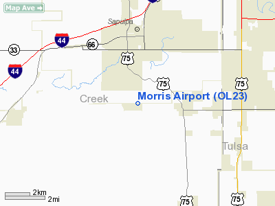
Location & QuickFacts
| FAA Information Effective: | 2008-09-25 |
| Airport Identifier: | OL23 |
| Airport Status: | Operational |
| Longitude/Latitude: | 096-06-15.9950W/35-57-00.3280N
-96.104443/35.950091 (Estimated) |
| Elevation: | 730 ft / 222.50 m (Estimated) |
| Land: | 15 acres |
| From nearest city: | 2 nautical miles S of Sapulpa, OK |
| Location: | Creek County, OK |
| Magnetic Variation: | 06E (1985) |
Owner & Manager
| Ownership: | Privately owned |
| Owner: | Harvey Morris |
| Address: | 9901 W. 151 St South
Sapulpa, OK 74066 |
| Phone number: | 918-224-2622 |
| Manager: | Harvey Morris |
| Address: | 9901 W. 151 St South
Sapulpa, OK 74066 |
| Phone number: | 918-224-2622 |
Airport Operations and Facilities
| Airport Use: | Private
PERSONAL USE |
| Wind indicator: | Yes |
| Segmented Circle: | No |
| Control Tower: | No |
| Sectional chart: | Dallas-ft Worth |
| Region: | ASW - Southwest |
| Boundary ARTCC: | ZKC - Kansas City |
| Tie-in FSS: | MLC - Mc Alester |
| FSS Toll Free: | 1-800-WX-BRIEF |
Runway Information
Runway 17/35
| Dimension: | 2000 x 100 ft / 609.6 x 30.5 m |
| Surface: | TURF, |
| |
Runway 17 |
Runway 35 |
| Traffic Pattern: | Left | Left |
|
Radio Navigation Aids
| ID |
Type |
Name |
Ch |
Freq |
Var |
Dist |
| OWP | NDB | William Pogue | | 362.00 | 06E | 13.6 nm |
| TZO | NDB | Bristow | | 251.00 | 05E | 19.0 nm |
| DW | NDB | Owaso | | 375.00 | 06E | 24.2 nm |
| CUH | NDB | Cushing | | 242.00 | 05E | 32.9 nm |
| HET | NDB | Henryetta | | 267.00 | 04E | 33.1 nm |
| CQB | NDB | Tilghman | | 396.00 | 06E | 37.4 nm |
| GGU | NDB | Prague | | 314.00 | 06E | 39.7 nm |
| MKO | NDB | Muskogee | | 306.00 | 06E | 45.2 nm |
| SRE | NDB | Seminole | | 278.00 | 06E | 49.4 nm |
| MEE | VOR | Davis | | 108.60 | 06E | 39.8 nm |
| GNP | VOR/DME | Glenpool | 043X | 110.60 | 06E | 6.8 nm |
| OKM | VOR/DME | Okmulgee | 096X | 114.90 | 08E | 19.3 nm |
| TUL | VORTAC | Tulsa | 091X | 114.40 | 08E | 21.3 nm |
| TUL | VOT | Tulsa Intl | | 109.00 | | 21.3 nm |
Remarks
- LIVESTOCK MAY BE ON RWY
- PRVDD 1500' MSL (800'AGL) TPA IS ESTABLISHED & USED; & RY THRS ARE DSPLCD TO PROVIDE A MIN 20:1 CLNC OVER ALL OBSTRUCTIONS IN FINAL APCH AREAS.
Images and information placed above are from
http://www.airport-data.com/airport/OL23/
We thank them for the data!
| General Info
|
| Country |
United States
|
| State |
OKLAHOMA
|
| FAA ID |
OL23
|
| Latitude |
35-57-00.328N
|
| Longitude |
096-06-15.995W
|
| Elevation |
730 feet
|
| Near City |
SAPULPA
|
We don't guarantee the information is fresh and accurate. The data may
be wrong or outdated.
For more up-to-date information please refer to other sources.
|
|


