 |
|
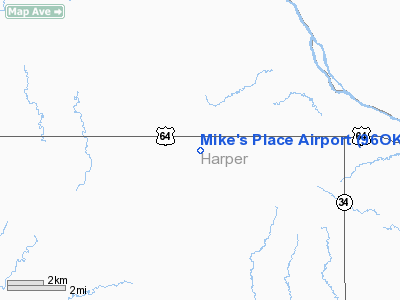
Location & QuickFacts
| FAA Information Effective: | 2008-09-25 |
| Airport Identifier: | 96OK |
| Airport Status: | Operational |
| Longitude/Latitude: | 099-27-24.0000W/36-50-56.0000N
-99.456667/36.848889 (Estimated) |
| Elevation: | 1787 ft / 544.68 m (Estimated) |
| Land: | 0 acres |
| From nearest city: | 8 nautical miles E of Buffalo, OK |
| Location: | Harper County, OK |
| Magnetic Variation: | 07E (1995) |
Owner & Manager
| Ownership: | Privately owned |
| Owner: | Mike Miller |
| Address: | Rt 2 Box 55
Selman, OK 73834-9623 |
| Phone number: | 580-727-4356 |
| Manager: | Mike Miller |
| Address: | Rt 2 Box 55
Selman, OK 73834-9623 |
| Phone number: | 580-727-4356 |
Airport Operations and Facilities
| Airport Use: | Private |
| Segmented Circle: | No |
| Control Tower: | No |
| Sectional chart: | Wichita |
| Region: | ASW - Southwest |
| Boundary ARTCC: | ZKC - Kansas City |
| Tie-in FSS: | MLC - Mc Alester |
| FSS on Airport: | No |
| FSS Toll Free: | 1-800-WX-BRIEF |
Runway Information
Runway 17/35
| Dimension: | 4000 x 35 ft / 1219.2 x 10.7 m |
| Surface: | TURF, |
| |
Runway 17 |
Runway 35 |
| Traffic Pattern: | Left | Left |
| Obstruction: | | 25 ft pline, 1000.0 ft from runway |
|
Radio Navigation Aids
| ID |
Type |
Name |
Ch |
Freq |
Var |
Dist |
| BFK | NDB | Buffalo | | 215.00 | 08E | 7.9 nm |
| OWU | NDB | West Woodward | | 329.00 | 08E | 25.1 nm |
| MDF | NDB | Mooreland/dcmsnd | | 284.00 | 08E | 25.2 nm |
| AVK | NDB | Alva | | 203.00 | 08E | 38.0 nm |
| GAG | VORTAC | Gage | 103X | 115.60 | 10E | 36.6 nm |
Images and information placed above are from
http://www.airport-data.com/airport/96OK/
We thank them for the data!
| General Info
|
| Country |
United States
|
| State |
OKLAHOMA
|
| FAA ID |
96OK
|
| Latitude |
36-50-56.000N
|
| Longitude |
099-27-24.000W
|
| Elevation |
1787 feet
|
| Near City |
BUFFALO
|
We don't guarantee the information is fresh and accurate. The data may
be wrong or outdated.
For more up-to-date information please refer to other sources.
|
|


