 |
|
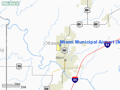
Location & QuickFacts
| FAA Information Effective: | 2008-09-25 |
| Airport Identifier: | MIO |
| Airport Status: | Operational |
| Longitude/Latitude: | 094-53-15.0010W/36-54-33.1950N
-94.887500/36.909221 (Estimated) |
| Elevation: | 808 ft / 246.28 m (Surveyed) |
| Land: | 300 acres |
| From nearest city: | 2 nautical miles NW of Miami, OK |
| Location: | Ottawa County, OK |
| Magnetic Variation: | 05E (1985) |
Owner & Manager
| Ownership: | Publicly owned |
| Owner: | City Of Miami
TIM WILSON, CITY MANAGER. |
| Address: | City Hall Po Box 1288
Miami, OK 74355 |
| Phone number: | 918-542-6685 |
| Manager: | Paul Dolph |
| Address: | Po Box 1288
Miami, OK 74355 |
| Phone number: | 918-542-7979
ALSO 918-541-2290. |
Airport Operations and Facilities
| Airport Use: | Open to public |
| Wind indicator: | Yes |
| Segmented Circle: | Yes |
| Control Tower: | No |
| Lighting Schedule: | DUSK-DAWN
ACTVT MIRL RY 17/35 - CTAF. |
| Beacon Color: | Clear-Green (lighted land airport) |
| Landing fee charge: | No |
| Sectional chart: | Kansas City |
| Region: | ASW - Southwest |
| Boundary ARTCC: | ZKC - Kansas City |
| Tie-in FSS: | MLC - Mc Alester |
| FSS on Airport: | No |
| FSS Toll Free: | 1-800-WX-BRIEF |
| NOTAMs Facility: | MLC (NOTAM-d service avaliable) |
| Federal Agreements: | NGRY |
Airport Communications
| CTAF: | 122.800 |
| Unicom: | 122.800 |
Airport Services
| Fuel available: | 100LLA |
| Airframe Repair: | MAJOR |
| Power Plant Repair: | MAJOR |
| Bottled Oxygen: | NONE |
| Bulk Oxygen: | NONE |
Runway Information
Runway 17/35
| Dimension: | 5020 x 100 ft / 1530.1 x 30.5 m |
| Surface: | ASPH, Fair Condition |
| Pavement Class: | 3 /F/C/Y/T |
| Weight Limit: | Single wheel: 23000 lbs. |
| Edge Lights: | Medium |
| |
Runway 17 |
Runway 35 |
| Longitude: | 094-53-14.7630W | 094-53-15.2360W |
| Latitude: | 36-54-58.0120N | 36-54-08.3760N |
| Elevation: | 808.00 ft | 801.00 ft |
| Alignment: | 127 | 127 |
| Traffic Pattern: | Right | Left |
| Markings: | Non-precision instrument, Fair Condition | Non-precision instrument, Fair Condition |
| Crossing Height: | 30.00 ft | 40.00 ft |
| VASI: | 2-light PAPI on left side | 2-light PAPI on left side |
| Visual Glide Angle: | 3.00° | 4.00° |
| Obstruction: | 40 ft trees, 900.0 ft from runway, 17:1 slope to clear | 100 ft stack, 4200.0 ft from runway, 250 ft left of centerline, 40:1 slope to clear |
|
Radio Navigation Aids
| ID |
Type |
Name |
Ch |
Freq |
Var |
Dist |
| PTS | NDB | Pittsburg | | 365.00 | 05E | 33.0 nm |
| CFV | NDB | Coffeyville | | 212.00 | 05E | 34.6 nm |
| PPF | NDB | Parsons | | 258.00 | 06E | 39.4 nm |
| LLU | NDB | Spring River | | 356.00 | 05E | 44.4 nm |
| SLG | NDB | Siloam Springs | | 284.00 | 04E | 47.4 nm |
| EOS | VOR/DME | Neosho | 120X | 117.30 | 07E | 22.1 nm |
| OSW | VORTAC | Oswego | 123X | 117.60 | 08E | 21.3 nm |
Remarks
- RY 35 +7 FT FENCE 855 FT FM END OF RY.
- ESTAB PRIOR TO 1959.
Images and information placed above are from
http://www.airport-data.com/airport/MIO/
We thank them for the data!
| General Info
|
| Country |
United States
|
| State |
OKLAHOMA
|
| FAA ID |
MIO
|
| Latitude |
36-54-33.195N
|
| Longitude |
094-53-15.001W
|
| Elevation |
808 feet
|
| Near City |
MIAMI
|
We don't guarantee the information is fresh and accurate. The data may
be wrong or outdated.
For more up-to-date information please refer to other sources.
|
|


