 |
|
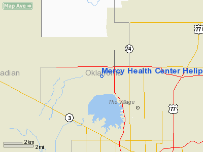
Mercy Health Center Heliport |
Location & QuickFacts
| FAA Information Effective: | 2008-09-25 |
| Airport Identifier: | OL16 |
| Airport Status: | Operational |
| Longitude/Latitude: | 097-36-01.1510W/35-36-00.1960N
-97.600320/35.600054 (Estimated) |
| Elevation: | 1143 ft / 348.39 m (Estimated) |
| Land: | 0 acres |
| From nearest city: | 0 nautical miles N of Oklahoma City, OK |
| Location: | Oklahoma County, OK |
| Magnetic Variation: | 07E (1985) |
Owner & Manager
| Ownership: | Privately owned |
| Owner: | Mercy Health Center |
| Address: | 4300 West Memorial Rd
Oklahoma City, OK 73120 |
| Phone number: | 405-755-1515 |
| Manager: | Kevin Roy, Safety Officer |
| Address: | 4300 West Memorial Rd
Oklahoma City, OK 73120 |
| Phone number: | 405-752-3832 |
Airport Operations and Facilities
| Airport Use: | Private
MEDICAL |
| Wind indicator: | Yes |
| Segmented Circle: | No |
| Control Tower: | No |
| Lighting Schedule: | PHONE REQ
FOR PERIMETER LGTS CALL 405-525-7451. |
| Sectional chart: | Dallas-ft Worth |
| Region: | ASW - Southwest |
| Boundary ARTCC: | ZKC - Kansas City |
| Responsible ARTCC: | ZFW - Fort Worth |
| Tie-in FSS: | MLC - Mc Alester |
| FSS Toll Free: | 1-800-WX-BRIEF |
Runway Information
Helipad H1
| Dimension: | 42 x 42 ft / 12.8 x 12.8 m |
| Surface: | CONC, |
| |
Runway H1 |
Runway |
| Traffic Pattern: | Left | Left |
|
Radio Navigation Aids
| ID |
Type |
Name |
Ch |
Freq |
Var |
Dist |
| OK | NDB | Tuloo | | 406.00 | 07E | 7.7 nm |
| LCY | NDB | Logan County | | 326.00 | 07E | 17.3 nm |
| RQO | NDB | El Reno | | 335.00 | 07E | 21.3 nm |
| OUN | NDB | Norman | | 260.00 | 07E | 22.1 nm |
| OLR | NDB | Chickasha | | 290.00 | 07E | 34.9 nm |
| CQB | NDB | Tilghman | | 396.00 | 06E | 38.9 nm |
| JWG | NDB | Watonga | | 359.00 | 07E | 43.2 nm |
| GGU | NDB | Prague | | 314.00 | 06E | 43.4 nm |
| CUH | NDB | Cushing | | 242.00 | 05E | 43.9 nm |
| SRE | NDB | Seminole | | 278.00 | 06E | 49.4 nm |
| TIK | TACAN | Tinker | 105X | | 07E | 14.6 nm |
| PWA | VOR/DME | Wiley Post | 081X | 113.40 | 08E | 4.6 nm |
| SWO | VOR/DME | Stillwater | 021X | 108.40 | 07E | 45.2 nm |
| ODG | VOR/DME | Woodring | 027X | 109.00 | 08E | 47.4 nm |
| IRW | VORTAC | Will Rogers | 088X | 114.10 | 07E | 14.5 nm |
| IFI | VORTAC | Kingfisher | 094X | 114.70 | 09E | 23.2 nm |
| END | VORTAC | Vance | 101X | 115.40 | 09E | 47.4 nm |
| OKC | VOT | Oklahoma Will Rgs W | | 108.80 | | 12.4 nm |
Remarks
- PRVDD INGRESS/EGRESS ROUTES ARE FM/TO THE SOUTH ONLY.
Images and information placed above are from
http://www.airport-data.com/airport/OL16/
We thank them for the data!
| General Info
|
| Country |
United States
|
| State |
OKLAHOMA
|
| FAA ID |
OL16
|
| Latitude |
35-36-00.196N
|
| Longitude |
097-36-01.151W
|
| Elevation |
1143 feet
|
| Near City |
OKLAHOMA CITY
|
We don't guarantee the information is fresh and accurate. The data may
be wrong or outdated.
For more up-to-date information please refer to other sources.
|
|


