 |
|
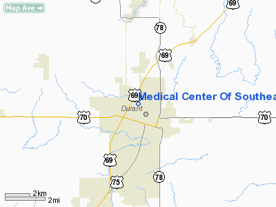
Medical Center Of Southeastern Oklahoma Heliport |
Location & QuickFacts
| FAA Information Effective: | 2008-09-25 |
| Airport Identifier: | OL11 |
| Airport Status: | Operational |
| Longitude/Latitude: | 096-23-29.9680W/34-00-27.3490N
-96.391658/34.007597 (Estimated) |
| Elevation: | 700 ft / 213.36 m (Estimated) |
| Land: | 0 acres |
| From nearest city: | 0 nautical miles N of Durant, OK |
| Location: | Bryan County, OK |
| Magnetic Variation: | 06E (1985) |
Owner & Manager
| Ownership: | Privately owned |
| Owner: | Med Ctr Of Southeastern Ok |
| Address: | Po Box 1207 1800 University
Durant, OK 74701 |
| Phone number: | 580-924-3080 |
| Manager: | Jackie Harms |
| Address: | Po Box 1207 1800 University
Durant, OK 74701 |
| Phone number: | 580-924-3080 |
Airport Operations and Facilities
| Airport Use: | Private
MEDICAL |
| Wind indicator: | Yes |
| Segmented Circle: | Yes |
| Control Tower: | No |
| Lighting Schedule: | PHONE REQ
FOR PERIMETER LGTS CALL 580-924-3080. |
| Sectional chart: | Dallas-ft Worth |
| Region: | ASW - Southwest |
| Boundary ARTCC: | ZFW - Fort Worth |
| Tie-in FSS: | MLC - Mc Alester |
| FSS Toll Free: | 1-800-WX-BRIEF |
Runway Information
Helipad H1
| Dimension: | 33 x 33 ft / 10.1 x 10.1 m |
| Surface: | CONC, |
| |
Runway H1 |
Runway |
| Traffic Pattern: | Left | Left |
|
Radio Navigation Aids
| ID |
Type |
Name |
Ch |
Freq |
Var |
Dist |
| DUA | NDB | Durant | | 359.00 | 05E | 3.9 nm |
| DNI | NDB | Denison | | 341.00 | 06E | 17.7 nm |
| HJM | NDB | Rayburn | | 415.00 | 06E | 26.0 nm |
| AUV | NDB | Arbuckle | | 284.00 | 07E | 37.5 nm |
| AEE | NDB | Antlers | | 391.00 | 05E | 38.4 nm |
| HHW | NDB | Hugo | | 323.00 | 05E | 42.5 nm |
| GLE | NDB | Gainesville | | 330.00 | 06E | 43.9 nm |
| URH | VOR/DME | Texoma | 090X | 114.30 | 05E | 3.8 nm |
| ADH | VOR/DME | Ada | 125X | 117.80 | 06E | 49.7 nm |
| BYP | VORTAC | Bonham | 093X | 114.60 | 06E | 29.3 nm |
| ADM | VORTAC | Ardmore | 114X | 116.70 | 06E | 40.6 nm |
Remarks
- PRVDD PLINES ON NORTH& EAST SIDES OF LNDG AREA MKD; AND NO VEHICLE TFC ALLOWED ON ROAD ON EAST SIDE DURG HELICOPTERS OPNS.
Images and information placed above are from
http://www.airport-data.com/airport/OL11/
We thank them for the data!
| General Info
|
| Country |
United States
|
| State |
OKLAHOMA
|
| FAA ID |
OL11
|
| Latitude |
34-00-27.349N
|
| Longitude |
096-23-29.968W
|
| Elevation |
700 feet
|
| Near City |
DURANT
|
We don't guarantee the information is fresh and accurate. The data may
be wrong or outdated.
For more up-to-date information please refer to other sources.
|
|


