 |
|
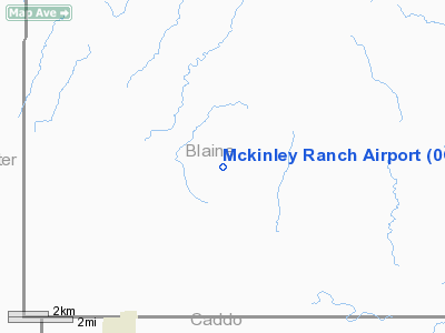
Location & QuickFacts
| FAA Information Effective: | 2008-09-25 |
| Airport Identifier: | 0OK3 |
| Airport Status: | Operational |
| Longitude/Latitude: | 098-31-21.2540W/35-37-10.1780N
-98.522571/35.619494 (Estimated) |
| Elevation: | 1420 ft / 432.82 m (Estimated) |
| Land: | 0 acres |
| From nearest city: | 8 nautical miles W of Geary, OK |
| Location: | Blaine County, OK |
| Magnetic Variation: | 07E (1985) |
Owner & Manager
| Ownership: | Privately owned |
| Owner: | Mark Mckinley |
| Address: | Rt 1 Box 67
Geary, OK 73040 |
| Phone number: | 405-884-2628 |
| Manager: | Mark Mckinley |
| Address: | Rt 1 Box 67
Geary, OK 73040 |
| Phone number: | 405-884-2628 |
Airport Operations and Facilities
| Airport Use: | Private |
| Wind indicator: | Yes |
| Segmented Circle: | No |
| Control Tower: | No |
| Landing fee charge: | No |
| Sectional chart: | Dallas-ft Worth |
| Region: | ASW - Southwest |
| Boundary ARTCC: | ZFW - Fort Worth |
| Tie-in FSS: | MLC - Mc Alester |
| FSS on Airport: | No |
| FSS Toll Free: | 1-800-WX-BRIEF |
Airport Services
| Airframe Repair: | NONE |
| Power Plant Repair: | NONE |
Runway Information
Runway 16/34
| Dimension: | 5000 x 30 ft / 1524.0 x 9.1 m |
| Surface: | ASPH, |
| |
Runway 16 |
Runway 34 |
| Traffic Pattern: | Right | Left |
|
Radio Navigation Aids
| ID |
Type |
Name |
Ch |
Freq |
Var |
Dist |
| OJA | NDB | Weatherford | | 272.00 | 07E | 9.0 nm |
| JWG | NDB | Watonga | | 359.00 | 07E | 15.3 nm |
| CLK | NDB | Clinton | | 320.00 | 07E | 20.7 nm |
| RQO | NDB | El Reno | | 335.00 | 07E | 26.5 nm |
| BZ | NDB | Fossi | | 393.00 | 08E | 34.7 nm |
| FAU | NDB | Fairview | | 246.00 | 07E | 40.1 nm |
| OLR | NDB | Chickasha | | 290.00 | 07E | 41.1 nm |
| EZY | NDB | Elk City | | 241.00 | 08E | 44.4 nm |
| OK | NDB | Tuloo | | 406.00 | 07E | 45.7 nm |
| PWA | VOR/DME | Wiley Post | 081X | 113.40 | 08E | 43.1 nm |
| IFI | VORTAC | Kingfisher | 094X | 114.70 | 09E | 27.7 nm |
| BFV | VORTAC | Burns Flat | 037X | 110.00 | 08E | 40.6 nm |
| IRW | VORTAC | Will Rogers | 088X | 114.10 | 07E | 47.4 nm |
| OKC | VOT | Oklahoma Will Rgs W | | 108.80 | | 47.1 nm |
Remarks
Images and information placed above are from
http://www.airport-data.com/airport/0OK3/
We thank them for the data!
| General Info
|
| Country |
United States
|
| State |
OKLAHOMA
|
| FAA ID |
0OK3
|
| Latitude |
35-37-10.178N
|
| Longitude |
098-31-21.254W
|
| Elevation |
1420 feet
|
| Near City |
GEARY
|
We don't guarantee the information is fresh and accurate. The data may
be wrong or outdated.
For more up-to-date information please refer to other sources.
|
|


