 |
|
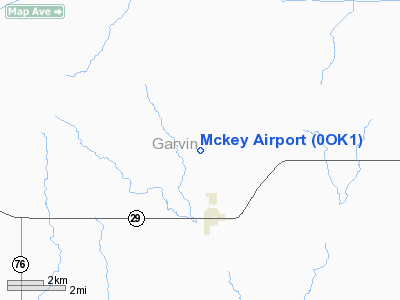
Location & QuickFacts
| FAA Information Effective: | 2008-09-25 |
| Airport Identifier: | 0OK1 |
| Airport Status: | Operational |
| Longitude/Latitude: | 097-24-06.0910W/34-39-25.2900N
-97.401692/34.657025 (Estimated) |
| Elevation: | 1056 ft / 321.87 m (Estimated) |
| Land: | 0 acres |
| From nearest city: | 2 nautical miles N of Elmore City, OK |
| Location: | Garvin County, OK |
| Magnetic Variation: | 07E (1985) |
Owner & Manager
| Ownership: | Privately owned |
| Owner: | Clay & Leslie Bowerman |
| Address: | Po Box 793
Elmore City, OK 73433 |
| Address: |
|
Airport Operations and Facilities
| Airport Use: | Private |
| Wind indicator: | Yes |
| Segmented Circle: | No |
| Control Tower: | No |
| Landing fee charge: | No |
| Sectional chart: | Dallas-ft Worth |
| Region: | ASW - Southwest |
| Boundary ARTCC: | ZFW - Fort Worth |
| Tie-in FSS: | MLC - Mc Alester |
| FSS on Airport: | No |
| FSS Toll Free: | 1-800-WX-BRIEF |
Airport Services
| Airframe Repair: | NONE |
| Power Plant Repair: | NONE |
Runway Information
Runway N/S
| Dimension: | 3200 x 135 ft / 975.4 x 41.1 m |
| Surface: | TURF, |
| |
Runway N |
Runway S |
| Traffic Pattern: | Left | Left |
|
Radio Navigation Aids
| ID |
Type |
Name |
Ch |
Freq |
Var |
Dist |
| FSI | FAN MARKER | Trail | | | 09E | 50.0 nm |
| PVJ | NDB | Pauls Valley | | 384.00 | 06E | 9.2 nm |
| AUV | NDB | Arbuckle | | 284.00 | 07E | 33.4 nm |
| OUN | NDB | Norman | | 260.00 | 07E | 35.7 nm |
| OLR | NDB | Chickasha | | 290.00 | 07E | 38.9 nm |
| PFL | NDB | Post | | 308.00 | 08E | 49.6 nm |
| OK | NDB | Tuloo | | 406.00 | 07E | 50.0 nm |
| OFZ | NDB | Trail | | 388.00 | 09E | 50.0 nm |
| TIK | TACAN | Tinker | 105X | | 07E | 46.9 nm |
| DUC | VOR/DME | Duncan | 047X | 111.00 | 09E | 30.3 nm |
| ADH | VOR/DME | Ada | 125X | 117.80 | 06E | 37.2 nm |
| ADM | VORTAC | Ardmore | 114X | 116.70 | 06E | 29.2 nm |
| IRW | VORTAC | Will Rogers | 088X | 114.10 | 07E | 43.4 nm |
| OKC | VOT | Oklahoma Will Rgs W | | 108.80 | | 45.3 nm |
Images and information placed above are from
http://www.airport-data.com/airport/0OK1/
We thank them for the data!
| General Info
|
| Country |
United States
|
| State |
OKLAHOMA
|
| FAA ID |
0OK1
|
| Latitude |
34-39-25.290N
|
| Longitude |
097-24-06.091W
|
| Elevation |
1056 feet
|
| Near City |
ELMORE CITY
|
We don't guarantee the information is fresh and accurate. The data may
be wrong or outdated.
For more up-to-date information please refer to other sources.
|
|


