 |
|
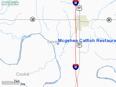
Mcgehee Catfish Restaurant Airport |
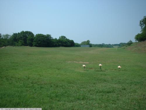 |
(Click on the photo to enlarge) |
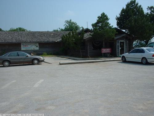 |
(Click on the photo to enlarge) |
Location & QuickFacts
| FAA Information Effective: | 2008-09-25 |
| Airport Identifier: | T40 |
| Airport Status: | Operational |
| Longitude/Latitude: | 097-10-13.8000W/33-53-56.3000N
-97.170500/33.898972 (Estimated) |
| Elevation: | 760 ft / 231.65 m (Estimated) |
| Land: | 8 acres |
| From nearest city: | 5 nautical miles SW of Marietta, OK |
| Location: | Love County, OK |
| Magnetic Variation: | 07E (1985) |
Owner & Manager
| Ownership: | Privately owned |
| Owner: | Enid Mcgehee |
| Address: | 407 W. Broadway
Marietta, OK 73448 |
| Phone number: | 580-276-2751 |
| Manager: | F. A. Shellenberger |
| Address: | 417 Abshire Circle
Ardmore, OK 73401 |
| Phone number: | 580-657-3888 |
Airport Operations and Facilities
| Airport Use: | Open to public |
| Wind indicator: | Yes |
| Segmented Circle: | No |
| Control Tower: | No |
| Landing fee charge: | No |
| Sectional chart: | Dallas-ft Worth |
| Region: | ASW - Southwest |
| Boundary ARTCC: | ZFW - Fort Worth |
| Tie-in FSS: | MLC - Mc Alester |
| FSS on Airport: | No |
| FSS Toll Free: | 1-800-WX-BRIEF |
| NOTAMs Facility: | MLC (NOTAM-d service avaliable) |
Airport Communications
Runway Information
Runway 17/35
| Dimension: | 2450 x 55 ft / 746.8 x 16.8 m |
| Surface: | TURF, Fair Condition
RY SLIPPERY AND SOFT WHEN WET; ROLLING AND UNEVEN. |
| |
Runway 17 |
Runway 35 |
| Longitude: | 097-10-13.2000W | 097-10-14.4000W |
| Latitude: | 33-54-08.4000N | 33-53-44.2000N |
| Traffic Pattern: | Left | Left |
| Obstruction: | 85 ft trees, 600.0 ft from runway, 7:1 slope to clear | 20 ft trees, 65.0 ft from runway, 40 ft left of centerline, 3:1 slope to clear |
|
Radio Navigation Aids
| ID |
Type |
Name |
Ch |
Freq |
Var |
Dist |
| GLE | NDB | Gainesville | | 330.00 | 06E | 10.9 nm |
| AUV | NDB | Arbuckle | | 284.00 | 07E | 15.3 nm |
| DNI | NDB | Denison | | 341.00 | 06E | 25.4 nm |
| GMZ | NDB | Grindstone Mountain | | 356.00 | 07E | 34.9 nm |
| DUA | NDB | Durant | | 359.00 | 05E | 38.5 nm |
| PVJ | NDB | Pauls Valley | | 384.00 | 06E | 49.2 nm |
| URH | VOR/DME | Texoma | 090X | 114.30 | 05E | 38.9 nm |
| DUC | VOR/DME | Duncan | 047X | 111.00 | 09E | 47.2 nm |
| ADM | VORTAC | Ardmore | 114X | 116.70 | 06E | 18.8 nm |
| UKW | VORTAC | Bowie | 071X | 112.40 | 06E | 39.2 nm |
Remarks
- RY SURROUNDED BY TALL TREES.
- RY 17/35 STEEP TERRAIN DROP (-80 FT) ON ALL SIDES WITH AREAS OF +20 FT RISING TERRAIN.
- LIVESTOCK AND WILDLIFE ON AND INVOF RY.
- SERVICE ROAD CROSSES RY 910 FT FM RY 35 END.
- DALGT OPNS ONLY.
- PROVIDED RWY THRESHOLDS ARE LOCATED TO PROVIDE A MINIMUM 20:1 CLEARANCE OVER ANY & ALL OBSTRUCTIONS IN RWY APPROACH AREAS.
Images and information placed above are from
http://www.airport-data.com/airport/T40/
We thank them for the data!
| General Info
|
| Country |
United States
|
| State |
OKLAHOMA
|
| FAA ID |
T40
|
| Latitude |
33-54-00.365N
|
| Longitude |
097-10-01.048W
|
| Elevation |
760 feet
|
| Near City |
MARIETTA
|
We don't guarantee the information is fresh and accurate. The data may
be wrong or outdated.
For more up-to-date information please refer to other sources.
|
|


