 |
|
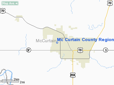
Mc Curtain County Rgnl Airport |
Location & QuickFacts
| FAA Information Effective: | 2008-09-25 |
| Airport Identifier: | 4O4 |
| Airport Status: | Operational |
| Longitude/Latitude: | 094-51-33.6950W/33-54-33.7100N
-94.859360/33.909364 (Estimated) |
| Elevation: | 472 ft / 143.87 m (Surveyed) |
| Land: | 187 acres |
| From nearest city: | 2 nautical miles NW of Idabel, OK |
| Location: | Mc Curtain County, OK |
| Magnetic Variation: | 03E (2005) |
Owner & Manager
| Ownership: | Publicly owned |
| Owner: | Mccurtain Co. Airport Trust |
| Address: | 201 East Main
Idabel, OK 74745 |
| Phone number: | 580-286-7608 |
| Manager: | George Whelton |
| Address: | 2907 W. Airport Rd.
Idabel, OK 74745 |
| Phone number: | 580-286-3558
ALTERNATES: 580-584-3954 OR 580-286-6554. |
Airport Operations and Facilities
| Airport Use: | Open to public |
| Wind indicator: | Yes |
| Segmented Circle: | Yes |
| Control Tower: | No |
| Lighting Schedule: | DUSK-DAWN
ACTVT MIRL RY 02/20, REIL & PAPI RYS 02 & 20 - CTAF. |
| Beacon Color: | Clear-Green (lighted land airport)
ROTG BCN OTS INDEFLY. |
| Sectional chart: | Memphis |
| Region: | ASW - Southwest |
| Boundary ARTCC: | ZFW - Fort Worth |
| Tie-in FSS: | MLC - Mc Alester |
| FSS Toll Free: | 1-800-WX-BRIEF |
| NOTAMs Facility: | 4O4 (NOTAM-d service avaliable) |
| Federal Agreements: | NGY |
Airport Communications
| CTAF: | 122.800 |
| Unicom: | 122.800 |
Airport Services
| Fuel available: | 100LLA
FUEL AVBL 24 HRS SELF SERVICE WITH MAJOR CREDIT CARD. |
Runway Information
Runway 02/20
| Dimension: | 5000 x 75 ft / 1524.0 x 22.9 m |
| Surface: | ASPH, Good Condition |
| Pavement Class: | 4 /F/C/X/U |
| Weight Limit: | Single wheel: 30000 lbs. |
| Edge Lights: | Medium |
| |
Runway 02 |
Runway 20 |
| Longitude: | 094-51-45.3700W | 094-51-22.0200W |
| Latitude: | 33-54-10.9600N | 33-54-56.4600N |
| Elevation: | 472.00 ft | 460.00 ft |
| Alignment: | 23 | 127 |
| Traffic Pattern: | Left | Right |
| Markings: | Non-precision instrument, Good Condition | Non-precision instrument, Good Condition |
| Crossing Height: | 40.00 ft | 41.00 ft |
| VASI: | 4-light PAPI on left side | 4-light PAPI on left side |
| Visual Glide Angle: | 3.00° | 3.00° |
| Runway End Identifier: | Yes | Yes |
| Obstruction: | , 50:1 slope to clear | 55 ft trees, 900.0 ft from runway, 12:1 slope to clear |
|
Radio Navigation Aids
| ID |
Type |
Name |
Ch |
Freq |
Var |
Dist |
| IBO | NDB | Idabel | | 271.00 | 03E | 0.8 nm |
| DEQ | NDB | De Queen | | 281.00 | 04E | 24.4 nm |
| HHW | NDB | Hugo | | 323.00 | 05E | 34.8 nm |
| AEE | NDB | Antlers | | 391.00 | 05E | 43.0 nm |
| PRX | VOR/DME | Paris | 083X | 113.60 | 07E | 36.8 nm |
| TXK | VORTAC | Texarkana | 110X | 116.30 | 07E | 45.9 nm |
| PGO | VORTAC | Rich Mountain | 082X | 113.50 | 04E | 48.0 nm |
Remarks
- PRVDD EXISTING IDABEL MUNI ARPT IS CLSD PRIOR TO OPNS STARTING AT THE NE MC CURTAIN ARPT.
Images and information placed above are from
http://www.airport-data.com/airport/4O4/
We thank them for the data!
| General Info
|
| Country |
United States
|
| State |
OKLAHOMA
|
| FAA ID |
4O4
|
| Latitude |
33-54-33.570N
|
| Longitude |
094-51-30.070W
|
| Elevation |
470 feet
|
| Near City |
IDABEL
|
We don't guarantee the information is fresh and accurate. The data may
be wrong or outdated.
For more up-to-date information please refer to other sources.
|
|


