 |
|
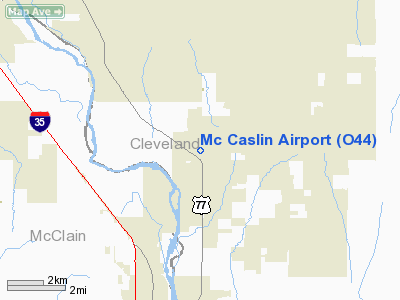
Location & QuickFacts
| FAA Information Effective: | 2008-09-25 |
| Airport Identifier: | O44 |
| Airport Status: | Operational |
| Longitude/Latitude: | 097-20-11.1040W/35-05-32.2540N
-97.336418/35.092293 (Estimated) |
| Elevation: | 1135 ft / 345.95 m (Estimated) |
| Land: | 140 acres |
| From nearest city: | 4 nautical miles N of Lexington, OK |
| Location: | Cleveland County, OK |
| Magnetic Variation: | 07E (1985) |
Owner & Manager
| Ownership: | Privately owned |
| Owner: | Gladys Mc Caslin |
| Address: | 10625 Hwy 77
Lexington, OK 73051 |
| Phone number: | 405-872-3253 |
| Manager: | Gladys Mc Caslin |
| Address: | 10625 Hwy 77
Lexington, OK 73051 |
| Phone number: | 405-872-3253 |
Airport Operations and Facilities
| Airport Use: | Open to public |
| Wind indicator: | Yes |
| Segmented Circle: | No |
| Control Tower: | No |
| Landing fee charge: | No |
| Sectional chart: | Dallas-ft Worth |
| Region: | ASW - Southwest |
| Boundary ARTCC: | ZFW - Fort Worth |
| Tie-in FSS: | MLC - Mc Alester |
| FSS on Airport: | No |
| FSS Toll Free: | 1-800-WX-BRIEF |
| NOTAMs Facility: | MLC (NOTAM-d service avaliable) |
Airport Communications
Airport Services
Runway Information
Runway 17/35
| Dimension: | 2135 x 80 ft / 650.7 x 24.4 m |
| Surface: | TURF, Good Condition |
| |
Runway 17 |
Runway 35 |
| Traffic Pattern: | Left | Left |
| Obstruction: | 4 ft fence, 15.0 ft from runway, 3:1 slope to clear | 35 ft pline, 475.0 ft from runway, 13:1 slope to clear |
|
Radio Navigation Aids
| ID |
Type |
Name |
Ch |
Freq |
Var |
Dist |
| OUN | NDB | Norman | | 260.00 | 07E | 11.4 nm |
| PVJ | NDB | Pauls Valley | | 384.00 | 06E | 23.3 nm |
| OK | NDB | Tuloo | | 406.00 | 07E | 26.3 nm |
| OLR | NDB | Chickasha | | 290.00 | 07E | 31.3 nm |
| SRE | NDB | Seminole | | 278.00 | 06E | 34.2 nm |
| GGU | NDB | Prague | | 314.00 | 06E | 39.6 nm |
| RQO | NDB | El Reno | | 335.00 | 07E | 40.4 nm |
| HDL | NDB | Holdenville | | 411.00 | 06E | 45.4 nm |
| LCY | NDB | Logan County | | 326.00 | 07E | 45.4 nm |
| CQB | NDB | Tilghman | | 396.00 | 06E | 45.6 nm |
| TIK | TACAN | Tinker | 105X | | 07E | 20.8 nm |
| PWA | VOR/DME | Wiley Post | 081X | 113.40 | 08E | 30.6 nm |
| ADH | VOR/DME | Ada | 125X | 117.80 | 06E | 37.2 nm |
| IRW | VORTAC | Will Rogers | 088X | 114.10 | 07E | 20.9 nm |
| OKC | VOT | Oklahoma Will Rgs W | | 108.80 | | 22.3 nm |
Images and information placed above are from
http://www.airport-data.com/airport/O44/
We thank them for the data!
| General Info
|
| Country |
United States
|
| State |
OKLAHOMA
|
| FAA ID |
O44
|
| Latitude |
35-05-32.254N
|
| Longitude |
097-20-11.104W
|
| Elevation |
1135 feet
|
| Near City |
LEXINGTON
|
We don't guarantee the information is fresh and accurate. The data may
be wrong or outdated.
For more up-to-date information please refer to other sources.
|
|


