 |
|
Coordinates: 34°52′57″N 095°47′00″W / 34.8825°N 95.7833333°W / 34.8825; -95.7833333
| McAlester Regional Airport |
| IATA: MLC – ICAO: KMLC – FAA LID: MLC |
| Summary |
| Airport type |
Public |
| Owner |
City of McAlester |
| Serves |
McAlester, Oklahoma |
| Elevation AMSL |
770 ft / 235 m |
| Runways |
| Direction |
Length |
Surface |
| ft |
m |
| 2/20 |
5,602 |
1,707 |
Concrete |
| Statistics (2005) |
| Aircraft operations |
9,000 |
| Based aircraft |
45 |
| Source: Federal Aviation Administration |
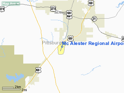
McAlester Regional Airport (IATA: MLC, ICAO: KMLC, FAA LID: MLC) is a public airport located three miles (5 km) southwest of the central business district of McAlester, a city in Pittsburg County, Oklahoma, United States. It is owned by the City of McAlester. The airport has no scheduled commercial flights. Ground services are provided by Brenair Aviation Services.
Facilities and aircraft
McAlester Regional Airport covers an area of 257 acres (104 ha) which contains one runway designated 2/20 with a 5,602 x 100 ft (1,707 x 30 m) concrete surface.
For the 12-month period ending September 12, 2005, the airport had 9,000 aircraft operations, an average of 24 per day: 73% general aviation, 17% air taxi and 10% military. There are 45 aircraft based at this airport: 89% single-engine, 9% multi-engine and 2% helicopter.
The above content comes from Wikipedia and is published under free licenses – click here to read more.
Location & QuickFacts
| FAA Information Effective: | 2008-09-25 |
| Airport Identifier: | MLC |
| Airport Status: | Operational |
| Longitude/Latitude: | 095-47-00.4660W/34-52-56.6470N
-95.783463/34.882402 (Estimated) |
| Elevation: | 770 ft / 234.70 m (Surveyed) |
| Land: | 257 acres |
| From nearest city: | 3 nautical miles SW of Mc Alester, OK |
| Location: | Pittsburg County, OK |
| Magnetic Variation: | 06E (1990) |
Owner & Manager
| Ownership: | Publicly owned |
| Owner: | City Of Mcalester |
| Address: | Po Box 578
Mcalester, OK 74502 |
| Phone number: | 918-423-9300 |
| Manager: | Butch Mellor |
| Address: | 104 Airport Rd.
Mcalester, OK 74502 |
| Phone number: | 918 426-1463 |
Airport Operations and Facilities
| Airport Use: | Open to public |
| Wind indicator: | Yes |
| Segmented Circle: | Yes |
| Control Tower: | No |
| Lighting Schedule: | DUSK-DAWN
MIRL RY 01/19 PRESET LOW INTST; TO INCR INTST & ACTVT MALS RY 01 - CTAF. |
| Beacon Color: | Clear-Green (lighted land airport) |
| Landing fee charge: | No |
| Sectional chart: | Dallas-ft Worth |
| Region: | ASW - Southwest |
| Boundary ARTCC: | ZFW - Fort Worth |
| Tie-in FSS: | MLC - Mc Alester |
| FSS on Airport: | No |
| FSS Toll Free: | 1-800-WX-BRIEF
FOR LOCAL CALL TO FSS DIAL 426-4110. |
| NOTAMs Facility: | MLC (NOTAM-d service avaliable) |
| Federal Agreements: | NGY |
Airport Communications
| CTAF: | 122.950 |
| Unicom: | 122.950 |
Airport Services
| Fuel available: | 100LLA |
| Airframe Repair: | MAJOR |
| Power Plant Repair: | MAJOR |
| Bottled Oxygen: | NONE |
| Bulk Oxygen: | NONE |
Runway Information
Runway 01/19
| Dimension: | 5602 x 100 ft / 1707.5 x 30.5 m |
| Surface: | CONC, Good Condition |
| Weight Limit: | Single wheel: 52000 lbs.
Dual wheel: 70000 lbs.
Dual tandem wheel: 120000 lbs. |
| Edge Lights: | Medium |
| |
Runway 01 |
Runway 19 |
| Longitude: | 095-47-12.2130W | 095-46-48.8010W |
| Latitude: | 34-52-30.6700N | 34-53-22.6080N |
| Elevation: | 741.00 ft | 770.00 ft |
| Alignment: | 20 | 127 |
| ILS Type: | LOCALIZER
| |
| Traffic Pattern: | Left | Left |
| Markings: | Non-precision instrument, Good Condition | Non-precision instrument, Good Condition |
| Crossing Height: | 39.00 ft | 45.00 ft |
| VASI: | pulsating/steady burning on left side | pulsating/steady burning on left side
PVASI OTS INDEFLY. |
| Visual Glide Angle: | 3.00° | 2.50° |
| Approach lights: | MALS | |
| Runway End Identifier: | | Yes |
| Obstruction: | 59 ft pole, 2138.0 ft from runway, 103 ft left of centerline, 32:1 slope to clear | 29 ft road, 900.0 ft from runway, 24:1 slope to clear |
|
Radio Navigation Aids
| ID |
Type |
Name |
Ch |
Freq |
Var |
Dist |
| HDL | NDB | Holdenville | | 411.00 | 06E | 33.3 nm |
| HET | NDB | Henryetta | | 267.00 | 04E | 33.4 nm |
| AEE | NDB | Antlers | | 391.00 | 05E | 42.0 nm |
| MKO | NDB | Muskogee | | 306.00 | 06E | 49.3 nm |
| SRE | NDB | Seminole | | 278.00 | 06E | 49.7 nm |
| ADH | VOR/DME | Ada | 125X | 117.80 | 06E | 44.0 nm |
| OKM | VOR/DME | Okmulgee | 096X | 114.90 | 08E | 48.9 nm |
| MLC | VORTAC | Mc Alester | 057X | 112.00 | 08E | 2.0 nm |
Remarks
- DEER & COYOTES ON & INVOF RY.
- ESTAB PRIOR TO 1959.
Images and information placed above are from
http://www.airport-data.com/airport/MLC/
We thank them for the data!
| General Info
|
| Country |
United States
|
| State |
OKLAHOMA
|
| FAA ID |
MLC
|
| Latitude |
34-52-56.647N
|
| Longitude |
095-47-00.466W
|
| Elevation |
770 feet
|
| Near City |
MC ALESTER
|
We don't guarantee the information is fresh and accurate. The data may
be wrong or outdated.
For more up-to-date information please refer to other sources.
|
|


