 |
|
Mc Alester Rgnl Hospital Heliport |
Location & QuickFacts
| FAA Information Effective: | 2008-09-25 |
| Airport Identifier: | 13OK |
| Airport Status: | Operational |
| Longitude/Latitude: | 095-44-55.9640W/34-56-10.3480N
-95.748879/34.936208 (Estimated) |
| Elevation: | 705 ft / 214.88 m (Estimated) |
| Land: | 0 acres |
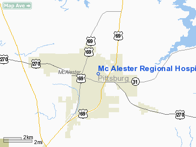
| From nearest city: | 0 nautical miles N of Mc Alester, OK |
| Location: | Pittsburg County, OK |
| Magnetic Variation: | 06E (1985) |
Owner & Manager
| Ownership: | Privately owned |
| Owner: | Mc Alester Regional Hospital |
| Address: | 1 Clark Bass Blvd
Mc Alester, OK 74501 |
| Phone number: | 918-426-1800 |
| Manager: | Johnny Matlock |
| Address: | 1 Clark Bass Blvd
Mc Alester, OK 74501 |
| Phone number: | 918-421-8161 |
Airport Operations and Facilities
| Airport Use: | Private
MEDICAL. |
| Wind indicator: | Yes |
| Segmented Circle: | No |
| Control Tower: | No |
| Landing fee charge: | No |
| Sectional chart: | Dallas-ft Worth |
| Region: | ASW - Southwest |
| Boundary ARTCC: | ZFW - Fort Worth |
| Tie-in FSS: | MLC - Mc Alester |
| FSS on Airport: | No |
| FSS Toll Free: | 1-800-WX-BRIEF |
Airport Communications
Runway Information
Helipad H1
| Dimension: | 40 x 40 ft / 12.2 x 12.2 m |
| Surface: | CONC, |
| |
Runway H1 |
Runway |
| Traffic Pattern: | Left | Left |
|
Radio Navigation Aids
| ID |
Type |
Name |
Ch |
Freq |
Var |
Dist |
| HET | NDB | Henryetta | | 267.00 | 04E | 31.0 nm |
| HDL | NDB | Holdenville | | 411.00 | 06E | 33.9 nm |
| AEE | NDB | Antlers | | 391.00 | 05E | 45.0 nm |
| MKO | NDB | Muskogee | | 306.00 | 06E | 45.6 nm |
| SRE | NDB | Seminole | | 278.00 | 06E | 49.8 nm |
| MEE | VOR | Davis | | 108.60 | 06E | 47.5 nm |
| OKM | VOR/DME | Okmulgee | 096X | 114.90 | 08E | 45.9 nm |
| ADH | VOR/DME | Ada | 125X | 117.80 | 06E | 46.1 nm |
| MLC | VORTAC | Mc Alester | 057X | 112.00 | 08E | 5.5 nm |
Images and information placed above are from
http://www.airport-data.com/airport/13OK/
We thank them for the data!
| General Info
|
| Country |
United States
|
| State |
OKLAHOMA
|
| FAA ID |
13OK
|
| Latitude |
34-56-10.348N
|
| Longitude |
095-44-55.964W
|
| Elevation |
705 feet
|
| Near City |
MC ALESTER
|
We don't guarantee the information is fresh and accurate. The data may
be wrong or outdated.
For more up-to-date information please refer to other sources.
|
|


