 |
|
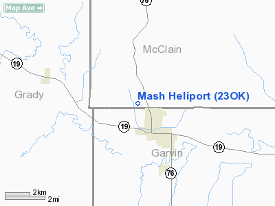
Location & QuickFacts
| FAA Information Effective: | 2008-09-25 |
| Airport Identifier: | 23OK |
| Airport Status: | Operational |
| Longitude/Latitude: | 097-37-40.1180W/34-51-31.2620N
-97.627811/34.858684 (Estimated) |
| Elevation: | 990 ft / 301.75 m (Estimated) |
| Land: | 1 acres |
| From nearest city: | 1 nautical miles NW of Lindsay, OK |
| Location: | Garvin County, OK |
| Magnetic Variation: | 07E (1985) |
Owner & Manager
| Ownership: | Publicly owned |
| Owner: | Lindsay Municipal Hospital |
| Address: | Po Box 888
Lindsay, OK 73052 |
| Phone number: | 405-756-1404 |
| Address: | Po Box 888
Lindsay, OK 73052 |
| Phone number: | 405-756-1404 |
Airport Operations and Facilities
| Airport Use: | Private |
| Segmented Circle: | No |
| Control Tower: | No |
| Lighting Schedule: | PHONE REQ
FOR PERIMETER LGTS CALL 405-756-1404. |
| Sectional chart: | Dallas-ft Worth |
| Region: | ASW - Southwest |
| Boundary ARTCC: | ZFW - Fort Worth |
| Tie-in FSS: | MLC - Mc Alester |
| FSS Toll Free: | 1-800-WX-BRIEF |
Runway Information
Helipad H1
| Dimension: | 40 x 40 ft / 12.2 x 12.2 m |
| Surface: | CONC, |
| |
Runway H1 |
Runway |
| Traffic Pattern: | Left | Left |
|
Radio Navigation Aids
| ID |
Type |
Name |
Ch |
Freq |
Var |
Dist |
| FSI | FAN MARKER | Trail | | | 09E | 38.5 nm |
| PVJ | NDB | Pauls Valley | | 384.00 | 06E | 21.5 nm |
| OLR | NDB | Chickasha | | 290.00 | 07E | 22.5 nm |
| OUN | NDB | Norman | | 260.00 | 07E | 24.7 nm |
| OK | NDB | Tuloo | | 406.00 | 07E | 36.8 nm |
| OFZ | NDB | Trail | | 388.00 | 09E | 38.5 nm |
| PFL | NDB | Post | | 308.00 | 08E | 41.2 nm |
| RQO | NDB | El Reno | | 335.00 | 07E | 41.7 nm |
| AUV | NDB | Arbuckle | | 284.00 | 07E | 49.3 nm |
| TIK | TACAN | Tinker | 105X | | 07E | 36.8 nm |
| DUC | VOR/DME | Duncan | 047X | 111.00 | 09E | 31.9 nm |
| PWA | VOR/DME | Wiley Post | 081X | 113.40 | 08E | 40.5 nm |
| LAW | VOR/DME | Lawton | 031X | 109.40 | 09E | 44.5 nm |
| ADH | VOR/DME | Ada | 125X | 117.80 | 06E | 47.4 nm |
| IRW | VORTAC | Will Rogers | 088X | 114.10 | 07E | 30.1 nm |
| ADM | VORTAC | Ardmore | 114X | 116.70 | 06E | 45.1 nm |
| OKC | VOT | Oklahoma Will Rgs W | | 108.80 | | 32.2 nm |
Remarks
- PRVDD INGRESS/EGRESS IS TO WEST; WIRES NEAR PAD SHOULD BE OBSTRUCTION MARKED. IF NIGHT OPERATIONS ARE PLANNED, RED OBSTRUCTION LGTS SHOULD BE INSTALLED ON TWO PWR POLES AND ON ANT ON TOP OF HOSPITAL; WIND SOCK SHOULD BE LGTD.
Images and information placed above are from
http://www.airport-data.com/airport/23OK/
We thank them for the data!
| General Info
|
| Country |
United States
|
| State |
OKLAHOMA
|
| FAA ID |
23OK
|
| Latitude |
34-51-31.262N
|
| Longitude |
097-37-40.118W
|
| Elevation |
990 feet
|
| Near City |
LINDSAY
|
We don't guarantee the information is fresh and accurate. The data may
be wrong or outdated.
For more up-to-date information please refer to other sources.
|
|


