 |
|
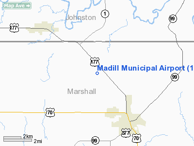
Location & QuickFacts
| FAA Information Effective: | 2008-09-25 |
| Airport Identifier: | 1F4 |
| Airport Status: | Operational |
| Longitude/Latitude: | 096-48-43.3160W/34-08-25.4470N
-96.812032/34.140402 (Estimated) |
| Elevation: | 890 ft / 271.27 m (Surveyed) |
| Land: | 59 acres |
| From nearest city: | 3 nautical miles NW of Madill, OK |
| Location: | Marshall County, OK |
| Magnetic Variation: | 06E (1995) |
Owner & Manager
| Ownership: | Publicly owned |
| Owner: | City Of Madill |
| Address: | City Hall, 201 E. Overton
Madill, OK 73446 |
| Phone number: | 580-795-3378 |
| Manager: | David Sprouse |
| Address: | City Hall, 201 E. Overton
Madill, OK 73446 |
| Phone number: | 580-795-5333
ALT: 580-795-5586. |
Airport Operations and Facilities
| Airport Use: | Open to public |
| Wind indicator: | Yes |
| Segmented Circle: | Yes |
| Control Tower: | No |
| Lighting Schedule: | DUSK-DAWN
ACTVT MIRL RY 18/36 - CTAF. |
| Beacon Color: | Clear-Green (lighted land airport) |
| Landing fee charge: | No |
| Sectional chart: | Dallas-ft Worth |
| Region: | ASW - Southwest |
| Boundary ARTCC: | ZFW - Fort Worth |
| Tie-in FSS: | MLC - Mc Alester |
| FSS on Airport: | No |
| FSS Toll Free: | 1-800-WX-BRIEF |
| NOTAMs Facility: | MLC (NOTAM-d service avaliable) |
| Federal Agreements: | NGY |
Airport Communications
Airport Services
| Bottled Oxygen: | NONE |
| Bulk Oxygen: | NONE |
Runway Information
Runway 18/36
| Dimension: | 3005 x 50 ft / 915.9 x 15.2 m |
| Surface: | ASPH, Poor Condition
SEVERE CRACKING AND SPALLING. |
| Weight Limit: | Single wheel: 8000 lbs. |
| Edge Lights: | Medium |
| |
Runway 18 |
Runway 36 |
| Longitude: | 096-48-41.3480W | 096-48-45.3340W |
| Latitude: | 34-08-40.2050N | 34-08-10.6680N |
| Elevation: | 862.00 ft | 881.00 ft |
| Alignment: | 127 | 6 |
| Traffic Pattern: | Left | Left |
| Markings: | Basic, Fair Condition | Basic, Fair Condition |
| Crossing Height: | 47.00 ft | 60.00 ft |
| VASI: | 2-light PAPI on left side | 2-light PAPI on left side
PAPI OTS INDEFLY. |
| Visual Glide Angle: | 4.00° | 4.00° |
| Runway End Identifier: | Yes
RIGHT SIDE REIL OTS INDEFLY. | Yes |
| Obstruction: | 25 ft tree, 640.0 ft from runway, 17:1 slope to clear
+6 INCH CONC REIL BASES ON RY END THLD. | 8 ft trees, 250.0 ft from runway, 6:1 slope to clear
+6 INCH CONC REIL BASES ON RY END THLD. |
|
Radio Navigation Aids
| ID |
Type |
Name |
Ch |
Freq |
Var |
Dist |
| AUV | NDB | Arbuckle | | 284.00 | 07E | 15.6 nm |
| DNI | NDB | Denison | | 341.00 | 06E | 20.3 nm |
| DUA | NDB | Durant | | 359.00 | 05E | 23.7 nm |
| GLE | NDB | Gainesville | | 330.00 | 06E | 31.8 nm |
| PVJ | NDB | Pauls Valley | | 384.00 | 06E | 40.3 nm |
| HJM | NDB | Rayburn | | 415.00 | 06E | 44.8 nm |
| URH | VOR/DME | Texoma | 090X | 114.30 | 05E | 24.0 nm |
| ADH | VOR/DME | Ada | 125X | 117.80 | 06E | 40.4 nm |
| ADM | VORTAC | Ardmore | 114X | 116.70 | 06E | 18.2 nm |
| BYP | VORTAC | Bonham | 093X | 114.60 | 06E | 46.3 nm |
Remarks
- +1694 FT TWR 6.2 MI SOUTH OF RY 36 END.
Images and information placed above are from
http://www.airport-data.com/airport/1F4/
We thank them for the data!
| General Info
|
| Country |
United States
|
| State |
OKLAHOMA
|
| FAA ID |
1F4
|
| Latitude |
34-08-25.447N
|
| Longitude |
096-48-43.316W
|
| Elevation |
890 feet
|
| Near City |
MADILL
|
We don't guarantee the information is fresh and accurate. The data may
be wrong or outdated.
For more up-to-date information please refer to other sources.
|
|


