 |
|
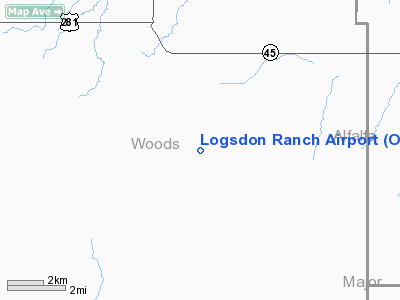
Location & QuickFacts
| FAA Information Effective: | 2008-09-25 |
| Airport Identifier: | OK43 |
| Airport Status: | Operational |
| Longitude/Latitude: | 098-38-12.3010W/36-31-50.1200N
-98.636750/36.530589 (Estimated) |
| Elevation: | 1475 ft / 449.58 m (Estimated) |
| Land: | 0 acres |
| From nearest city: | 14 nautical miles N of Alva, OK |
| Location: | Woods County, OK |
| Magnetic Variation: | 08E (1985) |
Owner & Manager
| Ownership: | Privately owned |
| Owner: | Dale Logsdon |
| Address: | 710 N. Sunset
Alva, OK 73717 |
| Phone number: | 405-327-0906 |
| Manager: | Dale Logsdon |
| Address: | 710 N. Sunset
Alva, OK 73717 |
| Phone number: | 405-327-0906 |
Airport Operations and Facilities
| Airport Use: | Private |
| Segmented Circle: | No |
| Control Tower: | No |
| Sectional chart: | Wichita |
| Region: | ASW - Southwest |
| Boundary ARTCC: | ZKC - Kansas City |
| Tie-in FSS: | MLC - Mc Alester |
| FSS on Airport: | No |
| FSS Toll Free: | 1-800-WX-BRIEF |
Runway Information
Runway 17/35
| Dimension: | 1350 x 75 ft / 411.5 x 22.9 m |
| Surface: | TURF, |
| |
Runway 17 |
Runway 35 |
| Traffic Pattern: | Left | Left |
|
Radio Navigation Aids
| ID |
Type |
Name |
Ch |
Freq |
Var |
Dist |
| AVK | NDB | Alva | | 203.00 | 08E | 15.0 nm |
| FAU | NDB | Fairview | | 246.00 | 07E | 16.6 nm |
| MDF | NDB | Mooreland/dcmsnd | | 284.00 | 08E | 27.0 nm |
| JWG | NDB | Watonga | | 359.00 | 07E | 41.5 nm |
| OWU | NDB | West Woodward | | 329.00 | 08E | 43.3 nm |
| ODG | VOR/DME | Woodring | 027X | 109.00 | 08E | 42.1 nm |
| END | VORTAC | Vance | 101X | 115.40 | 09E | 36.5 nm |
| ANY | VORTAC | Anthony | 076X | 112.90 | 07E | 43.9 nm |
Images and information placed above are from
http://www.airport-data.com/airport/OK43/
We thank them for the data!
| General Info
|
| Country |
United States
|
| State |
OKLAHOMA
|
| FAA ID |
OK43
|
| Latitude |
36-31-50.120N
|
| Longitude |
098-38-12.301W
|
| Elevation |
1475 feet
|
| Near City |
ALVA
|
We don't guarantee the information is fresh and accurate. The data may
be wrong or outdated.
For more up-to-date information please refer to other sources.
|
|


