 |
|
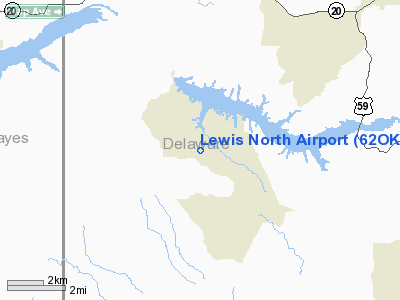
Location & QuickFacts
| FAA Information Effective: | 2008-09-25 |
| Airport Identifier: | 62OK |
| Airport Status: | Operational |
| Longitude/Latitude: | 094-55-13.4400W/36-20-21.2900N
-94.920400/36.339247 (Estimated) |
| Elevation: | 960 ft / 292.61 m (Estimated) |
| Land: | 0 acres |
| From nearest city: | 6 nautical miles W of Jay, OK |
| Location: | Delaware County, OK |
| Magnetic Variation: | 05E (1995) |
Owner & Manager
| Ownership: | Privately owned |
| Owner: | James Lewis |
| Address: | Rt 1 Box 295
Eucha, OK 74342 |
| Phone number: | 918-253-4943 |
| Manager: | James Lewis |
| Address: | Rt 1 Box 295
Eucha, OK 74342 |
| Phone number: | 918-253-4943 |
Airport Operations and Facilities
| Airport Use: | Private |
| Segmented Circle: | No |
| Control Tower: | No |
| Sectional chart: | Kansas City |
| Region: | ASW - Southwest |
| Boundary ARTCC: | ZME - Memphis |
| Tie-in FSS: | MLC - Mc Alester |
| FSS on Airport: | No |
| FSS Toll Free: | 1-800-WX-BRIEF |
Runway Information
Runway 09/27
| Dimension: | 2900 x 150 ft / 883.9 x 45.7 m |
| Surface: | TURF, |
| |
Runway 09 |
Runway 27 |
| Traffic Pattern: | Right | Left |
| Obstruction: | | 30 ft pline, 100.0 ft from runway |
|
Radio Navigation Aids
| ID |
Type |
Name |
Ch |
Freq |
Var |
Dist |
| SLG | NDB | Siloam Springs | | 284.00 | 04E | 22.8 nm |
| TQH | NDB | Tahlequah | | 215.00 | 05E | 25.2 nm |
| DW | NDB | Owaso | | 375.00 | 06E | 46.3 nm |
| MKO | NDB | Muskogee | | 306.00 | 06E | 48.2 nm |
| MEE | VOR | Davis | | 108.60 | 06E | 46.1 nm |
| EOS | VOR/DME | Neosho | 120X | 117.30 | 07E | 38.2 nm |
| DAK | VOR/DME | Drake | 025X | 108.80 | 07E | 39.3 nm |
| RZC | VORTAC | Razorback | 111X | 116.40 | 04E | 39.1 nm |
| TUL | VORTAC | Tulsa | 091X | 114.40 | 08E | 42.9 nm |
| TUL | VOT | Tulsa Intl | | 109.00 | | 42.9 nm |
Remarks
- PRVDD ALL TFC PATTERNS RSTRD TO S SIDE OF ARPT; RY LNDG THLDS DSPLCD IF NECESSARY TO PROVIDE 20:1 CLEARANCE OVER OBSTRUCTION IN APCH AREAS.
Images and information placed above are from
http://www.airport-data.com/airport/62OK/
We thank them for the data!
| General Info
|
| Country |
United States
|
| State |
OKLAHOMA
|
| FAA ID |
62OK
|
| Latitude |
36-20-21.290N
|
| Longitude |
094-55-13.440W
|
| Elevation |
960 feet
|
| Near City |
JAY
|
We don't guarantee the information is fresh and accurate. The data may
be wrong or outdated.
For more up-to-date information please refer to other sources.
|
|


