 |
|
Location & QuickFacts
| FAA Information Effective: | 2008-09-25 |
| Airport Identifier: | 65OK |
| Airport Status: | Operational |
| Longitude/Latitude: | 094-54-00.8430W/36-28-00.2920N
-94.900234/36.466748 (Estimated) |
| Elevation: | 850 ft / 259.08 m (Estimated) |
| Land: | 0 acres |
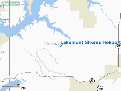
| From nearest city: | 7 nautical miles E of Disney, OK |
| Location: | Delaware County, OK |
| Magnetic Variation: | 06E (1985) |
Owner & Manager
| Ownership: | Privately owned |
| Owner: | Lakemont Shores Poa |
| Address: | 37609 S 540 Rd
Eucht, OK 74342 |
| Phone number: | 918-435-4505 |
| Manager: | Lakemont Shores Fd |
| Address: | Po Box 610
Disney, OK 74340 |
| Phone number: | 918-435-8351 |
Airport Operations and Facilities
| Airport Use: | Private
MEDICAL. |
| Wind indicator: | Yes |
| Segmented Circle: | No |
| Control Tower: | No |
| Sectional chart: | Kansas City |
| Region: | ASW - Southwest |
| Boundary ARTCC: | ZKC - Kansas City |
| Tie-in FSS: | MLC - Mc Alester |
| FSS Toll Free: | 1-800-WX-BRIEF |
Runway Information
Helipad H1
| Dimension: | 30 x 30 ft / 9.1 x 9.1 m |
| Surface: | TURF, |
| |
Runway H1 |
Runway |
| Traffic Pattern: | Left | Left |
|
Radio Navigation Aids
| ID |
Type |
Name |
Ch |
Freq |
Var |
Dist |
| SLG | NDB | Siloam Springs | | 284.00 | 04E | 26.0 nm |
| TQH | NDB | Tahlequah | | 215.00 | 05E | 32.9 nm |
| DW | NDB | Owaso | | 375.00 | 06E | 48.1 nm |
| CFV | NDB | Coffeyville | | 212.00 | 05E | 49.6 nm |
| EOS | VOR/DME | Neosho | 120X | 117.30 | 07E | 31.8 nm |
| DAK | VOR/DME | Drake | 025X | 108.80 | 07E | 42.5 nm |
| RZC | VORTAC | Razorback | 111X | 116.40 | 04E | 40.0 nm |
| OSW | VORTAC | Oswego | 123X | 117.60 | 08E | 44.0 nm |
| TUL | VORTAC | Tulsa | 091X | 114.40 | 08E | 46.0 nm |
| TUL | VOT | Tulsa Intl | | 109.00 | | 46.0 nm |
Remarks
- PROVIDED PLINE WEST BE REMOVED-RELOCATED-OR BURIED;INGRES/EGRESS BE 8:1 CLRNCE OVER OBSTRUCTIONS.
Images and information placed above are from
http://www.airport-data.com/airport/65OK/
We thank them for the data!
| General Info
|
| Country |
United States
|
| State |
OKLAHOMA
|
| FAA ID |
65OK
|
| Latitude |
36-28-00.292N
|
| Longitude |
094-54-00.843W
|
| Elevation |
850 feet
|
| Near City |
DISNEY
|
We don't guarantee the information is fresh and accurate. The data may
be wrong or outdated.
For more up-to-date information please refer to other sources.
|
|


