 |
|
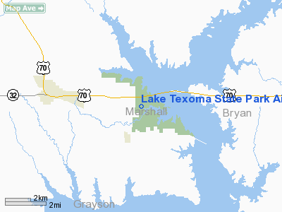
Lake Texoma State Park Airport |
Location & QuickFacts
| FAA Information Effective: | 2008-09-25 |
| Airport Identifier: | F31 |
| Airport Status: | Operational |
| Longitude/Latitude: | 096-38-34.0000W/33-59-27.5000N
-96.642778/33.990972 (Estimated) |
| Elevation: | 693 ft / 211.23 m (Estimated) |
| Land: | 50 acres |
| From nearest city: | 4 nautical miles E of Kingston, OK |
| Location: | Marshall County, OK |
| Magnetic Variation: | 06E (1985) |
Owner & Manager
| Ownership: | Publicly owned |
| Owner: | Corp Of Engineers |
| Address: | Ok Dep Of Tourism & Rec, Lessee, Po Box 52002
Oklahoma City, OK 73105 |
| Phone number: | 580-521-3411 |
| Manager: | Richard Keithley |
| Address: | Box 279, 2038 Hwy 70e
Kingston, OK 73439 |
| Phone number: | 580-564-2566 |
Airport Operations and Facilities
| Airport Use: | Open to public |
| Wind indicator: | Yes |
| Segmented Circle: | Yes |
| Control Tower: | No |
| Lighting Schedule: | DUSK-DAWN
MIRL RY 18/36 PRESET LOW INTST; TO INCR INTST ACTVT - CTAF. |
| Beacon Color: | Clear-Green (lighted land airport)
ROTG BCN OTS INDEFLY. |
| Landing fee charge: | No |
| Sectional chart: | Dallas-ft Worth |
| Region: | ASW - Southwest |
| Boundary ARTCC: | ZFW - Fort Worth |
| Tie-in FSS: | MLC - Mc Alester |
| FSS on Airport: | No |
| FSS Toll Free: | 1-800-WX-BRIEF |
| NOTAMs Facility: | MLC (NOTAM-d service avaliable) |
| Federal Agreements: | NY1 |
Airport Communications
| CTAF: | 122.800 |
| Unicom: | 122.800 |
Airport Services
| Airframe Repair: | NONE |
| Power Plant Repair: | NONE |
| Bottled Oxygen: | NONE |
| Bulk Oxygen: | NONE |
Runway Information
Runway 18/36
| Dimension: | 3000 x 50 ft / 914.4 x 15.2 m |
| Surface: | ASPH, Poor Condition
RY SEVERE CRACKING AND SPALLING. |
| Pavement Class: | 2 /F/D/Z/T |
| Weight Limit: | Single wheel: 4000 lbs. |
| Edge Lights: | Medium |
| |
Runway 18 |
Runway 36 |
| Longitude: | 096-38-32.3100W | 096-38-35.5900W |
| Latitude: | 33-59-42.3200N | 33-59-12.7700N |
| Traffic Pattern: | Left | Left |
| Markings: | Basic, Poor Condition
MARKINGS SEVERELY FADED. | Basic, Poor Condition
MARKINGS SEVERELY FADED. |
| Obstruction: | 40 ft trees, 900.0 ft from runway, 17:1 slope to clear | 40 ft trees, 240.0 ft from runway, 1:1 slope to clear
RISING TERRAIN AND +12 FT TREES 90 FT FM THLD. |
|
Radio Navigation Aids
| ID |
Type |
Name |
Ch |
Freq |
Var |
Dist |
| DNI | NDB | Denison | | 341.00 | 06E | 10.1 nm |
| DUA | NDB | Durant | | 359.00 | 05E | 12.5 nm |
| AUV | NDB | Arbuckle | | 284.00 | 07E | 25.8 nm |
| GLE | NDB | Gainesville | | 330.00 | 06E | 32.2 nm |
| HJM | NDB | Rayburn | | 415.00 | 06E | 32.5 nm |
| URH | VOR/DME | Texoma | 090X | 114.30 | 05E | 12.8 nm |
| ADH | VOR/DME | Ada | 125X | 117.80 | 06E | 48.8 nm |
| ADM | VORTAC | Ardmore | 114X | 116.70 | 06E | 29.3 nm |
| BYP | VORTAC | Bonham | 093X | 114.60 | 06E | 34.1 nm |
Remarks
- EXERCISE CAUTION FOR DEER ON RWY.
Images and information placed above are from
http://www.airport-data.com/airport/F31/
We thank them for the data!
|
|


