|
|
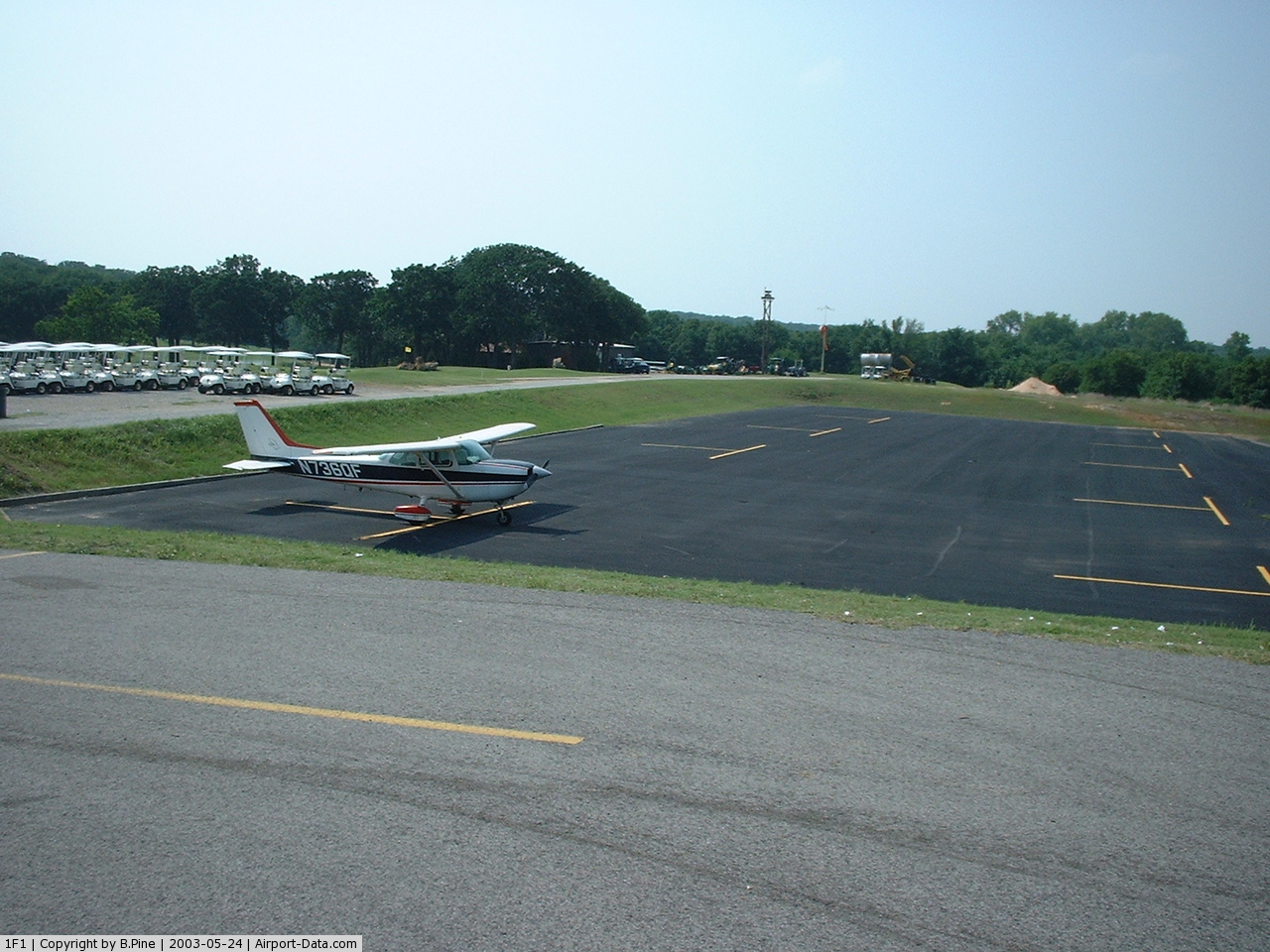
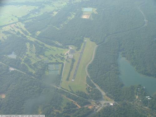
Lake Murray State Park Airport |
 |
(Click on the photo to enlarge) |
 |
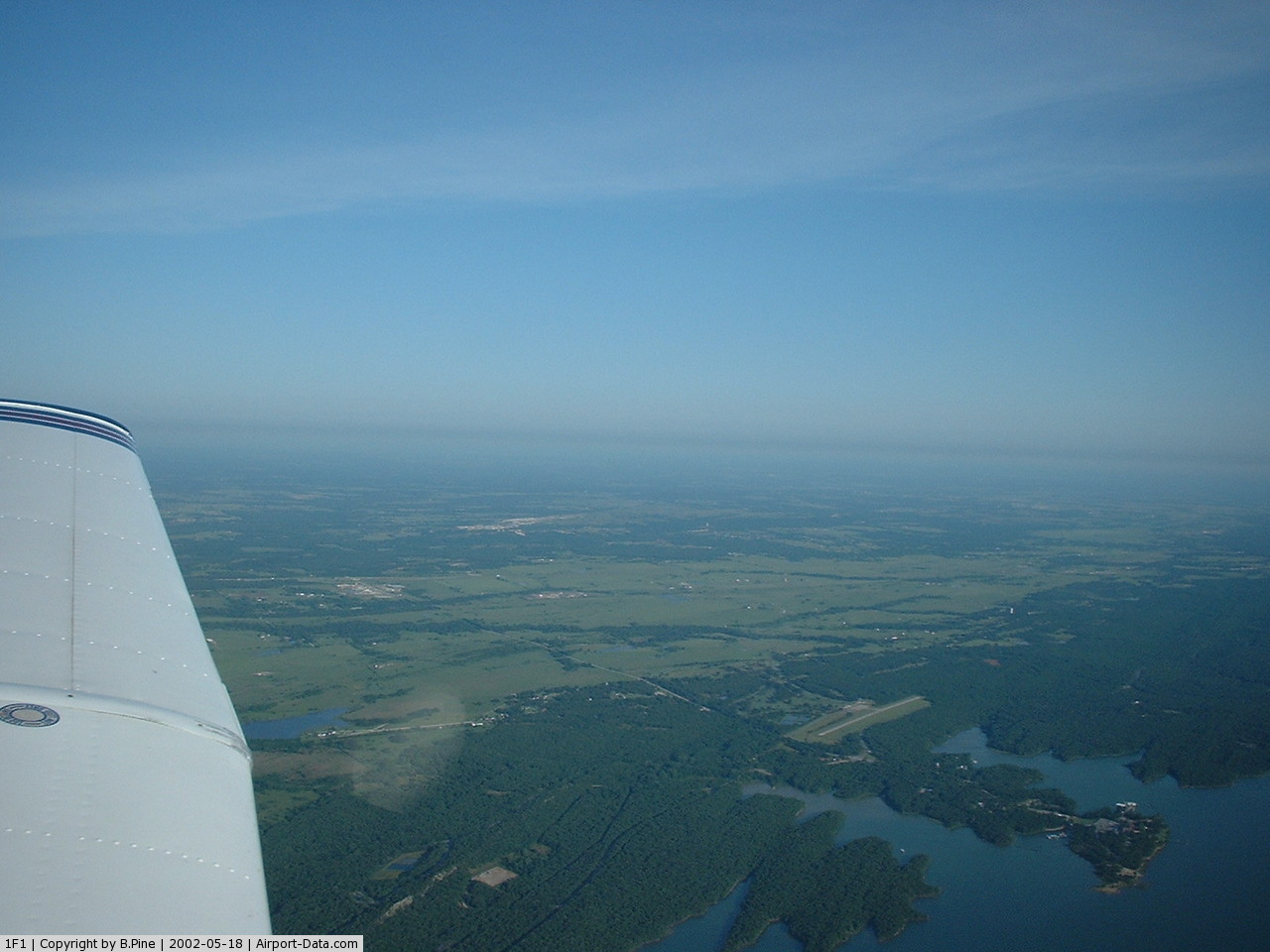
(Click on the photo to enlarge) |
 |
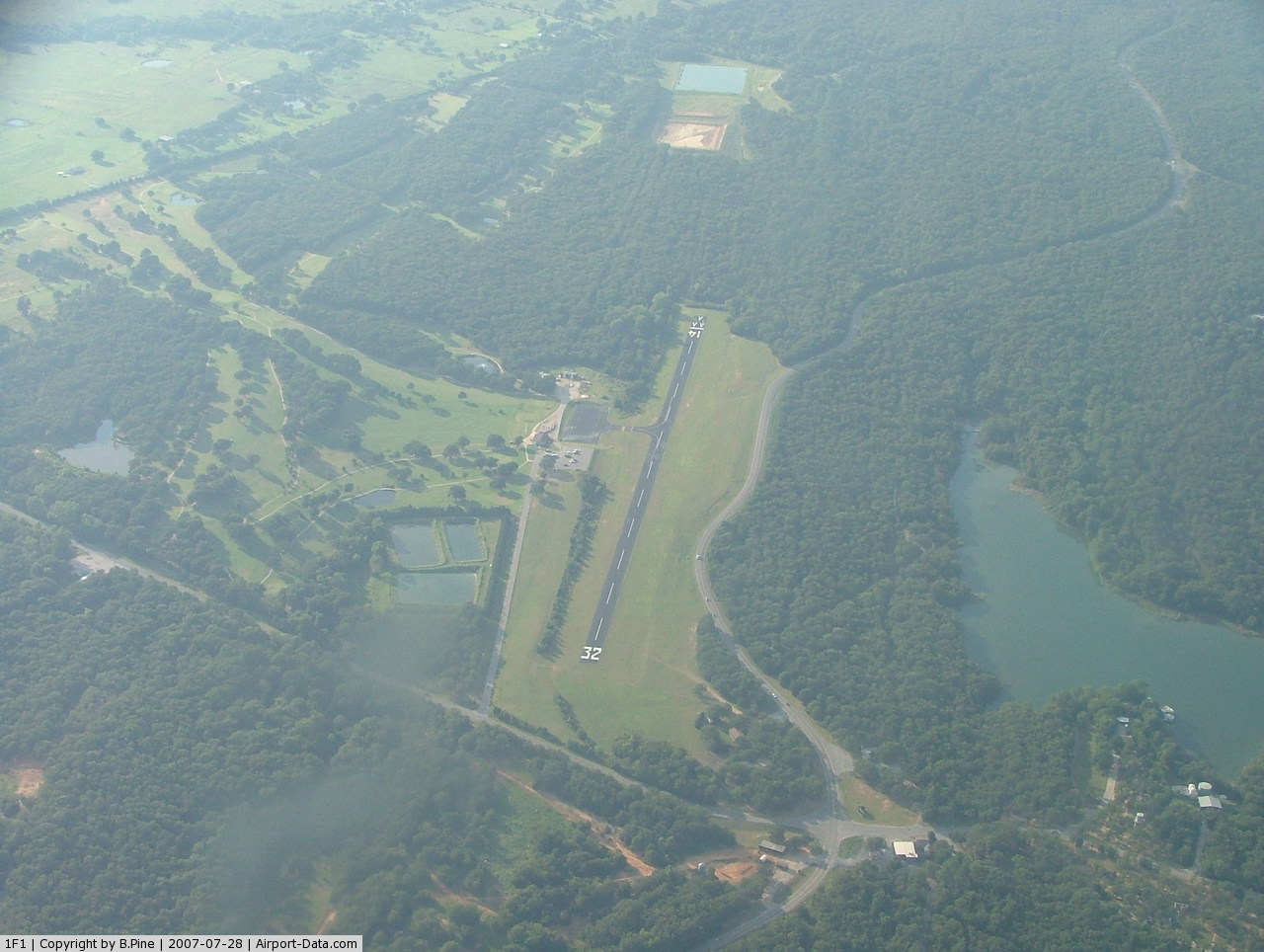
(Click on the photo to enlarge) |
Location & QuickFacts
| FAA Information Effective: | 2008-09-25 |
| Airport Identifier: | 1F1 |
| Airport Status: | Operational |
| Longitude/Latitude: | 097-06-24.0450W/34-04-30.3490N
-97.106679/34.075097 (Estimated) |
| Elevation: | 817 ft / 249.02 m (Surveyed) |
| Land: | 16 acres |
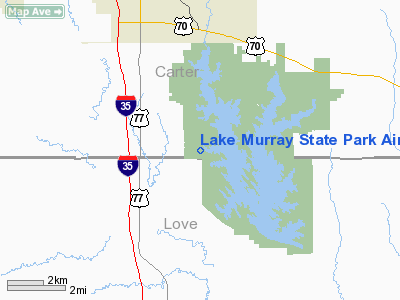
| From nearest city: | 2 nautical miles E of Overbrook, OK |
| Location: | Carter County, OK |
| Magnetic Variation: | 07E (1985) |
Owner & Manager
| Ownership: | Publicly owned |
| Owner: | State Oklahoma |
| Address: | Tourism & Recreation Dept, Po Box 52002 Suite 200
Oklahoma City, OK 73105 |
| Phone number: | 580-521-2413 |
| Manager: | Carol Jackson, Park Mgr |
| Address: | 18407 Scenic State Hwy 77
Ardmore, OK 73401 |
| Phone number: | 580-223-4044 |
Airport Operations and Facilities
| Airport Use: | Open to public |
| Wind indicator: | Yes |
| Segmented Circle: | Yes |
| Control Tower: | No |
| Lighting Schedule: | DUSK-DAWN |
| Beacon Color: | Clear-Green (lighted land airport)
ROTG BCN OTS INDEFLY. |
| Landing fee charge: | No |
| Sectional chart: | Dallas-ft Worth |
| Region: | ASW - Southwest |
| Boundary ARTCC: | ZFW - Fort Worth |
| Tie-in FSS: | MLC - Mc Alester |
| FSS on Airport: | No |
| FSS Toll Free: | 1-800-WX-BRIEF |
| NOTAMs Facility: | MLC (NOTAM-d service avaliable) |
| Federal Agreements: | NY1 |
Airport Communications
Airport Services
| Airframe Repair: | NONE |
| Power Plant Repair: | NONE |
| Bottled Oxygen: | NONE |
| Bulk Oxygen: | NONE |
Runway Information
Runway 14/32
| Dimension: | 2500 x 48 ft / 762.0 x 14.6 m |
| Surface: | ASPH, Fair Condition |
| Weight Limit: | Single wheel: 4000 lbs. |
| Edge Lights: | Non-standard lighting system
NSTD LIRL DUE TO THLD PLACEMENT. |
| |
Runway 14 |
Runway 32 |
| Longitude: | 097-06-30.7600W | 097-06-16.2500W |
| Latitude: | 34-04-40.2700N | 34-04-18.6900N |
| Elevation: | 817.00 ft | 817.00 ft |
| Alignment: | 127 | 127 |
| Traffic Pattern: | Left | Left |
| Markings: | Basic, Good Condition | Basic, Good Condition |
| Displaced threshold: | 120.00 ft | 0.00 ft |
| Obstruction: | 30 ft trees, 240.0 ft from runway, 1:1 slope to clear
APCH SLOPE 12:1 FM DSPLCD THLD.
-30 FT TERRAIN DROP 78 FT FROM RY 14 END. | 30 ft trees, 350.0 ft from runway, 5:1 slope to clear
-3 FT DITCH ON WEST SIDE OF RY EXTND AROUND & INTO APCH END OF RY 32. |
|
Radio Navigation Aids
| ID |
Type |
Name |
Ch |
Freq |
Var |
Dist |
| AUV | NDB | Arbuckle | | 284.00 | 07E | 4.6 nm |
| GLE | NDB | Gainesville | | 330.00 | 06E | 21.9 nm |
| DNI | NDB | Denison | | 341.00 | 06E | 26.5 nm |
| DUA | NDB | Durant | | 359.00 | 05E | 36.1 nm |
| PVJ | NDB | Pauls Valley | | 384.00 | 06E | 39.0 nm |
| GMZ | NDB | Grindstone Mountain | | 356.00 | 07E | 43.6 nm |
| URH | VOR/DME | Texoma | 090X | 114.30 | 05E | 36.5 nm |
| DUC | VOR/DME | Duncan | 047X | 111.00 | 09E | 44.3 nm |
| ADH | VOR/DME | Ada | 125X | 117.80 | 06E | 48.8 nm |
| ADM | VORTAC | Ardmore | 114X | 116.70 | 06E | 8.8 nm |
| UKW | VORTAC | Bowie | 071X | 112.40 | 06E | 48.2 nm |
Remarks
- OCNL DEER & BIRDS ON OR NEAR RY.
- LIRL RY 14/32 OTS INDEFLY. DAYLIGHT USE ONLY.
- WIND SOCK OTS INDEFLY.
Images and information placed above are from
http://www.airport-data.com/airport/1F1/
We thank them for the data!
| General Info
|
| Country |
United States
|
| State |
OKLAHOMA
|
| FAA ID |
1F1
|
| Latitude |
34-04-30.349N
|
| Longitude |
097-06-24.045W
|
| Elevation |
817 feet
|
| Near City |
OVERBROOK
|
We don't guarantee the information is fresh and accurate. The data may
be wrong or outdated.
For more up-to-date information please refer to other sources.
|
|