 |
|
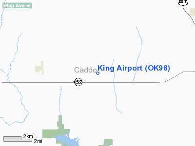
Location & QuickFacts
| FAA Information Effective: | 2008-09-25 |
| Airport Identifier: | OK98 |
| Airport Status: | Operational |
| Longitude/Latitude: | 098-29-01.2180W/35-18-00.2010N
-98.483672/35.300056 (Estimated) |
| Elevation: | 1535 ft / 467.87 m (Estimated) |
| Land: | 0 acres |
| From nearest city: | 3 nautical miles E of Eakly, OK |
| Location: | Caddo County, OK |
| Magnetic Variation: | 07E (1985) |
Owner & Manager
| Ownership: | Privately owned |
| Owner: | Paul King |
| Address: | Rte 2
Lookeba, OK 73053 |
| Phone number: | 405-797-3323 |
| Address: |
|
Airport Operations and Facilities
| Airport Use: | Private |
| Wind indicator: | Yes |
| Segmented Circle: | No |
| Control Tower: | No |
| Landing fee charge: | No |
| Sectional chart: | Dallas-ft Worth |
| Region: | ASW - Southwest |
| Boundary ARTCC: | ZFW - Fort Worth |
| Tie-in FSS: | MLC - Mc Alester |
| FSS on Airport: | No |
| FSS Toll Free: | 1-800-WX-BRIEF |
Airport Services
| Airframe Repair: | NONE |
| Power Plant Repair: | NONE |
Runway Information
Runway 17/35
| Dimension: | 2000 x 50 ft / 609.6 x 15.2 m |
| Surface: | ASPH, |
| |
Runway 17 |
Runway 35 |
| Traffic Pattern: | Left | Left |
| VASI: | non-specific system | |
|
Radio Navigation Aids
| ID |
Type |
Name |
Ch |
Freq |
Var |
Dist |
| FSI | FAN MARKER | Trail | | | 09E | 31.4 nm |
| OJA | NDB | Weatherford | | 272.00 | 07E | 16.6 nm |
| RQO | NDB | El Reno | | 335.00 | 07E | 25.6 nm |
| CLK | NDB | Clinton | | 320.00 | 07E | 26.4 nm |
| OLR | NDB | Chickasha | | 290.00 | 07E | 27.8 nm |
| OFZ | NDB | Trail | | 388.00 | 09E | 31.4 nm |
| JWG | NDB | Watonga | | 359.00 | 07E | 33.9 nm |
| BZ | NDB | Fossi | | 393.00 | 08E | 36.3 nm |
| PFL | NDB | Post | | 308.00 | 08E | 41.7 nm |
| OK | NDB | Tuloo | | 406.00 | 07E | 44.3 nm |
| EZY | NDB | Elk City | | 241.00 | 08E | 45.5 nm |
| OUN | NDB | Norman | | 260.00 | 07E | 49.8 nm |
| PWA | VOR/DME | Wiley Post | 081X | 113.40 | 08E | 43.3 nm |
| LAW | VOR/DME | Lawton | 031X | 109.40 | 09E | 48.4 nm |
| BFV | VORTAC | Burns Flat | 037X | 110.00 | 08E | 35.7 nm |
| IFI | VORTAC | Kingfisher | 094X | 114.70 | 09E | 38.4 nm |
| HBR | VORTAC | Hobart | 055X | 111.80 | 10E | 38.6 nm |
| IRW | VORTAC | Will Rogers | 088X | 114.10 | 07E | 43.0 nm |
| OKC | VOT | Oklahoma Will Rgs W | | 108.80 | | 43.7 nm |
Images and information placed above are from
http://www.airport-data.com/airport/OK98/
We thank them for the data!
| General Info
|
| Country |
United States
|
| State |
OKLAHOMA
|
| FAA ID |
OK98
|
| Latitude |
35-18-00.201N
|
| Longitude |
098-29-01.218W
|
| Elevation |
1535 feet
|
| Near City |
EAKLY
|
We don't guarantee the information is fresh and accurate. The data may
be wrong or outdated.
For more up-to-date information please refer to other sources.
|
|


