 |
|
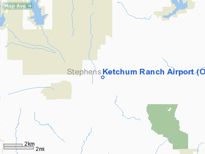
Location & QuickFacts
| FAA Information Effective: | 2008-09-25 |
| Airport Identifier: | OK97 |
| Airport Status: | Operational |
| Longitude/Latitude: | 097-46-01.1170W/34-32-00.2910N
-97.766977/34.533414 (Estimated) |
| Elevation: | 1100 ft / 335.28 m (Estimated) |
| Land: | 0 acres |
| From nearest city: | 10 nautical miles NE of Duncan, OK |
| Location: | Stephens County, OK |
| Magnetic Variation: | 07E (1985) |
Owner & Manager
| Ownership: | Privately owned |
| Owner: | Jack Ketchum |
| Address: | Route 4, Box 207b
Duncan, OK 73533 |
| Phone number: | 405-255-9236 |
| Address: |
|
Airport Operations and Facilities
| Airport Use: | Private |
| Wind indicator: | Yes |
| Segmented Circle: | No |
| Control Tower: | No |
| Landing fee charge: | No |
| Sectional chart: | Dallas-ft Worth |
| Region: | ASW - Southwest |
| Boundary ARTCC: | ZFW - Fort Worth |
| Tie-in FSS: | MLC - Mc Alester |
| FSS on Airport: | No |
| FSS Toll Free: | 1-800-WX-BRIEF |
Airport Services
| Airframe Repair: | NONE |
| Power Plant Repair: | NONE |
Runway Information
Runway N/S
| Dimension: | 2600 x 100 ft / 792.5 x 30.5 m |
| Surface: | TURF, |
| |
Runway N |
Runway S |
| Traffic Pattern: | Left | Left |
|
Radio Navigation Aids
| ID |
Type |
Name |
Ch |
Freq |
Var |
Dist |
| FSI | FAN MARKER | Trail | | | 09E | 34.8 nm |
| PVJ | NDB | Pauls Valley | | 384.00 | 06E | 28.8 nm |
| PFL | NDB | Post | | 308.00 | 08E | 31.8 nm |
| OFZ | NDB | Trail | | 388.00 | 09E | 34.8 nm |
| OLR | NDB | Chickasha | | 290.00 | 07E | 35.8 nm |
| AUV | NDB | Arbuckle | | 284.00 | 07E | 39.3 nm |
| OUN | NDB | Norman | | 260.00 | 07E | 45.4 nm |
| SHP | TACAN | Sheppard | 045X | | 10E | 48.8 nm |
| DUC | VOR/DME | Duncan | 047X | 111.00 | 09E | 11.6 nm |
| LAW | VOR/DME | Lawton | 031X | 109.40 | 09E | 32.1 nm |
| ADM | VORTAC | Ardmore | 114X | 116.70 | 06E | 35.4 nm |
Remarks
- WATCH FOR CATTLE ON RWY.
- EXISTED PRIOR TO OCT 1959.
Images and information placed above are from
http://www.airport-data.com/airport/OK97/
We thank them for the data!
| General Info
|
| Country |
United States
|
| State |
OKLAHOMA
|
| FAA ID |
OK97
|
| Latitude |
34-32-00.291N
|
| Longitude |
097-46-01.117W
|
| Elevation |
1100 feet
|
| Near City |
DUNCAN
|
We don't guarantee the information is fresh and accurate. The data may
be wrong or outdated.
For more up-to-date information please refer to other sources.
|
|


