 |
|
Kegelman Af Aux Field Airport |
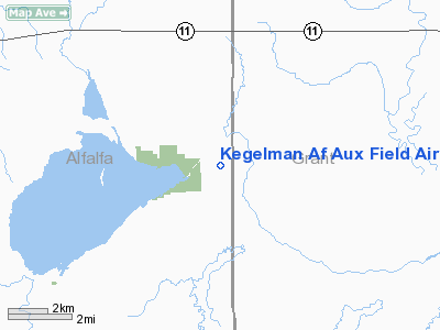
Kegelman Air Force Auxiliary Field is located near the Salt Plains National Wildlife Refuge in Alfalfa County, Oklahoma, approximately 10 miles east of Cherokee, Oklahoma.
The installation is located an elevation of 1202 feet and has the IATA code of CKA.
The field has one runway, a fire station, personnel offices and a NEXRAD tower, which is used for weather forecasting for both the military and civilian entities. It is located on 1,066 acres. Runway 17/35 is the only remaining active runway; it is 6800 feet long and 150 feet wide and has displaced thresholds at each end.
Currently Kegelman AFAF is a sub-base of Vance Air Force Base, but was previously administered by Will Rogers Field, Clovis Army Air Field, Woodward Army Air Field, and Liberal Army Airfield. Vance AFB pilots use the airfield to practice landings in T-6A Texan II aircraft, and refer to the field with the callsign "Dogface".
The installation was first known the Great Salt Plains Auxiliary Field, but was named after Kegelman in 1949.
The above content comes from Wikipedia and is published under free licenses – click here to read more.
Location & QuickFacts
| FAA Information Effective: | 2008-09-25 |
| Airport Identifier: | CKA |
| Airport Status: | Operational |
| Longitude/Latitude: | 098-07-00.0000W/36-45-00.0000N
-98.116667/36.750000 (Estimated) |
| Elevation: | 1202 ft / 366.37 m (Surveyed) |
| Land: | 0 acres |
| From nearest city: | 10 nautical miles E of Cherokee, OK |
| Location: | Alfalfa County, OK |
| Magnetic Variation: | 07E (1985) |
Owner & Manager
| Ownership: | Air Force owned |
| Owner: | U.s. Air Force |
| Address: | 71st Flt Trng Wg Vance Afb
Enid, OK 73701 |
| Manager: | Chief Airfield Management |
| Address: | 71st Flt Trng Wg Vance Afb
Enid, OK 73701 |
Airport Operations and Facilities
| Airport Use: | Private |
| Wind indicator: | Yes |
| Segmented Circle: | No |
| Control Tower: | No |
| Landing fee charge: | Yes |
| Sectional chart: | Wichita |
| Region: | ASW - Southwest |
| Boundary ARTCC: | ZKC - Kansas City |
| Tie-in FSS: | MLC - Mc Alester |
| FSS on Airport: | No |
| FSS Toll Free: | 1-800-WX-BRIEF |
Airport Services
| Airframe Repair: | NONE |
| Power Plant Repair: | NONE |
| Bottled Oxygen: | NONE |
| Bulk Oxygen: | NONE |
Runway Information
Runway 17/35
| Dimension: | 6800 x 150 ft / 2072.6 x 45.7 m |
| Surface: | CONC, |
| Pavement Class: | 19 /F/B/W/T |
| |
Runway 17 |
Runway 35 |
| Alignment: | 127 | 3 |
| Traffic Pattern: | Left | Left |
| Markings: | Nonstandard, Good Condition | Nonstandard, Good Condition |
| Displaced threshold: | 0.00 ft | 1000.00 ft |
| Runway End Identifier: | No | No |
| Centerline Lights: | No | No |
| Touchdown Lights: | No | No |
|
Radio Navigation Aids
| ID |
Type |
Name |
Ch |
Freq |
Var |
Dist |
| AVK | NDB | Alva | | 203.00 | 08E | 26.8 nm |
| FAU | NDB | Fairview | | 246.00 | 07E | 32.9 nm |
| EGT | NDB | Wellington | | 414.00 | 07E | 49.0 nm |
| PN | NDB | Ponca | | 515.00 | 05E | 49.1 nm |
| ODG | VOR/DME | Woodring | 027X | 109.00 | 08E | 27.6 nm |
| ANY | VORTAC | Anthony | 076X | 112.90 | 07E | 24.7 nm |
| END | VORTAC | Vance | 101X | 115.40 | 09E | 26.1 nm |
| PER | VORTAC | Pioneer | 079X | 113.20 | 06E | 46.1 nm |
Remarks
- TFC PAT: MIL ACFT USE RIGHT AND LEFT 360 OVERHEAD APCH TO RY 17/35.
- 1000 FT ASPH OVRN EA END OF RWY 17 AND 35.
- MISC: AUX TO VANCE AFB. LTD EXCLUSIVELY TO VANCE AFB JET TRNG ACFT.
- MISC: RWY SUPERVISORY UNIT CALL DOGFACE (139.6/349.3) CTL HI DENSITY VANCE STUDENT TRNG ACFT DALGT HR MON-FRI.
Images and information placed above are from
http://www.airport-data.com/airport/CKA/
We thank them for the data!
| General Info
|
| Country |
United States
|
| State |
OKLAHOMA
|
| FAA ID |
CKA
|
| Latitude |
36-45-00.000N
|
| Longitude |
098-07-00.000W
|
| Elevation |
1202 feet
|
| Near City |
CHEROKEE
|
We don't guarantee the information is fresh and accurate. The data may
be wrong or outdated.
For more up-to-date information please refer to other sources.
|
|


