 |
|
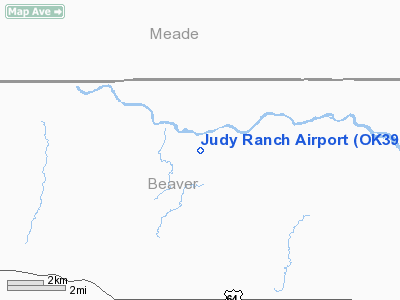
Location & QuickFacts
| FAA Information Effective: | 2008-09-25 |
| Airport Identifier: | OK39 |
| Airport Status: | Operational |
| Longitude/Latitude: | 100-19-01.5220W/36-58-00.1000N
-100.317089/36.966694 (Estimated) |
| Elevation: | 2240 ft / 682.75 m (Estimated) |
| Land: | 100 acres |
| From nearest city: | 10 nautical miles NE of Forgan, OK |
| Location: | Beaver County, OK |
| Magnetic Variation: | 08E (1985) |
Owner & Manager
| Ownership: | Privately owned |
| Owner: | Ronald W. Judy |
| Address: | Hcr 1, Box 45
Meade, KS 67864 |
| Phone number: | 580-934-2141 |
| Manager: | Ronald W. Judy |
| Address: | Hcr 1, Box 45
Meade, KS 67864 |
| Phone number: | 580-934-2141 |
Airport Operations and Facilities
| Airport Use: | Private |
| Wind indicator: | Yes |
| Segmented Circle: | No |
| Control Tower: | No |
| Landing fee charge: | No |
| Sectional chart: | Wichita |
| Region: | ASW - Southwest |
| Boundary ARTCC: | ZKC - Kansas City |
| Tie-in FSS: | MLC - Mc Alester |
| FSS on Airport: | No |
| FSS Toll Free: | 1-800-WX-BRIEF |
Airport Services
| Fuel available: | 100LL |
| Airframe Repair: | NONE |
| Power Plant Repair: | NONE |
Runway Information
Runway 06/24
| Dimension: | 3100 x 60 ft / 944.9 x 18.3 m |
| Surface: | TURF, |
| |
Runway 06 |
Runway 24 |
| Traffic Pattern: | Left | Left |
|
Runway 10/28
| Dimension: | 2600 x 40 ft / 792.5 x 12.2 m |
| Surface: | TURF, |
| |
Runway 10 |
Runway 28 |
| Traffic Pattern: | Left | Left |
|
Runway 16/34
| Dimension: | 1900 x 30 ft / 579.1 x 9.1 m |
| Surface: | TURF, |
| |
Runway 16 |
Runway 34 |
| Traffic Pattern: | Left | Left |
|
Radio Navigation Aids
| ID |
Type |
Name |
Ch |
Freq |
Var |
Dist |
| MEJ | NDB | Meade | | 389.00 | 09E | 19.2 nm |
| BFK | NDB | Buffalo | | 215.00 | 08E | 34.1 nm |
| PYX | NDB | Perryton | | 266.00 | 09E | 39.3 nm |
| OWU | NDB | West Woodward | | 329.00 | 08E | 49.8 nm |
| LBL | VORTAC | Liberal | 070X | 112.30 | 11E | 31.7 nm |
| GAG | VORTAC | Gage | 103X | 115.60 | 10E | 43.0 nm |
Remarks
- LIVESTOCK ON FLD. FLD ROUGH.
- VIOLENT WIND CURRENTS NEAR RIVER.
- 200' HILL S, FENCE ADJ N & S.
Images and information placed above are from
http://www.airport-data.com/airport/OK39/
We thank them for the data!
| General Info
|
| Country |
United States
|
| State |
OKLAHOMA
|
| FAA ID |
OK39
|
| Latitude |
36-58-00.100N
|
| Longitude |
100-19-01.522W
|
| Elevation |
2240 feet
|
| Near City |
FORGAN
|
We don't guarantee the information is fresh and accurate. The data may
be wrong or outdated.
For more up-to-date information please refer to other sources.
|
|


